Addington Parish, New Brunswick
Addington is a civil parish[lower-alpha 1] in Restigouche County, New Brunswick, Canada.[2]
Addington | |
|---|---|
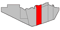 Location within Restigouche County. | |
| Coordinates: 47.707777°N 66.76111°W | |
| Country | |
| Province | |
| County | Restigouche |
| Established | 1826 |
| Area | |
| • Land | 935.17 km2 (361.07 sq mi) |
| Population (2016)[1] | |
| • Total | 656* |
| • Density | 0.7/km2 (2/sq mi) |
| • Change 2011-2016 | |
| • Dwellings | 333 |
| Time zone | UTC-4 (AST) |
| • Summer (DST) | UTC-3 (ADT) |
| |
For governance purposes it is divided between the city of Campbellton, the villages of Atholville and Tide Head, and the local service districts of Flatlands, Glencoe, and the parish of Addington.[3]
Delineation
Addington Parish is described in the Territorial Division Act[2] as being bounded
- West by Eldon Parish; north by the Province of Quebec; south by the Northumberland County line; and east by a line running true south from the most eastern point of the western side of the mouth of Walkers Brook,[lower-alpha 2] including all the islands in front in the Restigouche River which belong to this Province.
Communities
Parish population total does not include incorporated municipalities (in bold).
Demographics
Population
| Canada census – Addington Parish, New Brunswick community profile | |||
|---|---|---|---|
| 2016 | 2011 | 2006 | |
| Population: | 656 (-8.5% from 2011) | 2,615 (-4.1% from 2006) | 2,727 (-8.6% from 2001) |
| Land area: | 935.17 km2 (361.07 sq mi) | 1,024.99 km2 (395.75 sq mi) | 1,024.99 km2 (395.75 sq mi) |
| Population density: | 0.7/km2 (1.8/sq mi) | 2.6/km2 (6.7/sq mi) | 2.7/km2 (7.0/sq mi) |
| Median age: | 53.3 (M: 53.6, F: 53.1) | 46.6 (M: 46.6, F: 46.6) | 41.9 (M: 41.7, F: 42.0) |
| Total private dwellings: | 333 | 1,086 | 1,080 |
| Median household income: | $48,640 | $47,794 | $37,279 |
| References: 2016[4] 2011[5] 2006[6] earlier[7] | |||
|
|
| ||||||||||||||||||||||||||||||
| [8][1] | ||||||||||||||||||||||||||||||||
Language
| Canada Census Mother Tongue - Addington Parish, New Brunswick[8] | ||||||||||||||||||
|---|---|---|---|---|---|---|---|---|---|---|---|---|---|---|---|---|---|---|
| Census | Total | French |
English |
French & English |
Other | |||||||||||||
| Year | Responses | Count | Trend | Pop % | Count | Trend | Pop % | Count | Trend | Pop % | Count | Trend | Pop % | |||||
2016 |
660 |
180 | 27.2% | 470 | 71.2% | 5 | 0.8% | 5 | 0.8% | |||||||||
2011 |
2,610 |
1,950 | 74.71% | 630 | 24.14% | 30 | 1.15% | 0 | 0.00% | |||||||||
2006 |
2,720 |
2,000 | 73.53% | 685 | 25.18% | 25 | 0.92% | 10 | 0.37% | |||||||||
2001 |
2,990 |
2,315 | 77.42% | 645 | 21.57% | 20 | 0.67% | 10 | 0.33% | |||||||||
1996 |
2,995 |
2,150 | n/a | 71.79% | 785 | n/a | 26.21% | 40 | n/a | 1.33% | 20 | n/a | 0.67% | |||||
Access Routes
Highways and numbered routes that run through the parish, including external routes that start or finish at the parish limits:[9]
|
|
|
|
|
gollark: I think that even if you don't like keepinv the game should at least summon a chest of your items on death.
gollark: It'll just generate wrong code.
gollark: Sad.
gollark: Be.e.e.eqpioform.
gollark: I actually won a competition against Codex, because I am very good at writing bad code fast.
See also
- List of parishes in New Brunswick
- Popelogan River
- Upsalquitch River
- Upsalquitch Southeast River
- Little Upsalquitch Southeast River
- Upsalquitch Northwest River
Notes
- Civil parishes served a variety of government functions until 1966, when the new Municipalities Act stripped them of their responsibilities; they continue to provide convenient boundaries for government uses, especially electoral districts and local service districts. Statistics Canada uses civil parishes as census subdivisions for all parts of the province that are not within municipalities and similar entities.
- Now officially called Walker Brook.
References
- "Census Profile, 2016 Census: Addington, Parish [Census subdivision], New Brunswick". Statistics Canada. Retrieved December 28, 2018.
- "Chapter T-3 Territorial Division Act". Government of New Brunswick. Retrieved 22 July 2020.
- "New Brunswick Regulation 84-168 under the Municipalities Act (O.C. 84-582)". Government of New Brunswick. Retrieved 22 July 2020.
- "2016 Community Profiles". 2016 Canadian Census. Statistics Canada. February 21, 2017. Retrieved 2019-09-28.
- "2011 Community Profiles". 2011 Canadian Census. Statistics Canada. July 5, 2013. Retrieved 2014-03-16.
- "2006 Community Profiles". 2006 Canadian Census. Statistics Canada. March 30, 2011. Retrieved 2014-03-16.
- "2001 Community Profiles". 2001 Canadian Census. Statistics Canada. February 17, 2012.
- Statistics Canada: 1996, 2001, 2006, 2011 census
- Atlantic Canada Back Road Atlas ISBN 978-1-55368-618-7 Pages 5, 14
External links
Places adjacent to Addington Parish, New Brunswick | |
|---|---|
| Subdivisions |
|
|---|---|
| Cities | |
| Counties | |
| |
This article is issued from Wikipedia. The text is licensed under Creative Commons - Attribution - Sharealike. Additional terms may apply for the media files.