Grimmer Parish, New Brunswick
Grimmer is a civil parish[lower-alpha 1] in Restigouche County, New Brunswick, Canada.[2]
Grimmer | |
|---|---|
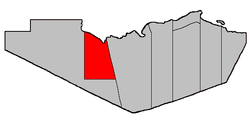 Location within Restigouche County. | |
| Coordinates: 47.67°N 67.45°W | |
| Country | |
| Province | |
| County | Restigouche |
| Established | 1916 |
| Area | |
| • Land | 653.48 km2 (252.31 sq mi) |
| Population (2011)[1] | |
| • Total | 1,096 |
| • Density | 1.7/km2 (4/sq mi) |
| • Pop 2006-2011 | |
| • Dwellings | 469 |
| Time zone | UTC-4 (AST) |
| • Summer (DST) | UTC-3 (ADT) |
For governance purposes it is part of the incorporated rural community of Kedgwick[3] and the local service district of White's Brook.[4]
Delineation
Grimmer Parish is defined in the Territorial Division Act[2] as being bounded:
- Southerly by the southern boundary line of lot number twenty-five, granted to Paul Berube, in Range 6, Rang-Double-Sud,[lower-alpha 2] and the prolongation of said boundary line easterly to the Parish of Eldon, and westerly to a point on the bank or shore of the Restigouche River. West by a straight line drawn due north astronomically from the said last-mentioned point to the southern boundary line of the Province of Quebec. Northerly by said Province and easterly by the Parish of Eldon.
Communities
Parish population total does not include incorporated municipalities (in bold).
|
|
Demographics
Population
| Canada census – Grimmer Parish, New Brunswick community profile | |||
|---|---|---|---|
| 2011 | 2006 | ||
| Population: | 1,096 (-0.8% from 2006) | 1,105 (-5.0% from 2001) | |
| Land area: | 653.48 km2 (252.31 sq mi) | 653.48 km2 (252.31 sq mi) | |
| Population density: | 1.7/km2 (4.4/sq mi) | 1.7/km2 (4.4/sq mi) | |
| Median age: | 41.8 (M: 42.5, F: 41.3) | 39.7 (M: 39.6, F: 39.8) | |
| Total private dwellings: | 469 | 531 | |
| Median household income: | $.N/A | $37,213 | |
| Notes: 2011 income data for this area has been suppressed for data quality or confidentiality reasons. – References: 2011[1] 2006[5] earlier[6] | |||
|
|
|
Language
| Canada Census Mother Tongue - Grimmer Parish, New Brunswick[7] | ||||||||||||||||||
|---|---|---|---|---|---|---|---|---|---|---|---|---|---|---|---|---|---|---|
| Census | Total | French |
English |
French & English |
Other | |||||||||||||
| Year | Responses | Count | Trend | Pop % | Count | Trend | Pop % | Count | Trend | Pop % | Count | Trend | Pop % | |||||
2011 |
1,090 |
1,060 | 97.25% | 25 | 2.29% | 0 | 0.00% | 5 | 0.46% | |||||||||
2006 |
1,095 |
1,080 | 98.63% | 15 | 1.37% | 0 | 0.00% | 0 | 0.00% | |||||||||
2001 |
1,165 |
1,120 | 96.14% | 25 | 2.14% | 20 | 1.72% | 0 | 0.00% | |||||||||
1996 |
1,100 |
1,065 | n/a | 96.82% | 25 | n/a | 2.27% | 10 | n/a | 0.91% | 0 | n/a | 0.00% | |||||
Access Routes
Highways and numbered routes that run through the parish, including external routes that start or finish at the parish limits:[8]
gollark: Idea; outdo them all by including 100 audio tracks, 99 of which are just rickrolls.
gollark: Who would make such an accursed file? In any case I think it lets you select operations to do on specific streams.
gollark: Oh, and Go's "simple"ness is mostly just simple-looking but inconsistent and arbitrary half the time.
gollark: There's the whole incredibly stupid monotonic time thing.
gollark: Poor type-and-otherwise safety in many OS interactions, moronically stupid hacks over sane code...
Notes
- Civil parishes served a variety of government functions until 1966, when the new Municipalities Act stripped them of their responsibilities; they continue to provide convenient boundaries for government uses, especially electoral districts and local service districts. Statistics Canada uses civil parishes as census subdivisions for all parts of the province that are not within municipalities and similar entities.
- Stewart Settlement.
References
- "2011 Community Profiles". 2011 Canadian Census. Statistics Canada. July 5, 2013. Retrieved 2014-03-21.
- "Chapter T-3 Territorial Division Act". Government of New Brunswick. Retrieved 22 July 2020.
- "New Brunswick Regulation 2012-18 under the Municipalities Act (O.C. 2012-75)". Government of New Brunswick. Retrieved 22 July 2020.
- "New Brunswick Regulation 84-168 under the Municipalities Act (O.C. 84-582)". Government of New Brunswick. Retrieved 22 July 2020.
- "2006 Community Profiles". 2006 Canadian Census. Statistics Canada. March 30, 2011. Retrieved 2014-03-21.
- "2001 Community Profiles". 2001 Canadian Census. Statistics Canada. February 17, 2012.
- Statistics Canada: 1996, 2001, 2006, 2011 census
- Atlantic Canada Back Road Atlas ISBN 978-1-55368-618-7 Pages 4, 12
Places adjacent to Grimmer Parish, New Brunswick | ||||||||||
|---|---|---|---|---|---|---|---|---|---|---|
| ||||||||||
| Subdivisions |
|
|---|---|
| Cities | |
| Counties | |
| |
This article is issued from Wikipedia. The text is licensed under Creative Commons - Attribution - Sharealike. Additional terms may apply for the media files.