East Gloucester Square Historic District
East Gloucester Square Historic District is a historic district encapsulating the evolutionary history of the active maritime community of Gloucester, Massachusetts, over a period of more than 200 years. East Gloucester is located on the south side of Gloucester's Inner Harbor, opposite the city's main downtown area. The district is essentially linear in character extending along East Main Street between Rocky Neck Avenue and Montgomery Place, with a southward extension along Highland, Chapel, and Plum Streets to Mount Pleasant Avenue. East Main Street was formally laid out in 1704 to East Gloucester Square (its junction with Highland Street), and provides access to numerous waterfront facilities, including stone wharves and 19th century ship building and repair facilities. Housing is set on the roads leading up the hill from East Gloucester Square, and is generally densely set Greek Revival or Italianate in style, reflecting the dominant period of the area's development, the mid-to-late 19th century. Higher style residences were placed on larger lots on Mount Pleasant Avenue.[2]
East Gloucester Square Historic District | |
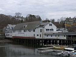 Eastern Wharf | |
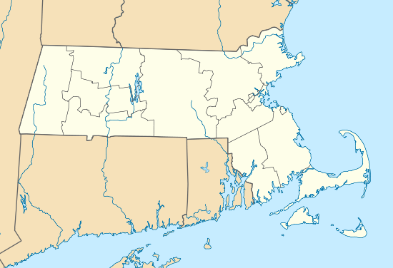  | |
| Location | Gloucester, Massachusetts |
|---|---|
| Coordinates | 42°36′28″N 70°39′7″W |
| Area | 75 acres (30 ha) |
| Built | 1700 |
| Architect | Unknown |
| Architectural style | Bungalow/Craftsman, Greek Revival, Georgian |
| MPS | Gloucester MPS |
| NRHP reference No. | 96000471 [1] |
| Added to NRHP | April 26, 1996 |
The district was listed on the National Register of Historic Places in 1996.[1]
See also
References
- "National Register Information System". National Register of Historic Places. National Park Service. April 15, 2008.
- "NRHP nomination for East Gloucester Square Historic District". Commonwealth of Massachusetts. Retrieved 2014-12-02.
| Topics |  | ||||||||||||||||
|---|---|---|---|---|---|---|---|---|---|---|---|---|---|---|---|---|---|
| Lists by county | |||||||||||||||||
| Lists by city |
| ||||||||||||||||
| Other lists | |||||||||||||||||
| |||||||||||||||||