Dix Township, Ford County, Illinois
Dix Township is one of twelve townships in Ford County, Illinois, USA. As of the 2010 census, its population was 642 and it contained 284 housing units.[2]
Dix Township | |
|---|---|
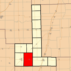 Location in Ford County | |
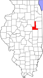 Ford County's location in Illinois | |
| Coordinates: 40°27′58″N 88°17′29″W | |
| Country | United States |
| State | Illinois |
| County | Ford |
| Established | November 6, 1860 |
| Area | |
| • Total | 53.99 sq mi (139.8 km2) |
| • Land | 53.93 sq mi (139.7 km2) |
| • Water | 0.06 sq mi (0.2 km2) 0.11% |
| Elevation | 768 ft (234 m) |
| Population (2010) | |
| • Estimate (2016)[1] | 614 |
| • Density | 11.9/sq mi (4.6/km2) |
| Time zone | UTC-6 (CST) |
| • Summer (DST) | UTC-5 (CDT) |
| ZIP codes | 60933, 60936, 60952, 60957 |
| FIPS code | 17-053-20110 |
History
Dix Township was originally named Drummer Grove Township; on September 2, 1864 it was renamed named in honor of John Adams Dix.[3]
Geography
According to the 2010 census, the township has a total area of 53.99 square miles (139.8 km2), of which 53.93 square miles (139.7 km2) (or 99.89%) is land and 0.06 square miles (0.16 km2) (or 0.11%) is water.[2]
Cities, towns, villages
Unincorporated towns
- Guthrie
Cemeteries
The township contains these three cemeteries: Blackford, Oregon, and Pontoppidan.
Major highways
Airports and landing strips
- Barnes Landing Strip
- Gibson City Municipal Airport
School districts
- Gibson City-Melvin-Sibley Community Unit School District 5
Political districts
- Illinois' 15th congressional district
- State House District 105
- State Senate District 53
gollark: Also the surprisingly large amount of people finding exploits.
gollark: PotatOS's 2 users.
gollark: 🐝
gollark: deathlife23, you will be glad to know that the potatOS sandbox exploit has been thoroughly patched.
gollark: Ħı.
References
- "Dix Township, Ford County, Illinois". Geographic Names Information System. United States Geological Survey. Retrieved 2010-01-16.
- United States Census Bureau 2007 TIGER/Line Shapefiles
- United States National Atlas
- "Population and Housing Unit Estimates". Retrieved June 9, 2017.
- "Population, Housing Units, Area, and Density: 2010 - County -- County Subdivision and Place -- 2010 Census Summary File 1". United States Census. Archived from the original on 2020-02-12. Retrieved 2013-05-28.
- Callary, Edward. 2009. Place Names of Illinois. Champaign: University of Illinois Press, p. 94.
- "Census of Population and Housing". Census.gov. Retrieved June 4, 2016.
External links
Places adjacent to Dix Township, Ford County, Illinois | |
|---|---|
Municipalities and communities of Ford County, Illinois, United States | ||
|---|---|---|
| Cities | Map of Illinois highlighting Ford County | |
| Villages | ||
| Townships | ||
| Unincorporated communities | ||
| Footnotes | ‡This populated place also has portions in an adjacent county or counties | |
This article is issued from Wikipedia. The text is licensed under Creative Commons - Attribution - Sharealike. Additional terms may apply for the media files.