Button Township, Ford County, Illinois
Button Township is one of twelve townships in Ford County, Illinois, USA. As of the 2010 census, its population was 281 and it contained 116 housing units.[2] The township was formed from a portion of Patton Township in December 1864.
Button Township | |
|---|---|
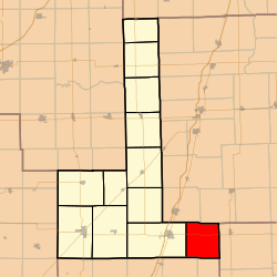
 Location in Ford County | |
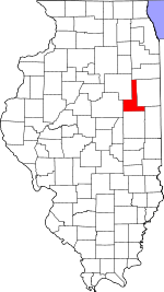
 Ford County's location in Illinois | |
| Coordinates: 40°26′54″N 87°59′36″W | |
| Country | United States |
| State | Illinois |
| County | Ford |
| Established | December, 1864 |
| Area | |
| • Total | 34.1 sq mi (88 km2) |
| • Land | 34.04 sq mi (88.2 km2) |
| • Water | 0.06 sq mi (0.2 km2) 0.18% |
| Elevation | 784 ft (239 m) |
| Population (2010) | |
| • Estimate (2016)[1] | 269 |
| • Density | 8.3/sq mi (3.2/km2) |
| Time zone | UTC-6 (CST) |
| • Summer (DST) | UTC-5 (CDT) |
| ZIP codes | 60957, 60960 |
| FIPS code | 17-053-10214 |
History
Button Township was named for James Porter Button, who served as township supervisor, justice of the peace, and county treasurer.[3]
Geography
According to the 2010 census, the township has a total area of 34.1 square miles (88 km2), of which 34.04 square miles (88.2 km2) (or 99.82%) is land and 0.06 square miles (0.16 km2) (or 0.18%) is water.[2]
Unincorporated towns
Cemeteries
The township contains these three cemeteries: Mount Olivet, Pleasant Grove and Trickle Grove.
Major highways
School districts
- Hoopeston Area Community Unit School District 11
- Paxton-Buckley-Loda Community Unit School District 10
Political districts
- Illinois' 15th congressional district
- State House District 106
- State Senate District 53
gollark: Idea: all Macron structs contain an implicit monoid.
gollark: Maybe I should write it in Python for now and port it "later".
gollark: The issue is that while the Rust and to some extent Nim versions are principled™, fast, and easy to deploy as they compile to mostly-static binaries, I cannot rapidly write and prototype accursuous code very fast.
gollark: But worse than supreme RUST™ types.
gollark: It isn't very good.
References
- "Button Township, Ford County, Illinois". Geographic Names Information System. United States Geological Survey. Retrieved 2010-01-16.
- United States Census Bureau 2007 TIGER/Line Shapefiles
- United States National Atlas
- "Population and Housing Unit Estimates". Retrieved June 9, 2017.
- "Population, Housing Units, Area, and Density: 2010 - County -- County Subdivision and Place -- 2010 Census Summary File 1". United States Census. Archived from the original on 2020-02-12. Retrieved 2013-05-28.
- Callary, Edward. 2009. Place Names of Illinois. Champaign: University of Illinois Press, p. 52.
- "Census of Population and Housing". Census.gov. Retrieved June 4, 2016.
External links
This article is issued from Wikipedia. The text is licensed under Creative Commons - Attribution - Sharealike. Additional terms may apply for the media files.