Division No. 5, Newfoundland and Labrador
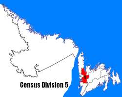
Census Division No. 5 is a Statistics Canada statistical division composed of the areas of the province of Newfoundland and Labrador called Humber Valley, Bay of Islands, and White Bay. It covers a land area of 10,365.63 km² (4,002.19 sq mi), and had a population of 42,014 according to the 2016 census.[1]
Division No. 5 | |
|---|---|
 | |
| Coordinates: 48°57′33″N 57°55′34″W | |
| Country | Canada |
| Province | Newfoundland and Labrador |
| Government | |
| • MPs | Gudie Hutchings |
| Area | |
| • Total | 10,366.48 km2 (4,002.52 sq mi) |
| As of 2016 | |
| Population (2016)[1] | |
| • Total | 42,014 |
| • Density | 4.1/km2 (10/sq mi) |
Cities
- Corner Brook
Towns
Unorganized subdivisions
- Subdivision A (Includes: St. Jude's, and Hinds Lake)
- Subdivision C (Includes: Spruce Brook, George's Lake, Pinchgut Lake)
- Subdivision D (Includes: North Arm, Middle Arm, Goose Arm, Serpentine Lake)
- Subdivision E (Includes: Galeville, The Beaches)
- Subdivision F (Includes: Pynn's Brook, Little Rapids, Humber Valley Resort)
- Subdivision G (Includes: Pollards Point, Sops Arm)
Demographics
| Year | Pop. | ±% |
|---|---|---|
| 2006 | 40,805 | — |
| 2011 | 41,004 | +0.5% |
| 2016 | 42,014 | +2.5% |
| [1][2] | ||
gollark: Step 2. Do.
gollark: Do you have a better idea for the potatOS development process?!
gollark: Both!
gollark: PotatOS doesn't experience that since bugs are features and features are bugs.
gollark: Minified Lua?
References
- "Census Profile, 2016 Census: Division No. 5, Census division [Census division], Newfoundland and Labrador". Statistics Canada. Retrieved October 15, 2019.
- "2011 Census Profile - Division No. 5, Census division". Statistics Canada. Retrieved March 2, 2012.
Sources
- "(Code 1005) Census Profile". 2011 census. Statistics Canada. 2012.
Places adjacent to Division No. 5, Newfoundland and Labrador | ||||||||||
|---|---|---|---|---|---|---|---|---|---|---|
| ||||||||||
Division No. 5, Newfoundland and Labrador (Humber District) | ||
|---|---|---|
| Cities | | |
| Towns | ||
| Unorganized subdivisions |
| |
| Census divisions | |
|---|---|
| Cities | |
| Other communities |
|
| |
This article is issued from Wikipedia. The text is licensed under Creative Commons - Attribution - Sharealike. Additional terms may apply for the media files.