Curel, Alpes-de-Haute-Provence
Curel is a commune in the Alpes-de-Haute-Provence department in southeastern France.
Curel | |
|---|---|
%2C_%C3%A9glise_neuve_Saint-Martin.jpg) The church of Saint-Martin, in Curel | |
 Coat of arms | |
Location of Curel 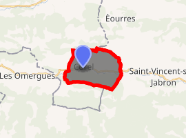
| |
 Curel  Curel | |
| Coordinates: 44°10′40″N 5°39′45″E | |
| Country | France |
| Region | Provence-Alpes-Côte d'Azur |
| Department | Alpes-de-Haute-Provence |
| Arrondissement | Forcalquier |
| Canton | Sisteron |
| Intercommunality | Vallée du Jabron |
| Government | |
| • Mayor (2008–2014) | Yves Robial |
| Area 1 | 10.45 km2 (4.03 sq mi) |
| Population (2017-01-01)[1] | 55 |
| • Density | 5.3/km2 (14/sq mi) |
| Time zone | UTC+01:00 (CET) |
| • Summer (DST) | UTC+02:00 (CEST) |
| INSEE/Postal code | 04067 /04200 |
| Elevation | 670–1,440 m (2,200–4,720 ft) (avg. 696 m or 2,283 ft) |
| 1 French Land Register data, which excludes lakes, ponds, glaciers > 1 km2 (0.386 sq mi or 247 acres) and river estuaries. | |
Population
| Year | Pop. | ±% |
|---|---|---|
| 1793 | 244 | — |
| 1800 | 267 | +9.4% |
| 1806 | 299 | +12.0% |
| 1821 | 267 | −10.7% |
| 1831 | 298 | +11.6% |
| 1836 | 268 | −10.1% |
| 1841 | 271 | +1.1% |
| 1846 | 267 | −1.5% |
| 1851 | 249 | −6.7% |
| 1856 | 241 | −3.2% |
| 1861 | 251 | +4.1% |
| 1866 | 237 | −5.6% |
| 1872 | 236 | −0.4% |
| 1876 | 224 | −5.1% |
| 1881 | 184 | −17.9% |
| 1886 | 169 | −8.2% |
| 1891 | 136 | −19.5% |
| 1896 | 120 | −11.8% |
| 1901 | 130 | +8.3% |
| 1906 | 127 | −2.3% |
| 1911 | 110 | −13.4% |
| 1921 | 74 | −32.7% |
| 1926 | 76 | +2.7% |
| 1931 | 64 | −15.8% |
| 1936 | 66 | +3.1% |
| 1946 | 64 | −3.0% |
| 1954 | 48 | −25.0% |
| 1962 | 50 | +4.2% |
| 1968 | 38 | −24.0% |
| 1975 | 31 | −18.4% |
| 1982 | 28 | −9.7% |
| 1990 | 37 | +32.1% |
| 1999 | 57 | +54.1% |
| 2008 | 51 | −10.5% |
gollark: Ideally secure ones.
gollark: There's already a bunch of terminal streaming protocols available, right? I'm interested in upgrading ARC to in-world-positioned 3D screens transmitted from a beacon thing.
gollark: And?
gollark: I doūbt it allows full GPŪ access.
gollark: 🇴 🇷 🇦 🇹 🇦 🇱 🇱 🇵 🇷 🇴 🇧 🇦 🇧 🇱 🇾
References
- "Populations légales 2017". INSEE. Retrieved 6 January 2020.
| Wikimedia Commons has media related to Curel, Alpes-de-Haute-Provence. |
This article is issued from Wikipedia. The text is licensed under Creative Commons - Attribution - Sharealike. Additional terms may apply for the media files.