Brunet, Alpes-de-Haute-Provence
Brunet is a commune in the Alpes-de-Haute-Provence department in southeastern France.
Brunet | |
|---|---|
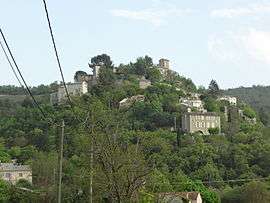 The village of Brunet, seen from the north | |
 Coat of arms | |
Location of Brunet 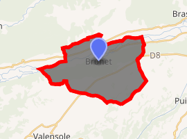
| |
 Brunet 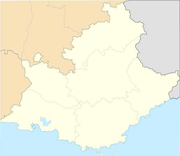 Brunet | |
| Coordinates: 43°53′32″N 6°01′52″E | |
| Country | France |
| Region | Provence-Alpes-Côte d'Azur |
| Department | Alpes-de-Haute-Provence |
| Arrondissement | Forcalquier |
| Canton | Valensole |
| Government | |
| • Mayor (2008–2014) | Francis Berard |
| Area 1 | 28.47 km2 (10.99 sq mi) |
| Population (2017-01-01)[1] | 278 |
| • Density | 9.8/km2 (25/sq mi) |
| Time zone | UTC+01:00 (CET) |
| • Summer (DST) | UTC+02:00 (CEST) |
| INSEE/Postal code | 04035 /04210 |
| Elevation | 369–690 m (1,211–2,264 ft) (avg. 425 m or 1,394 ft) |
| 1 French Land Register data, which excludes lakes, ponds, glaciers > 1 km2 (0.386 sq mi or 247 acres) and river estuaries. | |
Geography
The village lies on the left bank of the Asse, which forms most of the commune's northern border.
Population
| Year | Pop. | ±% |
|---|---|---|
| 1765 | 418 | — |
| 1793 | 415 | −0.7% |
| 1806 | 483 | +16.4% |
| 1821 | 521 | +7.9% |
| 1831 | 509 | −2.3% |
| 1836 | 520 | +2.2% |
| 1841 | 487 | −6.3% |
| 1846 | 427 | −12.3% |
| 1851 | 456 | +6.8% |
| 1856 | 463 | +1.5% |
| 1861 | 430 | −7.1% |
| 1866 | 433 | +0.7% |
| 1872 | 418 | −3.5% |
| 1876 | 414 | −1.0% |
| 1881 | 390 | −5.8% |
| 1886 | 368 | −5.6% |
| 1891 | 346 | −6.0% |
| 1896 | 330 | −4.6% |
| 1901 | 342 | +3.6% |
| 1906 | 356 | +4.1% |
| 1911 | 321 | −9.8% |
| 1921 | 290 | −9.7% |
| 1926 | 234 | −19.3% |
| 1931 | 228 | −2.6% |
| 1936 | 200 | −12.3% |
| 1946 | 182 | −9.0% |
| 1954 | 187 | +2.7% |
| 1962 | 190 | +1.6% |
| 1968 | 186 | −2.1% |
| 1975 | 217 | +16.7% |
| 1982 | 258 | +18.9% |
| 1990 | 162 | −37.2% |
| 1999 | 218 | +34.6% |
| 2008 | 258 | +18.3% |
gollark: *Java*? Really?
gollark: You can say `t*` i.e. "look up all things containing tokens starting with `t`".
gollark: It supports that somewhat as well.
gollark: What if infinite linked lists?
gollark: What if my computer has finite RAM?
References
- "Populations légales 2017". INSEE. Retrieved 6 January 2020.
| Wikimedia Commons has media related to Brunet, Alpes-de-Haute-Provence. |
This article is issued from Wikipedia. The text is licensed under Creative Commons - Attribution - Sharealike. Additional terms may apply for the media files.