Cookshire-Eaton, Quebec
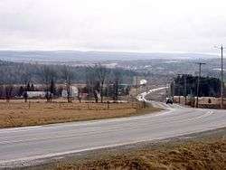
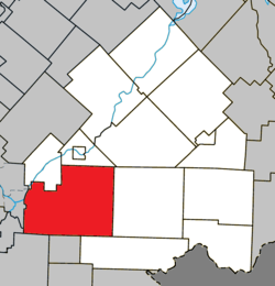
Cookshire-Eaton is a city in the Estrie region of Quebec. It is the seat of Le Haut-Saint-François Regional County Municipality. Sherbrooke Airport is located there.
Cookshire-Eaton | |
|---|---|
City | |
 | |
 Location within Le Haut-Saint-François RCM | |
 Cookshire-Eaton Location in southern Quebec | |
| Coordinates: 45.42°N 71.63°W[1] | |
| Country | |
| Province | |
| Region | Estrie |
| RCM | Le Haut-Saint-François |
| Constituted | July 24, 2002 |
| Government | |
| • Mayor | Sylvie Lapointe |
| • Federal riding | Compton—Stanstead |
| • Prov. riding | Mégantic |
| Area | |
| • Total | 298.70 km2 (115.33 sq mi) |
| • Land | 295.95 km2 (114.27 sq mi) |
| Population (2011)[3] | |
| • Total | 5,171 |
| • Density | 17.5/km2 (45/sq mi) |
| • Pop 2006-2011 | |
| Time zone | UTC−5 (EST) |
| • Summer (DST) | UTC−4 (EDT) |
| Postal code(s) | J0B 1M0 |
| Area code(s) | 819 |
| Highways | |
| Website | www |
As part of the 2000–2006 municipal reorganization in Quebec, on July 24, 2002 the city of Cookshire, the municipality of Newport and the township of Eaton were merged to form Cookshire-Eaton;[4] prior to this, on April 25, 2001, the village of Sawyerville had merged with Eaton.[5] After a 2004 referendum, however, Newport de-merged and was reconstituted as an independent municipality as of January 1, 2006. Nevertheless, Newport and Cookshire-Eaton both remain part of the urban agglomeration of Cookshire-Eaton.
The community had a population of 5,171 in the Canada 2011 Census.
References
- Reference number 377747 of the Commission de toponymie du Québec (in French)
- Geographic code 41038 in the official Répertoire des municipalités (in French)
- "(Code 2441038) Census Profile". 2011 census. Statistics Canada. 2012.
- http://www.stat.gouv.qc.ca/publications/referenc/pdf/modjuillet02.pdf%5B%5D
- http://www.toponymie.gouv.qc.ca/ct/ToposWeb/fiche.aspx?no_seq=58724
This article is issued from Wikipedia. The text is licensed under Creative Commons - Attribution - Sharealike. Additional terms may apply for the media files.