Codell, Kansas
Codell is an unincorporated community in Rooks County, Kansas, United States.[1]
Codell, Kansas | |
|---|---|
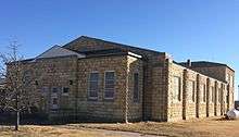
 Codell Kansas Cyclone Day Memorial (2018) | |
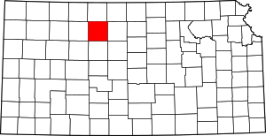
 KDOT map of Rooks County (legend) | |
| Coordinates: 39°11′36″N 99°10′38″W[1] | |
| Country | United States |
| State | Kansas |
| County | Rooks |
| Township | Township 12 |
| Founded | 1887 |
| Elevation | 1,985 ft (605 m) |
| Time zone | UTC-6 (CST) |
| • Summer (DST) | UTC-5 (CDT) |
| ZIP code | 67663 |
| Area code | 785 |
| FIPS code | 20-14575 [1] |
| GNIS ID | 472446 [1] |
History
Codell was established as a Union Pacific Railroad depot in 1887. Union Pacific could not reach agreement with the town of Motor, so Union Pacific established the community of Codell three-quarters of a mile west of Motor. The Motor Post Office, originally established as Floreyville in 1875, was moved to Codell in 1888. The frame buildings in Motor were moved to Codell and Motor was soon abandoned.[2]
Early in its history Codell had a school, multiple churches and a business district with a bank, telephone central office, lumber yard, grain elevator, several stores, a doctor and a barber.[3]
Tornadoes
Codell is notable for its tornado history which earned it mention in Ripley's Believe It or Not!. The community was hit by tornadoes on May 20 in three successive years: 1916, 1917 and 1918.[4]
The 1916 tornado, estimated at F2 intensity, passed east of Codell in the early evening.[5] The 1917 tornado reached F3 intensity and passed west of Codell, also in the early evening.[6] In 1918, Codell took a direct hit from an F4 tornado just after dark. The school, M. E. church, hotel and several residences were completely destroyed. Many more buildings were badly damaged. Although the school was rebuilt and a new high school was built in 1938, the town never fully recovered from the devastation of the 1918 tornado.[7]
Geography
Codell lies in Township 12 south of the city of Stockton (the county seat of Rooks County[8]) and near the southeastern corner of Rooks County. The community lies along the banks of Paradise Creek and an abandoned railroad line. The nearest city, Plainville, lies approximately 9 miles (14 km) away to the northwest by road; the community is connected via 24 Road to a state highway, K-18, which lies approximately 1 mile (1.6 km) to the north.[9]
Education

Codell is served by USD 270 Plainville Schools.[10]
Codell High School was closed through school unification in 1965.[11] The Codell High School mascot was Codell Cougars.[12]
See also
References
- Geographic Names Information System (GNIS) details for Codell, Kansas; United States Geological Survey (USGS); October 13, 1978.
- "Kansas Post Offices, 1828-1961". Kansas Historical Society. Retrieved 20 December 2016.
- Darland, H. O. "A History of Paradise Township", Plainville Times, 23 February 1961, p. 8.
- Heidorn, Keith C. (May 1, 2006). "Three Strikes on Codell". The Weather Doctor's Weather Almanac. Retrieved May 9, 2018.
- "CYCONE SAT. EVENING". Plainville Times. 12 (26). May 25, 1916. pp. 1, 4. Retrieved May 9, 2018.
- "DESTRUCTIVE TORNADO". Plainville Times. 13 (26). May 24, 1917. pp. 1, 5. Retrieved May 9, 2018.
- "Tornado Traverses Trego, Ellis, Rooks and Osborne Counties. Ten Killed, Scores of Injured. Property Damage in Million. Codell in Part Ruins". Plainville Times. 14 (27). May 23, 1918. p. 1. Retrieved May 9, 2018.
- "Find a County". National Association of Counties. Archived from the original on 2011-05-31. Retrieved 2011-06-07.
- DeLorme. Kansas Atlas & Gazetteer. 4th ed. Yarmouth: DeLorme, 2009, 32. ISBN 0-89933-342-7.
- "Plainville USD 270". USD 270. Retrieved 9 January 2017.
- "Patrons Vote To Close Codell High At End of Present Term", Plainville Times, 4 February 1965, p.1.
- "Lincoln Branch Tourney Tuesday at Russell Gym", The Salina Journal, 11 February 1951, p.18.
Further reading
External links
| Wikimedia Commons has media related to Codell, Kansas. |
- Rooks County
- Pictures of Codell
- Rooks County Maps: Current, Historic, KDOT
