Coatepeque Airport
Coatepeque Airport (IATA: CTF, ICAO: MGCT) is an airport serving Coatepeque, a city in the Quetzaltenango Department of Guatemala. The airport is in a wooded area on the southwest side of town.
Coatepeque Airport | |||||||||||
|---|---|---|---|---|---|---|---|---|---|---|---|
| Summary | |||||||||||
| Airport type | Public | ||||||||||
| Location | Coatepeque, Guatemala | ||||||||||
| Elevation AMSL | 1,486 ft / 453 m | ||||||||||
| Coordinates | 14°41′40″N 91°52′55″W | ||||||||||
| Map | |||||||||||
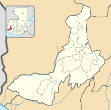 CTF Location in Quetzaltenango Department  CTF Location in Guatemala | |||||||||||
| Runways | |||||||||||
| |||||||||||
It has a small terminal and a runway 900 meters long.[4]
The Retalhuleu non-directional beacon (Ident: REU) is located 15 nautical miles (28 km) southeast of the airport. The Tapachula VOR-DME (Ident: TAP) is located 29.2 nautical miles (54.1 km) west-northwest of the airport.[5][6]
References
- Airport information for Coatepeque Airport at Great Circle Mapper.
- Google Maps - Coatepeque
- "Coatepeque Airport". SkyVector. Retrieved 2 September 2018.
- PrensaLibre.com - Red aeroportuaria, lista para fin de año (in Spanish)
- "Retalhuheu NDB". Our Airports. Retrieved 3 September 2018.
- "Tapachula VOR". Our Airports. Retrieved 3 September 2018.
External links
- OpenStreetMaps - Coatepeque
- FallingRain - Coatepeque Airport
- OurAirports - Coatepeque
- Accident history for Coatepeque Airport at Aviation Safety Network
This article is issued from Wikipedia. The text is licensed under Creative Commons - Attribution - Sharealike. Additional terms may apply for the media files.