City and County of Swansea Council
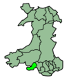
The City and County of Swansea Council (Welsh: Cyngor Dinas a Sir Abertawe) is the governing body for one of the Principal Areas of Wales covering Swansea, Gower and the surrounding area. The council consists of 72 councillors representing 36 electoral wards.[3]
Swansea Council Cyngor Abertawe | |
|---|---|
| Type | |
| Type | |
| History | |
| Founded | 1 April 1996 |
| Preceded by | West Glamorgan County Council |
| Leadership | |
Presiding Member | Cllr Des Thomas since 25 May 2017 |
Lord Mayor | Cllr Mark Child since 2020/21 |
Leader of the Council | |
Deputy Leaders | |
Leader of the Opposition | Cllr Chris Holley, Liberal Democrats |
Chief Executive | Phil Roberts |
| Structure | |
| Seats | 72 councillors[1][2] |
 | |
Political groups |
|
Length of term | 5 years |
| Elections | |
| First past the post | |
First election | 4 May 1995 |
Last election | 4 May 2017 |
Next election | 5 May 2022 |
| Meeting place | |
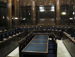 | |
| Guildhall, Swansea | |
| Website | |
| www | |
Since 2012 the council has been controlled by the Labour Party.
Municipal history
Swansea's first charter was granted sometime between 1158-1184 by William de Newburgh, 3rd Earl of Warwick. The charter gave Swansea the status of a borough, granting the townsmen, called burgesses certain rights to develop the area. A second charter was granted in 1215 by King John. By 1888, the borough acquired the status of county borough, separating it from the administrative county of Glamorgan.
Swansea County Borough Council was created in 1889 and the first elections held in November of that year.
In 1974, under the Local Government Act 1972, Swansea (which had previously been a county borough) was merged with Gower Rural District, to become a district of West Glamorgan called the District and City of Swansea. In 1996, another local government reform saw the district of Swansea merged with parts of the Lliw Valley district to form a unitary authority under the name of the 'City and County of Swansea' (Welsh: Dinas a Sir Abertawe.)
Political makeup
Elections take place every five years. The last election was 4 May 2017.
Current composition
The council is currently controlled by the Labour Party.[4]
| Group affiliation | Members | |
|---|---|---|
| Labour | 48 | |
| Conservative | 8 | |
| Independent |
7 | |
| Liberal Democrats | 7 | |
| Uplands | 2 | |
| Total |
72 | |
Historic results
| Year | Total | Labour | Conservative | Liberal Democrats | Plaid Cymru | Other | Turnout | Notes | |||||
|---|---|---|---|---|---|---|---|---|---|---|---|---|---|
| 2017 [5] | 72 | 48 | 8 | 7 | 0 | 9 | Labour controlled | ||||||
| 2012 [6][7] | 72 | 49 | 4 | 12 | 0 | 7 | 33.97% | Labour controlled | |||||
| 2008 [8] | 72 | 30 | 4 | 23 | 1 | 14 | 38.19% | NOC, Swansea Administration controlled | |||||
| 2004 [9][10] | 72 | 32 | 4 | 19 | 5 | 12 | 38.32% | NOC, Swansea Administration controlled | |||||
| 1999 | 72 | 45 | 4 | 11 | 3 | 9 | Labour controlled | ||||||
| 1995 | 72 | 56 | 1 | 5 | 0 | 7 | Labour controlled | ||||||
Between 1996 and 2004, and since 2012 the council is under Labour control. Between 2004 and 2012 there was no overall control and the council was led by a Liberal Democrat coalition in alliance with the Independents and the Conservatives, termed the Swansea Administration. However these figures changed during the 2004-2008 period with the defection of Cllr. Keith Morgan from Plaid Cymru to the Welsh Liberal Democrats in 2005 and Cllr. Rene Kinzett from the Welsh Liberal Democrats to the Conservatives in 2006.
In September 2014, Cllr Rob Stewart took over leadership of the council, from Cllr David Phillips. Phillips resigned at the end of August, after 2 years leading the council.[11]
Labour retained control at the 2017 elections despite predictions that the party would lose its majority.
Mayoralty
.jpg)
The Lord Mayor of Swansea (Welsh: Arglwydd Faer Abertawe) is a senior member of the elected Council. Swansea has had a Mayor since it became a borough in 1835. The dignity of Lord Mayor was conferred on the city by Queen Elizabeth II on 22 March 1982 to celebrate the wedding of Charles, Prince of Wales. The status was confirmed on 1 April 1996 when the Unitary Authority of the City and County of Swansea came into being.
The style of the Lord Mayor is "The Right Worshipful the Lord Mayor of Swansea". The official residence is the Mansion House in Ffynone, which was originally built as the home of a previous mayor, Evan Matthew Richards. It was purchased by the then County Borough of Swansea in 1922 and renamed the Mansion House.
Lord Mayors of Swansea
| Municipal Year | Mayor | Notes |
|---|---|---|
| 2020–21 | Mark Child | |
| 2019–20 | Peter Black | |
| 2018–19 | ||
| 2017–18 | Philip Downing | |
| 2016–17 | David Hopkins [12] | |
| 2015–16 | John Newbury [13] | |
| 2014–15 | Ceinwen Thomas [14] | |
| 2013–14 | June Stanton [15] | |
| 2012–13 | Dennis James | died 20 April 2013 |
| 2011–12 | Ioan Richard | |
| 2010–11 | Richard Lewis | |
| 2009–10 | Alan Lloyd | |
| 2008–09 | Gareth Sullivan | |
| 2007–08 | Susan Waller (Thomas) | |
| 2006–07 | Christopher Holley | |
| 2005–06 | Mair Gibbs | |
| 2004–05 | Margaret Smith | |
| 2003–04 | Lawrence Bailey | |
| 2002–03 | June Burtonshaw | |
| 2001–02 | Robert Francis-Davies | |
| 2000–01 | John Davies | |
| 1999–2000 | Robert J. Lloyd [16] | |
| 1998–99 | David I. E. Jones [16] | |
| 1997–98 | Gareth Williams[16] | |
| 1996–97 | Desmond Thomas/Len Howell | |
| 1995–96 | Grenville Phillips | |
| 1994–95 | Walter Dyer | |
| 1993–94 | Robert Davies | |
| 1992–93 | Charles Birss | |
| 1991–92 | Byron Owen | |
| 1990–91 | Colin Hammacott | |
| 1989–90 | Lorna Aldron | |
| 1988–89 | Howard John Morgan | |
| 1987–88 | Holland William Ayres | |
| 1986–87 | Lilian Maud Hopkin | First female Lord Mayor |
| 1985–86 | Trevor Gordon Burtonshaw | |
| 1984–85 | Michael Murphy | |
| 1983–84 | Charles Thomas | |
| 1982–83 | Tyssul Lewis | |
| 1982 | Paul Valerio | First Lord Mayor of Swansea |
- Undated : Cornelius Collins ;
Electoral divisions
.svg.png)
The city is divided into 36 electoral wards. Most of these wards are coterminous with communities (parishes) of the same name. Each community can have an elected council. The following table lists council wards, communities and associated geographical areas. Communities with a community council are indicated with a '*':
| Map # | Ward | Communities (Parishes) | Places covered | # Councillors | Population (*1) | Land Area (km²) | Population density (ppl/km²) |
|---|---|---|---|---|---|---|---|
| 1 | Bishopston | Bishopston* | Barland Common, Caswell, Bishopston, Clyne Common, Manselfield, Murton, Oldway | 1 | 3,341 | 5.89 | 567 |
| 2 | Bon-y-maen | Bon-y-maen | Pentrechwyth, Pentre Dwr, Winch Wen | 2 | 6,342 | 8.47 | 749 |
| 3 | Castle | Castle | Swansea city centre, Brynmelin, Dyfatty, Maritime Quarter, parts of Mount Pleasant and Sandfields | 4 | 11,933 | 3.03 | 3,938 |
| 4 | Clydach | Clydach* | Clydach, Faerdre, Glais (East) and Penydre | 2 | 7,320 | 8.46 | 865 |
| 5 | Cockett | Cockett | Cadle, Cwmdu, Coedweig, Gendros, Gors, Fforestfach, Waunarlwydd | 4 | 12,586 | 8.6 | 1,464 |
| 6 | Cwmbwrla | Cwmbwrla | Brondeg, Brynhyfryd, Cwmdu, Gendros, Manselton | 3 | 8,217 | 1.5 | 5,478 |
| 7 | Dunvant | Dunvant | Dunvant, Killay | 2 | 4,679 | 2.41 | 1,941 |
| 8 | Fairwood | Upper Killay*, Three Crosses ward of the community of Llanrhidian Higher* | Upper Killay, Three Crosses | 1 | 2,774 | 13.44 | 206 |
| 9 | Gorseinon | Gorseinon Central and Gorseinon East wards of the community of Gorseinon* | Gorseinon town | 1 | 3,275 | 2.23 | 1,469 |
| 10 | Gower | The Communities of:
|
Cheriton, Fairyhill, Horton, Knelston, Landimore, Llanddewi, Llangennith, Llanmadoc, Llanrhidian, Middleton, Nicholaston, Oldwalls, Overton, Oxwich Green, Oxwich, Parkmill, Penmaen, Penrice, Port Eynon, Reynoldston, Rhossili, Grovesend, Llanmorlais, Pentrebach, Pont-Lliw, Poundffald, Slade | 1 | 3,654 | 113.2 | 32 |
| 11 | Gowerton | Gowerton* | Gowerton village, Penclawdd, Waunarlwydd | 1 | 4,928 | 7.55 | 653 |
| 12 | Killay North | Killay* (North ward) | Carnglas, Olchfa and Waunarlwydd | 1 | 3,436 | 1.99 | 1,727 |
| 13 | Killay South | Killay* (South ward) | Dunvant, Ilston, Sketty | 1 | 2,297 | 1.24 | 1,852 |
| 14 | Kingsbridge | Llwchwr* (Garden Village and Kingsbridge wards) | Garden Village, Stafford Common | 1 | 4,089 | 4.82 | 848 |
| 15 | Landore | Landore | Hafod, Landore, Morfa, Plasmarl | 2 | 6,121 | 2.23 | 2,745 |
| 16 | Llangyfelach |
|
Pantlasau, Tircoed | 1 | 4,426 | 17.12 | 259 |
| 17 | Llansamlet | Llansamlet, Birchgrove | Birchgrove, Glais, Heol Las, Llansamlet, Morriston, Talycoppa, Summerhill and Trallwn | 4 | 12,003 | 15.54 | 772 |
| 18 | Lower Loughor | Llwchwr* (Lower Loughor ward) | Loughor | 1 | 2,146 | 1.61 | 1,767 |
| 19 | Mawr | Mawr* | Felindre, Craigcefnparc, Garnswllt, Ryhdypandy | 1 | 1,800 | 57.81 | 31 |
| 20 | Mayals | Mumbles* (Mayals ward) | Blackpill, Mayals, West Cross | 1 | 2,834 | 4.52 | 627 |
| 21 | Morriston | Morriston | Caemawr, Cwmrhydyceirw, Morriston town, Parc Gwernfadog, Pant-lasau, Ynysforgan and Ynystawe | 5 | 16,781 | 7.32 | 2,292 |
| 22 | Mynydd-Bach | Mynydd-Bach | Clase, Clasemont, Park View Estate, Penfillia Estate, Treboeth, Tirdeunaw, Pinewood, Mynydd Garnlywd and Bryn Rock | 3 | 8,756 | 3.57 | 2,453 |
| 23 | Newton | Mumbles* (Newton ward) | Caswell, Langland Bay | 1 | 3,150 | 2.36 | 1,335 |
| 24 | Oystermouth | Mumbles* (Oystermouth ward) | Norton, Mumbles, Thistleboon | 1 | 4,315 | 2.01 | 2,147 |
| 25 | Penclawdd | Llanrhidian Higher* (Llanmorlais and Penclawdd wards) | Blue Anchor, Llanmorlais, Penclawdd, Crofty and Wernffrwd | 1 | 3,672 | 14.3 | 257 |
| 26 | Penderry | Penderry | Penlan, Portmead, Blaen-y-Maes, Fforesthall and Caereithin | 3 | 10,981 | 4.04 | 2,718 |
| 27 | Penllergaer | Penllergaer* | Penllergaer and part of Gorseinon | 1 | 2,434 | 6.01 | 405 |
| 28 | Pennard | Pennard* | Bishopston, Fairwood Common, Kittle, Parkmill, Southgate | 1 | 2,648 | 11.64 | 227 |
| 29 | Penyrheol |
|
Grovesend and Waun Gron | 2 | 5,780 | 8.61 | 671 |
| 30 | Pontarddulais | Pontarddulais* | Pontarddulais town | 2 | 5,293 | 15.61 | 339 |
| 31 | St. Thomas | St. Thomas | Bon-y-maen, Dan-y-graig, Landore, Port Tennant, SA1 Waterfront, Swansea Docks, Kilvey Hill and the Grenfell Park Area, St. Thomas | 2 | 6,373 | 5.91 | 1,078 |
| 32 | Sketty | Sketty | Carnglas, Clyne Valley (Gwerneinon), Derwen Fawr, Hendrefoilan, Killay, Singleton Park, Sketty village, Tycoch, Cwmgwyn | 5 | 13,799 | 6.87 | 2,009 |
| 33 | Townhill | Townhill | Cwm-Gwyn, Mayhill, Mount Pleasant, Townhill | 3 | 8,443 | 1.8 | 4,691 |
| 34 | Uplands | Uplands | Brynmill, St. Helens, Cwmgwyn, Ffynone and The Lons, Uplands | 4 | 13,355 | 2.31 | 5,781 |
| 35 | Upper Loughor | Llwchwr* (Upper Loughor ward) | Loughor | 1 | 2,845 | 1.61 | 1,767 |
| 36 | West Cross | Mumbles* (West Cross ward) | Manselfield, Norton, Mumbles and Newton, West Cross
Remove Manselfield from the West Cross Ward. It is within the Bishopston Ward. As shown. |
2 | 6,475 | 2.48 | 2,611 |
*1 - 2001 Census
Corporate identity
Logo
The logo of the City and County of Swansea depicts a stylised Osprey. It is sometimes shown with the name the council written beneath it or written in a ring around the Osprey pictogram.
Coat of arms
The official coat of arms used by the council today were granted by the College of Arms in 1922. The motto is 'Floreat Swansea'.
The Arms are blazoned as follows:
- Per Fess wavy Azure and barry wavy of six Argent, of the first a double-towered Castle or, in Chief on an Inescutcheon of the third a Lion passant guardant Gules; And for the Crest, On a Wreath of the Colours an Osprey rising holding in the Beak a Fish proper; Supporters: on the dexter side a Lion Gules gorged with a Mural Crown or, and on the sinister side a Dragon Gules gorged with a Mural Crown or'.
The Arms are symbolic to an extent: the blue and white wavy bars represent the sea, since Swansea is a port town; the Castle represents the Medieval fortifications of the Town; the lion as dexter supporter and on the Inescutcheon commemorates the link with the de Breos family; and the dragon as sinister supporter is the National Emblem of Wales and is a supporter in the Achievement of Arms of the present Lord Swansea.
In April 1974, the City of Swansea was merged with the Gower Rural District to form the new District and City of Swansea. The Arms granted to the Corporation of the County Borough of Swansea in 1922 were transferred unchanged to the new City Council in May 1975. The Certificate of Transfer of the College of Arms dated 11 March 1976 confirmed the re-granting of the Arms. With the 1996 reorganisation of local government, the arms were transferred a second time to the present City Council.[17]
Local education authority
The council serves as the local education authority for schools based within the unitary authority area.
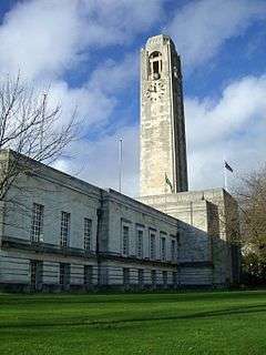
Council premises
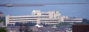
- Civic Centre née County Hall
- Guildhall
- Mansion House
See also
References
- https://www.swansea.gov.uk/article/3954/Political-make-up-of-the-Council
- https://www.swansea.gov.uk/byelectioncastleward
- "Swansea Welsh Unitary Council Election Results 1995-2012" (PDF). Elections Centre. Plymouth University. Retrieved 13 April 2020.
- "Political make up of the Council". Swansea Council. Retrieved 28 July 2019.
- "Labour increases Swansea lead and holds Neath Port Talbot". BBC News. 5 May 2017.
- "Vote 2012 - Swansea". BBC News. 4 May 2012.
- "Local Election Results 2012 - Swansea". Local Elections Archive Project (Andrew Teale).
- "Local Election Results 2008 - Swansea". Local Elections Archive Project (Andrew Teale).
- "Swansea council - Lab lose to NOC". BBC News. 11 June 2004.
- "Local Election Results 2004 - Swansea". Local Elections Archive Project (Andrew Teale).
- "Rob Stewart set to lead Labour-ruling Swansea council". BBC News. 2 September 2014. Retrieved 28 July 2019.
- "New Lord Mayor for Swansea". City of Swansea. Archived from the original on 9 August 2017. Retrieved 9 August 2017.
- "Lord Mayor of Swansea". City of Swansea. Retrieved 14 December 2015.
- "Ceinwen Thomas installed as the new mayor of Swansea". South Wales Evening Post. Retrieved 13 October 2014.
- "New Lord Mayor and Deputy Lord Mayor for Swansea". South Wales Evening Post. Retrieved 30 April 2014.
- "Records relating to the Mayor/Lord Mayor of Swansea". Swansea City Council. Archived from the original on 1 May 2014. Retrieved 30 April 2014.
- The Local Authorities (Armorial Bearings) (No. 2) (Wales) Order 1996 (1996 No. 1930 ) (OPSI website), accessed October 2, 2007
External links
City and County of Swansea | |||||||||||||||||||||
|---|---|---|---|---|---|---|---|---|---|---|---|---|---|---|---|---|---|---|---|---|---|
| |||||||||||||||||||||