Central Avenue station (BMT Myrtle Avenue Line)
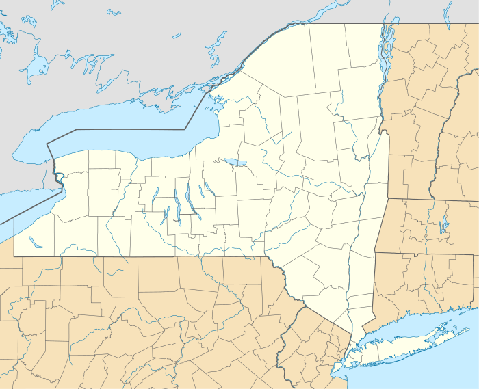
Central Avenue is a station on the BMT Myrtle Avenue Line of the New York City Subway. Located at Myrtle Avenue and Cedar Street in Bushwick, Brooklyn, it is served by the M train at all times.
Central Avenue | |||||||
|---|---|---|---|---|---|---|---|
.jpg) Middle Village-bound M train of R160s arriving at the renovated Central Avenue station | |||||||
| Station statistics | |||||||
| Address | Cedar Street & Myrtle Avenue Brooklyn, NY 11221 | ||||||
| Borough | Brooklyn | ||||||
| Locale | Bushwick | ||||||
| Coordinates | 40.698015°N 73.9252°W | ||||||
| Division | B (BMT) | ||||||
| Line | BMT Myrtle Avenue Line | ||||||
| Services | M | ||||||
| Transit connections | |||||||
| Structure | Elevated | ||||||
| Platforms | 2 side platforms | ||||||
| Tracks | 2 | ||||||
| Other information | |||||||
| Opened | December 19, 1889 | ||||||
| Closed | March 9, 2013 (first closing) July 1, 2017 (temporary line closure) | ||||||
| Rebuilt | August 2, 2013 (reconstruction) April 30, 2018 (temporary line closure) | ||||||
| Station code | 114[1] | ||||||
| Opposite-direction transfer available | Yes | ||||||
| Traffic | |||||||
| Passengers (2019) | 1,472,067[2] | ||||||
| Rank | 301 out of 424[2] | ||||||
| Station succession | |||||||
| Next east | Knickerbocker Avenue: M | ||||||
| Next west | Myrtle Avenue: M Broadway: no regular service (Demolished) | ||||||
| |||||||
| |||||||
| |||||||

%26groups%3D_c70571f97f7a7d795101beca8a443680a78c88da.svg)
Station layout
| P Platform level |
Side platform | |
| Westbound | ← | |
| Center trackway | No track or roadbed | |
| Eastbound | | |
| Side platform | ||
| M | Mezzanine | Fare control, station agent, MetroCard machines |
| G | Street level | Exit/entrance |
This elevated station, opened on December 19, 1889, has two side platforms and two tracks with space for a center track, which was removed by 1946.
The Queens-bound platform has brown canopies with green frames and support columns for the entire length except for small sections at either ends. A small section in the center below the canopy has beige windscreens while the rest of the platform has black, waist-high, steel fences. The Manhattan-bound platform has the same layout as the Queens-bound one except that the entire canopied portion has beige windscreens.
This station was rehabilitated from March to August 2013.[3] On July 1, 2017, the station was closed again until April 30, 2018, as part of the reconstruction of the Myrtle Avenue Line's junction with the BMT Jamaica Line.[4][5][6]
Exits
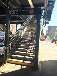
This station has one elevated station house beneath the platforms and tracks at the east end, though extra beams on the elevated structure suggests that another station house formerly existed at the west end. A single staircase from each platform goes down to a waiting area/crossunder, where a turnstile bank provides access to and from the station. Outside fare control, there is a token booth and two staircases going down to the southwest and northwest corners of Myrtle Avenue and Cedar Street. Only the northern staircase has a canopy above it.[7]
References
- "Station Developers' Information". Metropolitan Transportation Authority. Retrieved June 13, 2017.
- "Facts and Figures: Annual Subway Ridership 2014–2019". Metropolitan Transportation Authority. 2020. Retrieved May 26, 2020.
- "Central Avenue M Station Reopens Following Rehab". New York City Metropolitan Transportation Authority. Retrieved August 16, 2013.
- Rivoli, Dan (March 17, 2016). "M line to be shut down next year for repairs". New York Daily News. Retrieved July 23, 2016.
- Brown, Nicole (March 18, 2016). "MTA: M line will shut down for part of next year". am New York. Retrieved July 23, 2016.
- "Myrtle Avenue Line Infrastructure Projects". mta.info. Metropolitan Transportation Authority. Retrieved July 23, 2016.
- "MTA Neighborhood Maps: Bushwick" (PDF). mta.info. Metropolitan Transportation Authority. 2015. Retrieved 20 July 2016.
External links

- nycsubway.org – BMT Myrtle Avenue Line: Central Avenue
- Station Reporter — M Train
- The Subway Nut — Central Avenue Pictures
- Cedar Street entrance from Google Maps Street View
- Platforms from Google Maps Street View
| Myrtle Ave. Line | |
|---|---|
| |