Centerport, Pennsylvania
Centerport is a borough in north central Berks County, Pennsylvania, United States. The population was 387 at the 2010 census.
Centerport, Pennsylvania | |
|---|---|
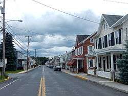 Main Street | |
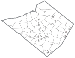 Location of Centerport in Berks County, Pennsylvania. | |
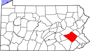
 Centerport Location of Centerport in Pennsylvania  Centerport Centerport (the United States) | |
| Coordinates: 40°29′12″N 76°00′26″W | |
| Country | United States |
| State | Pennsylvania |
| County | Berks |
| Area | |
| • Total | 0.17 sq mi (0.45 km2) |
| • Land | 0.17 sq mi (0.45 km2) |
| • Water | 0.00 sq mi (0.00 km2) |
| Elevation | 348 ft (106 m) |
| Population (2010) | |
| • Total | 387 |
| • Estimate (2019)[2] | 363 |
| • Density | 2,086.21/sq mi (805.55/km2) |
| Time zone | UTC-5 (EST) |
| • Summer (DST) | UTC-4 (EDT) |
| ZIP code | 19516 |
| Area code(s) | 610 and 484 |
| FIPS code | 42-12104 |
| Website | www |
It is in the Schuylkill Valley School District.
Geography
Centerport is located at 40°29′12″N 76°0′26″W (40.486726, -76.007190).[3] According to the United States Census Bureau, the borough has a total area of 0.2 square miles (0.52 km2), all of it land. It drains southeastward to the nearby Schuylkill River.
Demographics
| Historical population | |||
|---|---|---|---|
| Census | Pop. | %± | |
| 1890 | 133 | — | |
| 1900 | 141 | 6.0% | |
| 1910 | 111 | −21.3% | |
| 1920 | 134 | 20.7% | |
| 1930 | 137 | 2.2% | |
| 1940 | 191 | 39.4% | |
| 1950 | 226 | 18.3% | |
| 1960 | 208 | −8.0% | |
| 1970 | 227 | 9.1% | |
| 1980 | 246 | 8.4% | |
| 1990 | 284 | 15.4% | |
| 2000 | 327 | 15.1% | |
| 2010 | 387 | 18.3% | |
| Est. 2019 | 363 | [2] | −6.2% |
| Sources:[4][5][6] | |||
As of the census[5] of 2000, there were 387 people, 149 households, and 107 families living in the borough. The population density was 1,935 people per square mile (758.8/km²). There were 150 housing units at an average density of 750 per square mile (294.1/km²). The racial makeup of the borough was 96.4% White, 0.5% African American, 0.5% Native American, and 2.6% from other races.. Hispanic or Latino of any race were 3.6% of the population.
There were 149 households, out of which 29.5% had children under the age of 18 living with them, 51.7% were married couples living together, 11.4% had a female householder with no husband present, and 28.2% were non-families. 21.5% of all households were made up of individuals, and 6.7% had someone living alone who was 65 years of age or older. The average household size was 2.60 and the average family size was 2.93.
In the borough the population was spread out, with 24.0% under the age of 18, 9.6% from 18 to 24, 25.8% from 25 to 44, 24.6% from 45 to 64, and 16% who were 65 years of age or older. The median age was 37.9 years. Males made up 49.1% of the population and females made up 50.9%.
The median income for a household in the borough was $47,115, and the median income for a family was $51,250. Males had a median income of $30,938 versus $23,750 for females. The per capita income for the borough was $20,927. About 2.3% of families and 4.6% of the population were below the poverty line, including 3.3% of those under age 18 and 6.4% of those age 65 or over.
Landmarks
Centerport is known for having a literal nine foot tall "fork" in the road at the intersection of Main St. and Centerport Rd.
Gallery
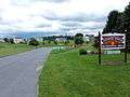 Recreation Area.
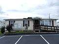 Centerport Borough Hall.
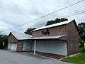 Borough Maintenance Bldg.
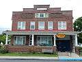 Central Berks Lions Club.
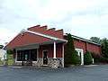 Amato's Pizza.
References
- "2019 U.S. Gazetteer Files". United States Census Bureau. Retrieved July 28, 2020.
- "Population and Housing Unit Estimates". United States Census Bureau. May 24, 2020. Retrieved May 27, 2020.
- "US Gazetteer files: 2010, 2000, and 1990". United States Census Bureau. 2011-02-12. Retrieved 2011-04-23.
- "Census of Population and Housing". U.S. Census Bureau. Retrieved 11 December 2013.
- "U.S. Census website". United States Census Bureau. Retrieved 2008-01-31.
- "Incorporated Places and Minor Civil Divisions Datasets: Subcounty Resident Population Estimates: April 1, 2010 to July 1, 2012". Population Estimates. U.S. Census Bureau. Archived from the original on 11 June 2013. Retrieved 11 December 2013.
Places adjacent to Centerport, Pennsylvania | ||||||||||
|---|---|---|---|---|---|---|---|---|---|---|
| ||||||||||
| Wikimedia Commons has media related to Centerport, Pennsylvania. |