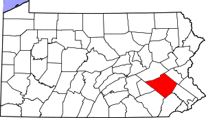
Union Township, Berks County, Pennsylvania
Union Township is a township in Berks County, Pennsylvania, United States. The population was 3,503 at the 2010 census.
Union Township | |
|---|---|
 Union Township Location of Union Township in Pennsylvania  Union Township Union Township (the United States) | |
| Coordinates: 40°15′06″N 75°44′35″W | |
| Country | United States |
| State | Pennsylvania |
| County | Berks |
| Area | |
| • Total | 23.5 sq mi (61 km2) |
| • Land | 23.2 sq mi (60 km2) |
| • Water | 0.3 sq mi (0.8 km2) |
| Elevation | 200 ft (60 m) |
| Population (2010) | |
| • Total | 3,503 |
| • Estimate (2016)[1] | 3,593 |
| • Density | 150/sq mi (58/km2) |
| Time zone | UTC-5 (EST) |
| • Summer (DST) | UTC-4 (EDT) |
| Area code(s) | 610 |
| Website | https://www.unionberks.org/ |
History
The French Creek State Park: Six Penny Day Use District, French Creek State Park: Organized Group Camp 4 District, and Hopewell Furnace National Historic Site are listed on the National Register of Historic Places.[2]
Demographics
At the 2000 census there were 3,453 people, 1,324 households, and 1,035 families living in the township. The population density was 148.9 people per square mile (57.5/km²). There were 1,370 housing units at an average density of 59.1/sq mi (22.8/km²). The racial makeup of the township was 98.03% White, 0.58% African American, 0.14% Native American, 0.12% Asian, 0.03% Pacific Islander, 0.29% from other races, and 0.81% from two or more races. Hispanic or Latino of any race were 0.96%.[3]
There were 1,324 households, 30.0% had children under the age of 18 living with them, 69.0% were married couples living together, 6.1% had a female householder with no husband present, and 21.8% were non-families. 17.5% of households were made up of individuals, and 7.3% were one person aged 65 or older. The average household size was 2.59 and the average family size was 2.93.
The age distribution was 21.6% under the age of 18, 6.0% from 18 to 24, 28.0% from 25 to 44, 29.7% from 45 to 64, and 14.7% 65 or older. The median age was 42 years. For every 100 females there were 100.3 males. For every 100 females age 18 and over, there were 97.6 males.
| Historical population | |||
|---|---|---|---|
| Census | Pop. | %± | |
| 1980 | 2,615 | — | |
| 1990 | 3,440 | 31.5% | |
| 2000 | 3,453 | 0.4% | |
| 2010 | 3,503 | 1.4% | |
| Est. 2016 | 3,593 | [1] | 2.6% |
| U.S. Decennial Census[4] | |||
The median household income was $54,205 and the median family income was $61,048. Males had a median income of $42,685 versus $27,901 for females. The per capita income for the township was $26,014. About 1.8% of families and 2.8% of the population were below the poverty line, including 2.9% of those under age 18 and 4.7% of those age 65 or over.
Geography
According to the United States Census Bureau, the township has a total area of 23.5 square miles (60.8 km²), of which, 23.2 square miles (60.1 km²) of it is land and 0.3 square miles (0.8 km²) of it (1.28%) is water. The township is located in the Hopewell Big Woods.
Recreation
Most of French Creek State Park and a small portion of the Pennsylvania State Game Lands Number 43 are located in Union Township.[5][6]
References
- "Population and Housing Unit Estimates". Retrieved June 9, 2017.
- "National Register Information System". National Register of Historic Places. National Park Service. July 9, 2010.
- "U.S. Census website". United States Census Bureau. Retrieved 2008-01-31.
- "Census of Population and Housing". Census.gov. Retrieved June 4, 2016.
- https://viewer.nationalmap.gov/advanced-viewer/ The National Map, retrieved 24 October 2018
- Pennsylvania State Game Lands Number 43, retrieved 25 October 2018
