Val-de-Chalvagne
Val-de-Chalvagne is a commune in the Alpes-de-Haute-Provence department in southeastern France.
Val-de-Chalvagne | |
|---|---|
 The Col de Laval à Montblanc | |
 Coat of arms | |
Location of Val-de-Chalvagne 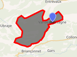
| |
 Val-de-Chalvagne 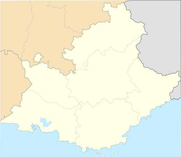 Val-de-Chalvagne | |
| Coordinates: 43°54′54″N 6°48′30″E | |
| Country | France |
| Region | Provence-Alpes-Côte d'Azur |
| Department | Alpes-de-Haute-Provence |
| Arrondissement | Castellane |
| Canton | Castellane |
| Government | |
| • Mayor (2008–2014) | Christian Gatti |
| Area 1 | 32.57 km2 (12.58 sq mi) |
| Population (2017-01-01)[1] | 87 |
| • Density | 2.7/km2 (6.9/sq mi) |
| Time zone | UTC+01:00 (CET) |
| • Summer (DST) | UTC+02:00 (CEST) |
| INSEE/Postal code | 04043 /04320 |
| Elevation | 599–1,587 m (1,965–5,207 ft) (avg. 900 m or 3,000 ft) |
| 1 French Land Register data, which excludes lakes, ponds, glaciers > 1 km2 (0.386 sq mi or 247 acres) and river estuaries. | |
Population
| Year | Pop. | ±% |
|---|---|---|
| 1793 | 47 | — |
| 1800 | 70 | +48.9% |
| 1806 | 80 | +14.3% |
| 1821 | 56 | −30.0% |
| 1831 | 139 | +148.2% |
| 1836 | 106 | −23.7% |
| 1841 | 89 | −16.0% |
| 1846 | 82 | −7.9% |
| 1851 | 83 | +1.2% |
| 1856 | 90 | +8.4% |
| 1861 | 90 | +0.0% |
| 1866 | 90 | +0.0% |
| 1872 | 86 | −4.4% |
| 1876 | 71 | −17.4% |
| 1881 | 75 | +5.6% |
| 1886 | 74 | −1.3% |
| 1891 | 62 | −16.2% |
| 1896 | 68 | +9.7% |
| 1901 | 81 | +19.1% |
| 1906 | 55 | −32.1% |
| 1911 | 50 | −9.1% |
| 1921 | 40 | −20.0% |
| 1926 | 44 | +10.0% |
| 1931 | 41 | −6.8% |
| 1936 | 44 | +7.3% |
| 1946 | 45 | +2.3% |
| 1954 | 37 | −17.8% |
| 1962 | 21 | −43.2% |
| 1968 | 11 | −47.6% |
| 1975 | 52 | +372.7% |
| 1982 | 68 | +30.8% |
| 1990 | 38 | −44.1% |
| 1999 | 48 | +26.3% |
| 2008 | 65 | +35.4% |
gollark: SGNS *does* do some of the GPS requesting over SPUDNET websocket, that's how it's fairly secure.
gollark: Since occasionally I do need actual fairly secure things.
gollark: I design a lot of random secure-ish systems on top of it, like SPUDNET and SGNS.
gollark: Well, sure.
gollark: So unless I bother to write a PR for anonymized GPS, people who don't go to the extra effort of writing their own implementation (as far as I'm aware nobody does so far) will be trackable by ID.
References
- "Populations légales 2017". INSEE. Retrieved 6 January 2020.
| Wikimedia Commons has media related to Val-de-Chalvagne. |
This article is issued from Wikipedia. The text is licensed under Creative Commons - Attribution - Sharealike. Additional terms may apply for the media files.