Carugo
Carugo (Brianzöö: Carugh [kaˈryːk]) is a comune (municipality) in the Province of Como in the Italian region Lombardy, located about 30 kilometres (19 mi) north of Milan and about 14 kilometres (8.7 mi) southeast of Como. As of 31 December 2004, it had a population of 5,729 and an area of 4.1 square kilometres (1.6 sq mi).[3]
Carugo | |
|---|---|
| Comune di Carugo | |
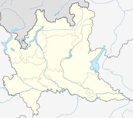
Location of Carugo 
| |
 Carugo Location of Carugo in Italy  Carugo Carugo (Lombardy) | |
| Coordinates: 45°43′N 9°12′E | |
| Country | Italy |
| Region | Lombardy |
| Province | Province of Como (CO) |
| Area | |
| • Total | 4.1 km2 (1.6 sq mi) |
| Population (Dec. 2004)[2] | |
| • Total | 5,729 |
| • Density | 1,400/km2 (3,600/sq mi) |
| Time zone | UTC+1 (CET) |
| • Summer (DST) | UTC+2 (CEST) |
| Postal code | 22060 |
| Dialing code | 031 |
Carugo borders the following municipalities: Arosio, Brenna, Giussano, Inverigo, Mariano Comense.
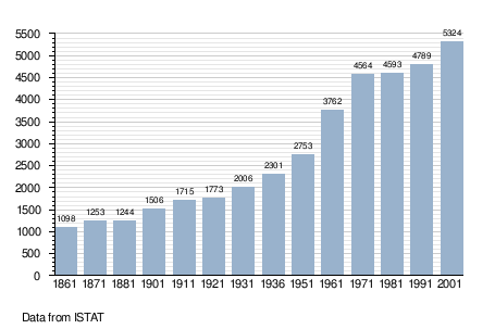
Demographic evolution

gollark: That doesn't address anything else I said.
gollark: Ah yes, indirectly then. Swap that for "in useful quantities" or "without expending tons of time/resources" if you like.
gollark: I didn't mention "money".
gollark: What?
gollark: (Sidenote: interestingly, apparently the development of farming actually led to significantly *worse* life for people for quite a long time, because it allowed much more population per land area, causing people to end up at a subsistence level and quite malnourished and stuff)
References
- "Superficie di Comuni Province e Regioni italiane al 9 ottobre 2011". Istat. Retrieved 16 March 2019.
- "Popolazione Residente al 1° Gennaio 2018". Istat. Retrieved 16 March 2019.
- All demographics and other statistics: Italian statistical institute Istat.
This article is issued from Wikipedia. The text is licensed under Creative Commons - Attribution - Sharealike. Additional terms may apply for the media files.