Camps-Saint-Mathurin-Léobazel
Camps-Saint-Mathurin-Léobazel is a commune in the Corrèze department in central France.
Camps-Saint-Mathurin-Léobazel | |
|---|---|
.svg.png) Coat of arms | |
Location of Camps-Saint-Mathurin-Léobazel 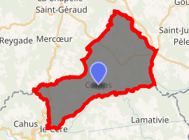
| |
 Camps-Saint-Mathurin-Léobazel  Camps-Saint-Mathurin-Léobazel | |
| Coordinates: 44°59′01″N 1°59′26″E | |
| Country | France |
| Region | Nouvelle-Aquitaine |
| Department | Corrèze |
| Arrondissement | Tulle |
| Canton | Argentat |
| Government | |
| • Mayor (2014–2020) | Jean Pestourie |
| Area 1 | 34.08 km2 (13.16 sq mi) |
| Population (2017-01-01)[1] | 237 |
| • Density | 7.0/km2 (18/sq mi) |
| Time zone | UTC+01:00 (CET) |
| • Summer (DST) | UTC+02:00 (CEST) |
| INSEE/Postal code | 19034 /19430 |
| Elevation | 160–623 m (525–2,044 ft) (avg. 540 m or 1,770 ft) |
| 1 French Land Register data, which excludes lakes, ponds, glaciers > 1 km2 (0.386 sq mi or 247 acres) and river estuaries. | |
Population
| Year | Pop. | ±% |
|---|---|---|
| 1962 | 451 | — |
| 1968 | 457 | +1.3% |
| 1975 | 381 | −16.6% |
| 1982 | 341 | −10.5% |
| 1990 | 293 | −14.1% |
| 1999 | 242 | −17.4% |
| 2008 | 248 | +2.5% |
gollark: Also, possible slogan for free tier: "Free to enjoy the potatOS experience™".
gollark: Sorry for any inconvenience caused but not very much.
gollark: This is a secret, so I'm deploying antimemes against you.
gollark: People would notice.
gollark: Not practically.
See also
References
- "Populations légales 2017". INSEE. Retrieved 6 January 2020.
| Wikimedia Commons has media related to Camps-Saint-Mathurin-Léobazel. |
| Authority control |
|
|---|
This article is issued from Wikipedia. The text is licensed under Creative Commons - Attribution - Sharealike. Additional terms may apply for the media files.