California Historical Landmarks in San Luis Obispo County, California
This list includes properties and districts listed on the California Historical Landmark listing in San Luis Obispo County, California. Click the "Map of all coordinates" link to the right to view a Google map of all properties and districts with latitude and longitude coordinates in the table below.
width = 8% class="unsortable" style="background-color:
|
style="background-color:
|
width = 18% style="background-color:
|
style="background-color:
|
City or town | style="background-color:
|
|---|---|---|---|---|---|
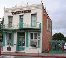 Ah Louis Store |
style="background-color:
|
Ah Louis Store | 800 Palm St. 35°16′54″N 120°39′51″W |
San Luis Obispo | |
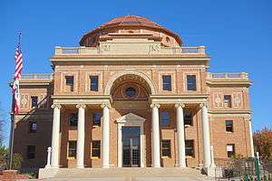 Atascadero Administration Building |
style="background-color:
|
Atascadero Administration Building | 6500 Palma Ave. 35°29′22″N 120°40′03″W |
Atascadero | |
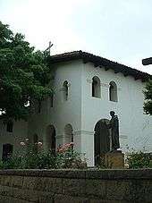
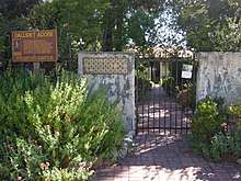 Dallidet Adobe |
style="background-color:
|
Dallidet Adobe | 1309 Toro at Pacific 35°16′51″N 120°39′23″W |
San Luis Obispo | |
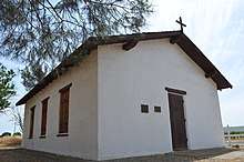 Estrella Adobe Church |
style="background-color:
|
Estrella Adobe Church | On Airport Rd. 35°40′50″N 120°38′27″W |
Paso Robles | |
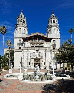 Hearst San Simeon State Historical Monument |
style="background-color:
|
Hearst San Simeon State Historical Monument | Hearst San Simeon State Historical Monument 35°41′07″N 121°10′00″W |
San Simeon | |
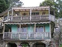 Nitt Witt Ridge |
style="background-color:
|
Nitt Witt Ridge | Nitt Witt Ridge, 881 Hillcrest Dr. 35°34′00″N 121°05′43″W |
Cambria | |
 Mission San Luis Obispo de Tolosa |
style="background-color:
|
Mission San Luis Obispo de Tolosa | Monterey between Chorro and Broad Sts. 35°16′51″N 120°39′52″W |
San Luis Obispo | |
 Mission San Miguel Arcángel |
style="background-color:
|
Mission San Miguel Arcángel | 775 Mission St. 35°44′41″N 120°41′53″W |
San Miguel | |
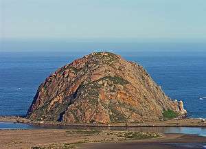 Morro Rock |
style="background-color:
|
Morro Rock | Off shore 35°22′10″N 120°52′03″W |
Morro Bay | |
 Rancho Nipomo |
style="background-color:
|
Rancho Nipomo | 6715 Oakglen Ave. 35°02′N 120°29′W |
Nipomo | |
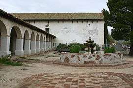
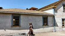
 Rios-Caledonia Adobe |
style="background-color:
|
Rios-Caledonia Adobe | 700 Mission St. 35°44′17″N 120°41′56″W |
San Miguel | |
Santa Margarita de Cortona Asistencia |
style="background-color:
|
Santa Margarita de Cortona Asistencia | Rancho Santa Margarita Hay Barn 35°24′02″N 120°36′44″W |
Santa Margarita | Private property |
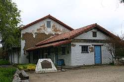
 Sebastian Store |
style="background-color:
|
Sebastian Store | San Simeon Rd. 35°38′36″N 121°11′29″W |
San Simeon |
References
- "California Historical Landmarks By County". Ohp.parks.ca.gov. Retrieved 2019-04-03.
See also
| Wikimedia Commons has media related to California Historical Landmarks in San Luis Obispo County, California. |
This article is issued from Wikipedia. The text is licensed under Creative Commons - Attribution - Sharealike. Additional terms may apply for the media files.