California Historical Landmarks in Los Angeles County
List table of the properties and districts — listed on the California Historical Landmarks in Los Angeles County, Southern California.
- Note: Click the "Map of all coordinates" link to the right to view a Google map of all properties and districts with latitude and longitude coordinates in the table below.
width = 8% class="unsortable" style="background-color:
|
style="background-color:
|
width = 18% style="background-color:
|
style="background-color:
|
City or town | style="background-color:
|
|---|---|---|---|---|---|
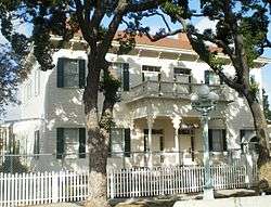
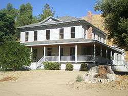
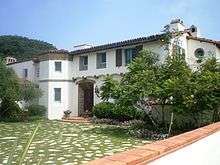 Adamson House |
style="background-color:
|
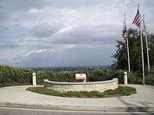
Adamson House | Adamson House 34°02′04″N 118°40′51″W |
Malibu | 23200 Pacific Coast Hwy, Malibu, CA |
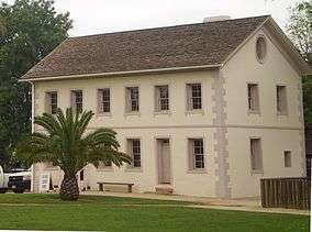
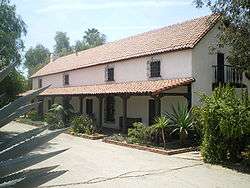
 Adobe de Palomares |
style="background-color:
|
Adobe de Palomares | 491 East Arrow Highway 34°05′26″N 117°44′35″W |
Pomona | |
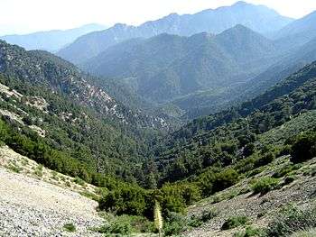 Angeles National Forest |
style="background-color:
|
Angeles National Forest | Angeles National Forest 34°16′11″N 118°10′06″W |
La Cañada Flintridge | |
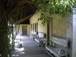
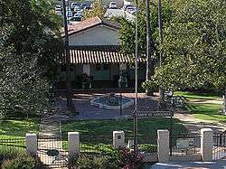
 Avila Adobe |
style="background-color:
|
Avila Adobe | El Pueblo de Los Angeles Historic Monument 34°03′26″N 118°14′16″W |
Los Angeles | Also on the NRHP list as NPS-72000231 |
 Banning Park |
style="background-color:
|
Banning Park | 401 East M St. 33°47′23″N 118°15′32″W |
Wilmington | |
 Beach Boys Historic Landmark |
style="background-color:
|
Beach Boys Historic Landmark | 3701 W. 119th St. 33°55′31″N 118°20′15″W |
Hawthorne | |
 Beale's Cut Stagecoach Pass |
style="background-color:
|
Beale's Cut Stagecoach Pass | Sierra Hwy and Clampitt Rd. 34°20′32″N 118°30′34″W |
Santa Clarita | |
 Bella Union Hotel site |
style="background-color:
|
Bella Union Hotel site | Fletcher Bowron Square 34°03′17″N 118°14′27″W |
Los Angeles | |
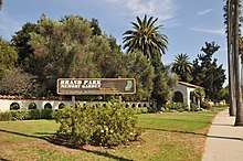 Brand Park |
style="background-color:
|
Brand Park | 15174 San Fernando Mission Blvd. 34°16′21″N 118°27′26″W |
Los Angeles | |
 Campo de Cahuenga |
style="background-color:
|
Campo de Cahuenga | 3919 Lankershim Blvd 34°08′24″N 118°21′42″W |
North Hollywood | Also on the NRHP list as NPS-72001602 |
Casa Adobe De San Rafael |
style="background-color:
|
Casa Adobe De San Rafael | 1330 Dorothy St. 34°09′58″N 118°15′50″W |
Glendale | |
 Casa De Governor Pio Pico |
style="background-color:
|
Casa De Governor Pio Pico | Pio Pico State Historic Park 33°59′37″N 118°04′16″W |
Whittier | Also on the NRHP list as NPS-73000408 |
 Casa De San Pedro |
style="background-color:
|
Casa De San Pedro | Meyler and Quartermaster Rds. 33°43′15″N 118°17′06″W |
San Pedro | |
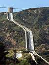 The Cascades |
style="background-color:
|
The Cascades | Foothill Blvd. & Balboa Blvd. 34°19′22″N 118°29′51″W |
Sylmar | |
 Catalina Adobe |
style="background-color:
|
Catalina Adobe | 2211 Bonita Dr. 34°10′48″N 118°13′57″W |
Glendale | Also on the NRHP list as NPS-76000487 |
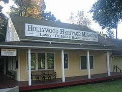 Cecil B. DeMille Studio Barn |
style="background-color:
|
Cecil B. DeMille Studio Barn | 2100 N. Highland Ave. 34°06′31″N 118°20′10″W |
Hollywood | |
 Centinela Springs |
style="background-color:
|
Centinela Springs | Centinela Park, 700 Warren Ln. 33°58′29″N 118°20′33″W |
Inglewood | |
 Chatsworth Calera |
style="background-color:
|
Chatsworth Calera | Woolsey Canyon Rd. & Valley Circle Blvd. 34°14′05″N 118°38′31″W |
Chatsworth | |
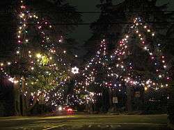 Christmas Tree Lane |
style="background-color:
|
Christmas Tree Lane | Santa Rosa Ave. 34°11′25″N 118°08′09″W |
Altadena | Also on the NRHP list as NPS-90001444 |
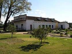
 Dominguez Ranch House |
style="background-color:
|
Dominguez Ranch House | 18127 S Alameda 33°52′01″N 118°13′03″W |
Compton | Also on the NRHP list as NPS-76000486 |
 Drum Barracks |
style="background-color:
|
Drum Barracks | 1053 Cary St. 33°47′05″N 118°15′24″W |
Wilmington | Also on the NRHP list as NPS-71000161 |
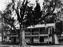
 E.J. Baldwin's Queen Anne Cottage |
style="background-color:
|
E.J. Baldwin's Queen Anne Cottage | Los Angeles State and County Arboretum 34°08′27″N 118°03′09″W |
Arcadia | Also on the NRHP list as NPS-80000804 |
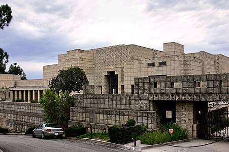 Ennis House |
style="background-color:
|
Ennis House | 2655 Glendower Ave. 34°06′58″N 118°17′34″W |
Los Angeles | Also on the NRHP list as NPS-71000145 |
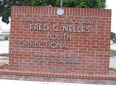 Fred C. Nelles Youth Correctional Facility |
style="background-color:
|
Fred C. Nelles Youth Correctional Facility | Fred C. Nelles Youth Correctional Facility 33°58′34″N 118°03′04″W |
Whittier | |
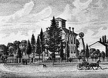
 First home of Pomona College |
style="background-color:
|
First home of Pomona College | Mission Blvd. & S White St. 34°03′17″N 117°45′32″W |
Pomona | |
 First Jewish site in Los Angeles |
style="background-color:
|
First Jewish site in Los Angeles | Chavez Ravine 34°04′11″N 118°14′28″W |
Los Angeles | |
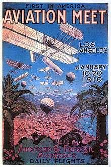 First United States Air Meet |
style="background-color:
|
First United States Air Meet | 18501 South Wilmington Avenue 33°51′42″N 118°14′06″W |
Carson | |
 Freeman House |
style="background-color:
|
Freeman House | 1962 Glencoe Way 34°06′20″N 118°20′19″W |
Los Angeles | Also on the NRHP list as NPS-71000146 |
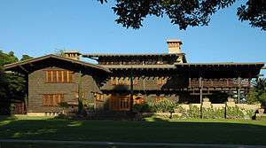 Gamble House |
style="background-color:
|
Gamble House | 4 Westmoreland Pl. 34°09′06″N 118°09′39″W |
Pasadena | Also on the NRHP list as NPS-71000155 |
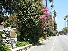 Glendora Bougainvillea |
style="background-color:
|
Glendora Bougainvillea | E Bennett Ave. at N. Minnesota Ave. 34°08′23″N 117°51′38″W |
Glendora | Also on the NRHP list as NPS-78000683 |
 Governor Stoneman Adobe, Los Robles |
style="background-color:
|
Governor Stoneman Adobe, Los Robles | 1912 Montrobles Pl. 34°06′51″N 118°08′10″W |
San Marino | |
 Grave of George Caralambo |
style="background-color:
|
Grave of George Caralambo | Founders' Memorial Park 33°59′12″N 118°02′47″W |
Whittier | |
 Griffith Ranch |
style="background-color:
|
Griffith Ranch | 12685 Foothill Blvd at Vaughn St. 34°17′24″N 118°24′41″W |
San Fernando | |
Hancock Park |
style="background-color:
|
Hancock Park | 5801 Wilshire Blvd 34°03′49″N 118°21′25″W |
Los Angeles | |
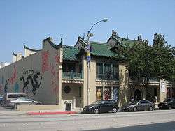
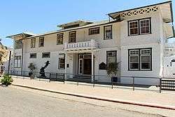
.jpg) Harold Lloyd Estate |
style="background-color:
|
Harold Lloyd Estate | 1740 Green Acres Place 34°05′17″N 118°25′37″W |
Beverly Hills | Also known as Greenacres. Also on the NRHP list as NPS-84000876 |
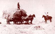 Hay Tree |
style="background-color:
|
Hay Tree | 16475 Paramount Blvd. 33°53′03″N 118°09′38″W |
Paramount | |
 Henry Gage Mansion |
style="background-color:
|
Henry Gage Mansion | 7000 E. Gage 33°58′19″N 118°08′04″W |
Bell Gardens | |
style="background-color:
|
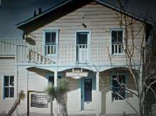
Heritage House | Willowbrook Ave. & Myrrh St. 33°53′34″N 118°13′28″W |
Compton | ||
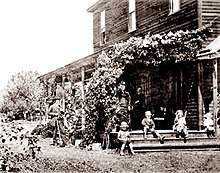
_Baldwin%2C_the_former_Hugo_Reid_Adobe%2C_at_Rancho_Santa_Anita%2C_ca.1903_(CHS-5178).jpg) Hugo Reid Adobe |
style="background-color:
|
Hugo Reid Adobe | Los Angeles State and County Arboretum 34°08′27″N 118°03′11″W |
Arcadia | |
 Jose Dolores Sepulveda Adobe |
style="background-color:
|
Jose Dolores Sepulveda Adobe | Madison St. & Courtney Way 33°47′49″N 118°20′53″W |
Torrance | |
style="background-color:
|
La Casa de Carrión | 919 Puddingstone Dr. 34°05′46″N 117°47′20″W |
La Verne | ||
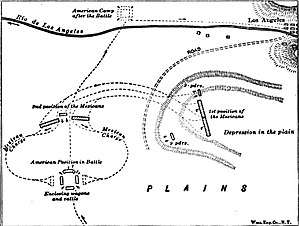 La Mesa Battlefield |
style="background-color:
|
La Mesa Battlefield | 4490 Exchange Ave at Downey Rd. 34°00′09″N 118°12′17″W |
Vernon | |
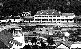
 Lang Southern Pacific Station |
style="background-color:
|
Lang Southern Pacific Station | Soledad Canyon 34°25′52″N 118°22′44″W |
Santa Clarita | |
 Liberty Hill site |
style="background-color:
|
Liberty Hill site | 5th St. & Harbor Blvd. 33°44′26″N 118°16′50″W |
San Pedro | |
Llano del Rio |
style="background-color:
|
Llano del Rio | State Hwy 138 34°30′23″N 117°49′37″W |
Llano | |
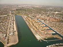 Long Beach Marine Stadium |
style="background-color:
|
Long Beach Marine Stadium | Pete Archer Rowing Center 33°46′09″N 118°07′58″W |
Long Beach | |
.JPG) Los Angeles Memorial Coliseum |
style="background-color:
|
Los Angeles Memorial Coliseum | University of Southern California 34°00′51″N 118°17′16″W |
Los Angeles | Also on the NRHP list as NPS-84003866 |
 Los Angeles Plaza |
style="background-color:
|
Los Angeles Plaza | El Pueblo de Los Angeles Historic Monument 34°03′25″N 118°14′16″W |
Los Angeles | |
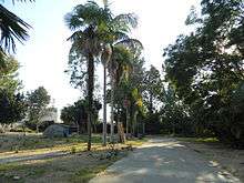
 Los Encinos State Historic Park |
style="background-color:
|
Los Encinos State Historic Park | Los Encinos State Historic Park 34°09′38″N 118°29′58″W |
Encino | |
 Lugo Adobe |
style="background-color:
|
Lugo Adobe | El Pueblo de Los Angeles Historic Monument 34°03′23″N 118°14′18″W |
Los Angeles | |
 Lummis Home |
style="background-color:
|
Lummis Home | 200 E. Ave 43 and Pasadena Freeway 34°05′35″N 118°12′22″W |
Los Angeles | Also on the NRHP list as NPS-71000148 |
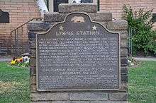 Lyons Station Stagecoach Stop |
style="background-color:
|
Lyons Station Stagecoach Stop | Eternal Valley Memorial Park, 23287 N Sierra Hwy 34°21′46″N 118°30′27″W |
Newhall | |
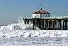 Manhattan Beach pier |
style="background-color:
|
Manhattan Beach pier | Manhattan Beach 33°53′01″N 118°24′49″W |
Manhattan Beach | |
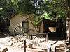
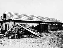
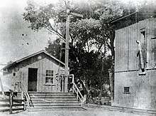
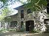
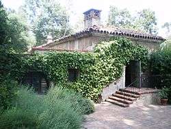
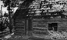
 Mentryville |
style="background-color:
|
Mentryville | 27201 W. Pico Canyon Rd. 34°22′45″N 118°36′40″W |
Newhall | |
.jpg) Merced Theatre |
style="background-color:
|
Merced Theatre | El Pueblo de Los Angeles Historic Monument 34°03′22″N 118°14′23″W |
Los Angeles | |
 Mirror Building |
style="background-color:
|
Mirror Building | 145 S. Spring St. 34°03′07″N 118°14′43″W |
Los Angeles | |
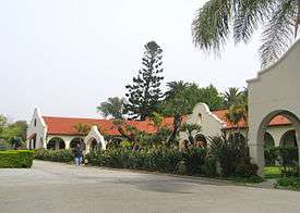
 Mission San Fernando Rey de España |
style="background-color:
|
Mission San Fernando Rey de España | 15151 San Fernando Mission Blvd. 34°16′23″N 118°27′40″W |
Mission Hills | Also on the NRHP list as NPS-71001076 |
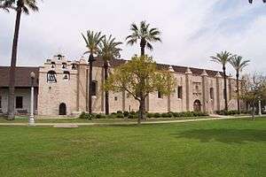 Mission San Gabriel Arcángel |
style="background-color:
|
Mission San Gabriel Arcángel | 537 W Mission Dr. 34°05′51″N 118°06′23″W |
San Gabriel | Also on the NRHP list as NPS-71000158 |
 Mission Vieja |
style="background-color:
|
Mission Vieja | N. Gabriel Blvd. & N. Lincoln Ave. 34°01′51″N 118°04′24″W |
Montebello | |
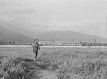
The Mojave Road |
style="background-color:
|
The Mojave Road | Drum Barracks to Route 66 crosses LA County line into San Bernardino County 33°47′05″N 118°15′29″W |
||
 Naval and Marine Corps Reserve Center |
style="background-color:
|
Naval and Marine Corps Reserve Center | 1700 Stadium Way 34°04′10″N 118°14′33″W |
Los Angeles | |
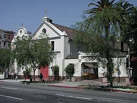 Nuestra Señora Reina de los Angeles |
style="background-color:
|
Nuestra Señora Reina de los Angeles | 535 N Main St. 34°03′25″N 118°14′22″W |
Los Angeles | |
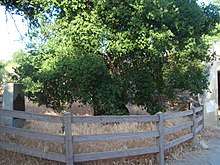 Oak of the Golden Dream |
style="background-color:
|
Oak of the Golden Dream | I-5 and Lyons Ave. 34°23′N 118°35′W |
Newhall | |
 Old Mill |
style="background-color:
|
Old Mill | 1120 Old Mill Rd. 34°07′08″N 118°07′41″W |
San Marino | Also on the NRHP list as NPS-71000154 |
.jpg) Old Plaza Firehouse |
style="background-color:
|
Old Plaza Firehouse | El Pueblo de Los Angeles Historic Monument 34°03′22″N 118°14′20″W |
Los Angeles | |
 Old Salt Lake |
style="background-color:
|
Old Salt Lake | Harbor Dr. & Yacht Club Way 33°51′07″N 118°23′49″W |
Redondo Beach | |
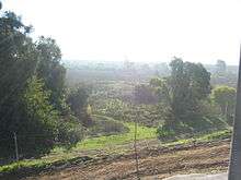
_(14596637437).jpg) Old Santa Monica Forestry Station |
style="background-color:
|
Old Santa Monica Forestry Station | Rustic Canyon 34°02′13″N 118°30′54″W |
Los Angeles | |
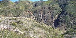
 Old Short Cut |
style="background-color:
|
Old Short Cut | Angeles National Forest 34°19′36″N 118°00′21″W |
La Cañada Flintridge | |
.jpg) Old Trapper's Lodge |
style="background-color:
|
Old Trapper's Lodge | Los Angeles Pierce College 34°11′06″N 118°35′00″W |
Woodland Hills | |
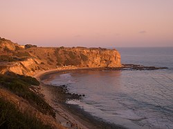 Old Whaling Station |
style="background-color:
|
Old Whaling Station | Portuguese Bend 33°44′05″N 118°21′16″W |
Rancho Palos Verdes | |
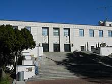
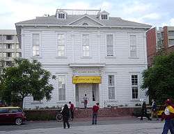 Original building of the University of Southern California |
style="background-color:
|
Original building of the University of Southern California | University of Southern California 34°01′11″N 118°16′58″W |
Los Angeles | |
style="background-color:
|
Ortega-Vigare Adobe | 616 S. Ramona St. 34°05′41″N 118°06′28″W |
San Gabriel | ||
 Pacific Asia Museum |
style="background-color:
|
Pacific Asia Museum | 46 North Los Robles Ave. 34°08′48″N 118°08′28″W |
Pasadena | Also on the NRHP list as NPS-77000300 |
 Paradox Hybrid Walnut Tree |
style="background-color:
|
Paradox Hybrid Walnut Tree | 12300 Whittier Blvd. and Mar Vista 33°58′26″N 118°02′45″W |
Whittier | |
 Pasadena Playhouse |
style="background-color:
|
Pasadena Playhouse | 39 El Molino Ave. 34°08′43″N 118°08′14″W |
Pasadena | Also on the NRHP list as NPS-75000435 |
 Pico House |
style="background-color:
|
Pico House | El Pueblo de Los Angeles Historic Monument 34°03′24″N 118°14′22″W |
Los Angeles | Also on the NRHP list as NPS-72000231 |
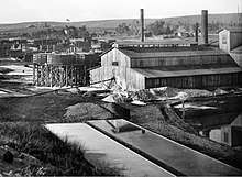
 Pioneer Oil Refinery |
style="background-color:
|
Pioneer Oil Refinery | Newhall Avenue west of Hwy 14. 34°22′42″N 118°33′50″W |
Newhall | Actual site is at 23864 Pine St. |
.JPG) Plummer House and oldest house in Hollywood |
style="background-color:
|
Plummer House and oldest house in Hollywood | 23537 Calabasas Rd. 34°09′27″N 118°38′23″W |
Calabasas | |
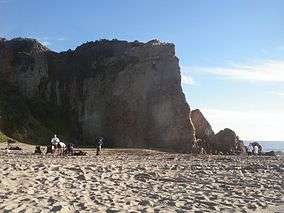 Point Dume |
style="background-color:
|
Point Dume | Point Dume 34°00′03″N 118°48′25″W |
Malibu | |
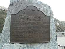 Pomona Water Powerplant |
style="background-color:
|
Pomona Water Powerplant | San Antonio Canyon, Camp Baldy Rd. 34°12′44″N 117°40′34″W |
Claremont | |
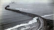 Port of Los Angeles Long Wharf in Santa Monica |
style="background-color:
|
Port of Los Angeles Long Wharf in Santa Monica | Will Rogers State Beach 34°01′53″N 118°31′38″W |
Pacific Palisades | |
 Portolá Trail Campsite 1 |
style="background-color:
|
Portolá Trail Campsite 1 | Elysian Park 34°04′19″N 118°13′38″W |
Los Angeles | |
 Portolá Trail Campsite 2 |
style="background-color:
|
Portolá Trail Campsite 2 | 325 South La Cienega Blvd. 34°03′41″N 118°22′33″W |
Beverly Hills | |
.jpg) Rancho Los Cerritos Historic Site |
style="background-color:
|
Rancho Los Cerritos Historic Site | 4600 Virginia Rd. 33°50′11″N 118°11′40″W |
Long Beach | Also on the NRHP list as NPS-70000135 |
 Rancho San Francisco |
style="background-color:
|
Rancho San Francisco | The Old Road & Henry Mayo Dr. 34°26′25″N 118°36′19″W |
Valencia | |
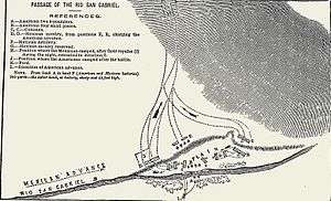 Rio San Gabriel Battlefield |
style="background-color:
|
Rio San Gabriel Battlefield | Washington Blvd. & Bluff Rd. 33°59′31″N 118°06′40″W |
Montebello | |
 Rómulo Pico Adobe |
style="background-color:
|
Rómulo Pico Adobe | 10940 N Sepulveda Blvd. 34°16′08″N 118°28′03″W |
Mission Hills | Also on the NRHP list as NPS-66000211 |
 St. Francis Dam Disaster Site |
style="background-color:
|
St. Francis Dam Disaster Site | San Francisquito Canyon 34°32′49″N 118°30′45″W |
Saugus | |
 St. Vincent's Place |
style="background-color:
|
St. Vincent's Place | St. Vincent Court 34°02′44″N 118°15′13″W |
Los Angeles | |
 San Fernando Cemetery |
style="background-color:
|
San Fernando Cemetery | San Fernando Cemetery, Bledsoe & Foothill 34°19′15″N 118°26′53″W |
Sylmar | |
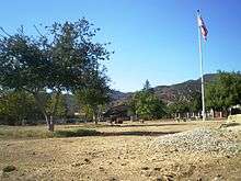
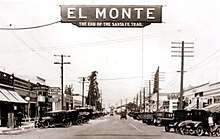 Santa Fe Trail Historical Park |
style="background-color:
|
Santa Fe Trail Historical Park | 3675 Santa Anita Ave, El Monte, CA 34°04′28″N 118°02′31″W |
El Monte | |
 Savannah Memorial Park |
style="background-color:
|
Savannah Memorial Park | 9263 Valley Blvd. 34°04′52″N 118°04′04″W |
Rosemead | |
 Serra Springs |
style="background-color:
|
Serra Springs | University High School 34°02′42″N 118°27′29″W |
Los Angeles | |
 Site of Home of Diego Sepúlveda |
style="background-color:
|
Site of Home of Diego Sepúlveda | 700 block of Channel St. 33°45′14″N 118°17′33″W |
San Pedro | |
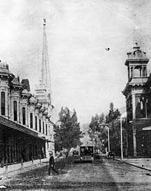
.jpg) Site of the Los Angeles Star |
style="background-color:
|
Site of the Los Angeles Star | Fletcher Bowron Square 34°03′16″N 118°14′28″W |
Los Angeles | |
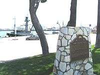
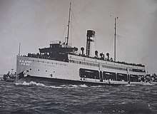 SS Catalina |
style="background-color:
|
SS Catalina | 33°44′55″N 118°16′29″W |
Ensenada, Baja California | It was scrapped in 2009. Also on the NRHP list as NPS-76000495. |
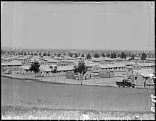 Temporary detention camp for Japanese Americans Pomona assembly center |
style="background-color:
|
Temporary detention camp for Japanese Americans Pomona assembly center | 1101 W McKinley Ave 34°04′53″N 117°45′59″W |
Pomona | |
 Temporary detention camp for Japanese Americans Santa Anita assembly center |
style="background-color:
|
Temporary detention camp for Japanese Americans Santa Anita assembly center | 285 W. Huntington 34°08′19″N 118°02′46″W |
Arcadia | |
 Timm's Point and Landing |
style="background-color:
|
Timm's Point and Landing | Sampson Way at Southern Pacific Slip 33°43′42″N 118°16′31″W |
San Pedro | |
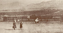
 Tuna Club of Avalon |
style="background-color:
|
Tuna Club of Avalon | 100 St. Catherine Way 33°21′18″N 118°19′53″W |
Avalon | |
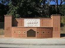
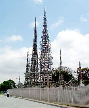 Watts Towers |
style="background-color:
|
Watts Towers | 1765 East 107th St. 33°56′20″N 118°14′30″W |
Los Angeles | Also on the NRHP list as NPS-77000297 |
 Well, Alamitos #1 |
style="background-color:
|
Well, Alamitos #1 | Temple Ave. & Hill St. 33°47′50″N 118°09′32″W |
Signal Hill | Discovery well in the Signal Hill oil field, June 23, 1921. |
 Well, CSO 4 |
style="background-color:
|
Well, CSO 4 | W. Pico Canyon Rd. 34°22′10″N 118°37′49″W |
Newhall | Also on the NRHP list as NPS-66000212 |
 Western Hotel |
style="background-color:
|
Western Hotel | 557 W. Lancaster Blvd. 34°41′54″N 118°08′20″W |
Lancaster | |
 Workman Home and Family Cemetery |
style="background-color:
|
Workman Home and Family Cemetery | 15415 E Don Julian Rd 34°01′12″N 117°57′51″W |
City of Industry |
See also
- List of California Historical Landmarks
- National Register of Historic Places listings in Pasadena, California
- National Register of Historic Places listings in Los Angeles County, California
- National Register of Historic Places listings in Los Angeles, California
References
| Wikimedia Commons has media related to California Historical Landmarks in Los Angeles County, California. |
- "California Historical Landmarks By County". Ohp.parks.ca.gov. Retrieved 2019-04-03.
This article is issued from Wikipedia. The text is licensed under Creative Commons - Attribution - Sharealike. Additional terms may apply for the media files.