Cífer
Cífer is a municipality (village) in the Trnava District, Slovakia. It has a population of 3,941.[1]
Cífer | |
|---|---|
village | |
Church of St. Michael in Cífer | |
 Flag  Coat of arms | |
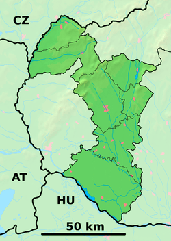
 Cífer Location of Cífer in the Trnava Region  Cífer Cífer (Slovakia) | |
| Coordinates: 48°19′00″N 17°30′00″E | |
| Country | Slovakia |
| Region | Trnava |
| District | Trnava |
| First mentioned | 1291 |
| Government | |
| • Mayor | Maroš Sagan |
| Area | |
| • Total | 22.340 km2 (8.626 sq mi) |
| Elevation | 139 m (456 ft) |
| Population (31 Dec. 2008) | |
| • Total | 4,013 |
| • Density | 180/km2 (470/sq mi) |
| Time zone | UTC+1 (CET) |
| • Summer (DST) | UTC+2 (CEST) |
| Postal code | 919 43 |
| Area code(s) | +421-33 |
| Car plate | TT |
| Website | http://www.cifer.sk/ |
Archaeological finds from the Neolithic, Bronze Age, Roman Period, and early Slavic period have been made in the village. The first written mention of the settlement dates from 1291. It received town status in the early 18th century, but it has lost it since then.

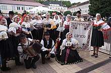
Folk group from Cífer wearing traditional costumes.
Prominent residents
- Marcel Gery, bronze medal-winner at the 1992 Olympic Games in Barcelona
- Eduard Mahler, Jewish Hungarian archaeologist
- Ladislav Lučenič, Slovak musician
Partner village
gollark: `a_function("string with spaces")` or even `a_function "string with spaces"` which is neat.
gollark: The same way as usual?
gollark: What happened?
gollark: Wait, past tense?
gollark: That would be quite neat.
References
Genealogical resources
The records for genealogical research are available at the state archive "Statny Archiv in Bratislava, Slovakia"
- Roman Catholic church records (births/marriages/deaths): 1666-1898 (parish A)
- Lutheran church records (births/marriages/deaths): 1666-1896 (parish B)
- Reformated church records (births/marriages/deaths): 1787-1924 (parish B)
External links
- Official website of village
- Official website of football club ŠK Cífer
- Surnames of living people in Cifer
| Wikimedia Commons has media related to Cífer. |
This article is issued from Wikipedia. The text is licensed under Creative Commons - Attribution - Sharealike. Additional terms may apply for the media files.