Dolná Krupá
Dolná Krupá (German: Unterkrupa, Hungarian: Alsókorompa) is a village and municipality of Trnava District in the Trnava region of Slovakia. It is located in the Danubian Hills at around 12 km from the city of Trnava.
Dolná Krupá | |
|---|---|
Village | |
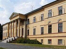 Mansion in Dolná Krupá | |
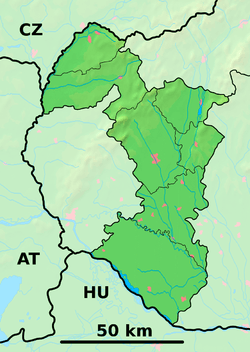 Dolná Krupá Location of Dolná Krupá in the Trnava Region  Dolná Krupá Location of Dolná Krupá in Slovakia | |
| Coordinates: 48°29′N 17°33′E | |
| Country | |
| Region | Trnava |
| District | Trnava |
| Area | |
| • Total | 24.63 km2 (9.51 sq mi) |
| Elevation | 192 m (630 ft) |
| Population (2004-12-31) | |
| • Total | 2,229 |
| • Density | 90/km2 (230/sq mi) |
| Time zone | UTC+1 (CET) |
| • Summer (DST) | UTC+2 (CEST) |
| Postal code | 919 65 |
| Area code(s) | +421-033 |
| Car plate | TT |
| Website | www.dolnakrupa.sk |
The important sights in the village are:
The Dolná Krupá mansion was one of the residences of the Chotek family. It was the place of the Dolná Krupá rosarium created by countess Marie Henrieta Chotek.
Famous people
- John Dopyera, inventor of Dobro
Genealogical resources
The records for genealogical research are available at the state archive "Statny Archiv in Bratislava, Slovakia"
- Roman Catholic church records (births/marriages/deaths): 1689-1895 (parish A)
- Lutheran church records (births/marriages/deaths): 1666-1895 (parish B)
gollark: * exists
gollark: I don't think that function exist.
gollark: Yes.
gollark: You must use metric. ALWAYS.
gollark: For all the many, many, many, many, many, many, many, many, many problems of the UK's NHS, it is in many ways better than the even messier mess of America.
External links

- Official website

- Surnames of living people in Dolna Krupa
| Authority control |
|---|
This article is issued from Wikipedia. The text is licensed under Creative Commons - Attribution - Sharealike. Additional terms may apply for the media files.