Brecon
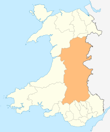
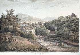
Brecon (/ˈbrɛkən/; Welsh: Aberhonddu pronounced [ˌabɛrˈhɔnðɪ]), archaically known as Brecknock, is a market and minster town in Powys, mid-Wales. In 1841, it had a population of 5,701.[3] The population in 2001 was 7,901,[4] increasing to 8,250 at the 2011 census. Historically it was the county town of Brecknockshire (Breconshire); although its role as such was eclipsed with the formation of the County of Powys, it remains an important local centre. Brecon is the third-largest town in Powys, after Newtown and Ystradgynlais. It lies north of the Brecon Beacons mountain range, but is just within the Brecon Beacons National Park.
Brecon
| |
|---|---|
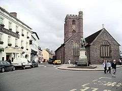 Brecon, with St. Mary's Church | |
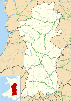 Brecon Location within Powys | |
| Population | 8,250 (2011)[1] |
| OS grid reference | SO045285 |
| Community |
|
| Principal area | |
| Ceremonial county | |
| Country | Wales |
| Sovereign state | United Kingdom |
| Post town | BRECON |
| Postcode district | LD3 |
| Dialling code | 01874 |
| Police | Dyfed-Powys |
| Fire | Mid and West Wales |
| Ambulance | Welsh |
| UK Parliament | |
| Senedd Cymru – Welsh Parliament |
|
History
Early history
The Welsh name, Aberhonddu, means "mouth of the Honddu". It is derived from the River Honddu, which meets the River Usk near the town centre, a short distance away from the River Tarell which enters the Usk a few hundred metres upstream. After the Dark Ages the original Welsh name of the kingdom in whose territory Brecon stands was (in modern orthography) "Brycheiniog", which was later anglicised to Brecknock or Brecon, and probably derives from Brychan, the eponymous founder of the kingdom.
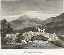
Before the building of the bridge over the Usk, Brecon was one of the few places where the river could be forded. In Roman Britain Y Gaer, Brecon (Cicucium) was established as a Roman cavalry base for the conquest of Roman Wales and Brecon was first established as a military base.
Norman control
The confluence of the Honddu and the River Usk made for a valuable defensive position for the Norman castle which overlooks the town, built by Bernard de Neufmarche in the late 11th century.[5]:80 Gerald of Wales came and made some speeches in 1188 to recruit men to go to the Crusades.
Town walls
Brecon's town walls were constructed by Humphrey de Bohun after 1240.[6]:8 The walls were built of cobble, with four gatehouses and was protected by ten semi-circular bastions.[6]:9 In 1400 the Welsh prince Owain Glyndŵr rose in rebellion against English rule, and in response in 1404 100 marks was spent by the royal government improving the fortifications to protect Brecon in the event of a Welsh attack. Brecon's walls were largely destroyed during the English Civil War. Today only fragments survive, including some earthworks and parts of one of the gatehouses; these are protected as scheduled monuments.[7]
In Shakespeare's play King Richard III, the Duke of Buckingham is suspected of supporting the Welsh pretender Richmond (the future Henry VII), and declares:
O, let me think on Hastings and be gone
To Brecknock, while my fearful head is on!
Priory and cathedral
A Priory was dissolved in 1538, and Brecon's Dominican Friary of St Nicholas was suppressed in August of the same year.[8] About 250 m (270 yd) north of the castle stands Brecon Cathedral, a fairly modest building compared to many cathedrals. The role of cathedral is a fairly recent one, and was bestowed upon the church in 1923 with the formation of the Diocese of Swansea and Brecon from what was previously the archdeaconry of Brecon — a part of the Diocese of St David's.
St. Mary's Church
Saint Mary's church began as a chapel of ease to the priory but most of the building is dated to later medieval times. The West Tower, some 27 m (90 ft) high, was built in 1510 by Edward, Duke of Buckingham at a cost of £2,000. The tower has eight bells which have been rung since 1750, the heaviest of which weighs 810 kg (16 long hundredweight). In March 2007 the bells were removed from the church tower for refurbishment.[9][10] The church is a Grade II* listed building.[11]
St. David's Church, Llanfaes
The Church of St. David, referred to locally as Llanfaes Church, was probably founded in the early sixteenth century. The first Parish Priest, Maurice Thomas, was installed there by John Blaxton, Archdeacon of Brecon in 1555. The name is derived from the Welsh – Llandewi yn y Maes – which translates as St. David's in the Field. It is probable that the site and the name of the present Church were chosen because of the close proximity of a fresh water well called Ffynnon Dewi (David's Well) which was situated approximately 150 metres south of the church.
Plough Lane Chapel, Lion Street
Plough Lane Chapel, also known as Plough United Reformed Church, is a Grade II* listed building. The present building dates back to 1841 and was re-modelled by Owen Morris Roberts and is considered to be one of the finest chapel interiors in Wales.
St Michael's Church
After the Reformation, some Breconshire families such as the Havards, the Gunters and the Powells persisted with Catholicism despite its suppression. In the 18th Century a Catholic Mass house in Watergate was active, and Rev John Williams was the local Catholic priest from 1788 to 1815. The Watergate house was sold in 1805, becoming the current Watergate Baptist Chapel, and property purchased as the priest's residence and a chapel between Wheat Street and the current St Michael Street, including the “Three Cocks Inn”; about this time Catholic parish records began again. The normal round of bishop's visitations and confirmations resumed in the 1830s. In 1832 most civil liberties were restored to Catholics and they became able to practise their faith more openly. A simple Gothic Church, dedicated to St Michael and designed by Charles Hansom, was built in 1851 at a cost of £1,000.[8]
Military town
The east end of town has two military establishments:
- Dering Lines, home to the Infantry Battle School (formerly Infantry Training Centre Wales),[12] where infantry officers and Other Ranks are trained, and
- The Barracks, Brecon, home to 160th (Wales) Brigade.
- Gurkha Company (Mandalay) is based here.
Approximately 9 miles (14 km) to the west of Brecon is Sennybridge Training Area, an important training facility for the British Army.[13]
Cattle market
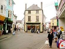
The west end of Brecon has a small industrial area, and recent years have seen the cattle market moved from the centre of the town to this area, with markets held several times a week.
Education
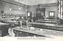
Brecon has primary schools, with a secondary school and further education college (Brecon Beacons College) on the northern edge of the town. The secondary school, known as Brecon High School, was formed from separate boys' and girls' grammar schools ('county schools') and Brecon Secondary Modern School, after comprehensive education was introduced into Breconshire in the early 1970s. The town is home to a famous independent school, Christ College, which was founded in 1541.[14]
Transport
Brecon is located near where the east-west A40 (Monmouth-Carmarthen-Fishguard) meets the north-south A470 (Cardiff-Merthyr Tydfil-Llandudno). The nearest airport is Cardiff Airport.
Monmouthshire and Brecon Canal
The Monmouthshire and Brecon Canal runs for 35 miles (56 km) between Brecon and Pontnewydd, Cwmbran. It then continues to Newport, the towpath being the line of communication and the canal being disjointed by obstructions and road crossings. The canal was built between 1797 and 1812 to link Brecon with Newport and the Severn Estuary. The canalside in Brecon was redeveloped in the 1990s and is now the site of two mooring basins and Theatr Brycheiniog.
Usk bridge
.jpg)
The bridge carries the B4601 across the River Usk. A plaque on a house wall adjacent to the eastern end of the bridge records that the present bridge was built in 1563 to replace a medieval bridge destroyed by floods in 1535. It was repaired in 1772 and widened in 1794 by Thomas Edwards, the son of William Edwards of Eglwysilan. It had stone parapets until the 1970s when the present deck was superimposed on the old structure. The bridge was painted by J.M.W. Turner c.1769.[15]
Former railways
The Neath and Brecon Railway reached Brecon in 1867, terminating at Free Street. By this point, Brecon already had two other railway stations:
- Watton – from 1 May 1863 when the Brecon and Merthyr Railway to Merthyr Tydfil was opened for traffic
- Mount Street – in September 1864, with Llanidloes by the Mid Wales Railway which linked to the Midland Railway at Talyllyn Junction. The three companies consolidated their stations at a newly rebuilt Free Street Joint Station from 1871.[16]
Hereford, Hay and Brecon Railway
.jpg)
The Hereford, Hay and Brecon Railway was opened gradually from Hereford towards Brecon. The first section opened in 1862, with passenger services on the complete line starting on 21 September 1864.[17] The Midland Railway Company (MR) took over the HH&BR from 1 October 1869, leasing the line by an Act of 30 July 1874 and absorbing the HH&BR in 1876.[18] The MR was absorbed into the London, Midland and Scottish Railway (LMSR) on 1 January 1923.
Passenger services to Merthyr ended in 1958, Neath in October 1962 and Newport in December 1962. In 1962 the important line to Hereford closed. Therefore, Brecon lost all its train services before the 1963 Reshaping of British Railways report (often referred to as the Beeching Axe) was implemented.
Governance
Brecon Town Council represents the town at the local level, with up to fifteen councillors elected from four wards: St David's, St Mary's, St John's East and St John's West.[19] The town elects a mayor annually. In May 2018 it elected its first mixed race mayor, local hotelier Emmanuel (Manny) Trailor, who is a town councillor for St John's West.[20]
There are three county council electoral wards in the town (St David Within, St John and St Mary) which each elect a county councillor to Powys County Council. All three are represented by Labour Party councillors, the St Mary ward being gained from the Conservatives in a November 2019 by-election.[21]
In 2018 a Review of Electoral Arrangements proposed that all three Brecon county wards be merged into a single, three councillor ward. If accepted, the proposal would take effect from the 2022 election.[22]
Town twinning


Points of interest
- Brecon Beacons and National Park Visitor Centre (also known as the Brecon Beacons Mountain Centre)
- Brecon Beacons Food Festival
- Brecon Cathedral, the seat of the Diocese of Swansea and Brecon
- St. Mary's Church, Brecon
- Brecon Jazz Festival
- Brecknock Museum
- Regimental Museum of The Royal Welsh
- Theatr Brycheiniog (Brecon Theatre)
- Christ College, Brecon
Notable people
- See Category:People from Brecon
- Gerald of Wales (c. 1146 – c. 1223)
- Sibyl de Neufmarché, Countess of Hereford, suo jure Lady of Brecknock (c. 1100 – after 1143)
- Sir Dafydd Gam (c. 1380–1415), archer, died fighting for Henry V of England at the Battle of Agincourt
- Edward, Duke of Buckingham, born at Brecon Castle in 1478
- Hugh Price (c. 1495–1574), founder of Jesus College, Oxford
- Henry Vaughan (1621–1695), physician, author and one of the major Metaphysical poets
- Sarah Siddons, best-known tragedienne actress of the 18th century, born 1755
- Charles Kemble (1775–1854), actor, younger brother of Sarah Siddons
- Thomas Coke, the first Methodist bishop, who previously had served as mayor of Brecon in 1772
- John Evan Thomas, sculptor, born 1810
- Frances Hoggan (1843–1927), first British woman to receive a doctorate in medicine
- Ernest Howard Griffiths (1851–1932), physicist
- Llewela Davies (1871-1952), pianist and composer
- Dame Olive Wheeler (1886–1963), educationist, psychologist and university lecturer
- Captain Richard Mayberry (1895–1917), World War I flying ace
- Reginald, Lord Talbot (1897–1975), buried in Brecon cemetery
- Tudor, Lord Watkins (1903–1983), buried at St David's Church cemetery
- George Melly (1926–2007), trad jazz and blues singer, art critic and writer
- Jeb Loy Nichols, musician
- Captain Thomas Phillips, slave trader
- Andy Powell, Welsh Rugby Union international number eight
- Sam Hobbs, rugby union player with Cardiff Blues
- Jessica Allen, cyclist
- Roger Glover, bassist and songwriter with the band Deep Purple
- Medicine Head's Peter Hope-Evans
- Sian Reese-Williams, actress
- Nia Roberts, actress
- Adrian Street, professional wrestler
Culture
Brecon hosted the National Eisteddfod in 1889.
August sees the annual Brecon Jazz Festival. Concerts are held in both open air and indoor venues, including the town's market hall and the 400-seat Theatr Brycheiniog, which opened in 1997.
October sees the annual 4-day weekend Brecon Baroque Music Festival, organised by leading violinist Rachel Podger.
References
- "Town population 2011". Archived from the original on 17 November 2015. Retrieved 14 November 2015.
- https://brecontowncouncil.org.uk/
- The National Cyclopaedia of Useful Knowledge, Vol III, (1847) London, Charles Knight, p.765.
- "Parish Headcounts: Powys", Census, Office for National Statistics, 2001, archived from the original on 13 June 2011, retrieved 22 November 2009.
- Davies (2008).
- Pettifer (2000).
- Davis, Philip, "Brecon Town Walls", Gatehouse, retrieved 13 October 2011.
- http://www.stmichaelsrcbrecon.org.uk/?page_id=11667
- "St Mary's Church in Wales", Wales Directory, UK.
- "St Mary's Church Brecon". www.stmarysbrecon.org.uk.
- Stuff, Good. "Church of St Mary, Brecon, Powys". www.britishlistedbuildings.co.uk.
- "Brecon", Brigade of Gurkhas, UK: Army, archived from the original on 18 November 2004.
- "160the Wales Brigade", 5th Division, UK: Army.
- "Christ College Brecon in £5m anniversary investment boost". BBC News. BBC. 5 July 2012. Retrieved 10 August 2018.
- "Joseph Mallord William TurnerBrecon Bridge c.1798-9". Tate. Retrieved 19 January 2014.
- "Railway stations", Victorian Brecon, UK: Powys
- Butt 1995, p. 103
- Awdry 1990, p. 80
- "Council Information". Brecon Town Council. Archived from the original on 23 September 2018. Retrieved 22 September 2018.
- "First mixed-race mayor elected by Brecon Town Council". The Brecon & Radnor Express. 16 May 2018. Retrieved 22 September 2018.
- "Labour wins by-election in Brecon and Radnorshire". The Brecon & Radnor Express. 15 November 2019. Retrieved 15 November 2019.
- "Review of Electoral Arrangements – Draft Proposals - County of Powys" (PDF). Powys County Council. 8 March 2018. Retrieved 22 September 2018.
Bibliography
- Butt, R. V. J. (1995). The Directory of Railway Stations: details every public and private passenger station, halt, platform and stopping place, past and present (1st ed.). Sparkford: Patrick Stephens Ltd. ISBN 978-1-85260-508-7. OCLC 60251199.
- Davies, John; Jenkins, Nigel (2008). The Welsh Academy Encyclopaedia of Wales. Cardiff: University of Wales Press. ISBN 978-0-7083-1953-6.
- Pettifer, Adrian (2000). Welsh Castles: a Guide by Counties. Woodbridge, UK: Boydell Press. ISBN 978-0-85115-778-8.
External links
| Wikimedia Commons has media related to Brecon. |
| Wikisource has the text of the 1911 Encyclopædia Britannica article Brecon. |

- Brecon Town Council website
