Boonah, Victoria
Boonah is a rural locality in the Surf Coast Shire, Victoria, Australia.[2]
| Boonah Victoria | |||||||||||||||
|---|---|---|---|---|---|---|---|---|---|---|---|---|---|---|---|
 Boonah | |||||||||||||||
| Coordinates | 38°25′32″S 143°58′47″E | ||||||||||||||
| Population | 21 (2016 census)[1] | ||||||||||||||
| Postcode(s) | 3235 | ||||||||||||||
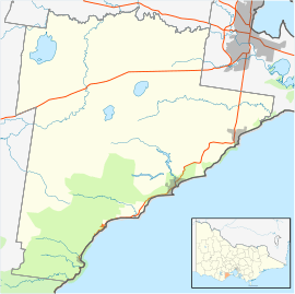
| Location | |||||||||||||||
| LGA(s) | Surf Coast Shire | ||||||||||||||
| State electorate(s) | Polwarth | ||||||||||||||
| Federal Division(s) | Corangamite | ||||||||||||||
| |||||||||||||||
The locality was the base for various sawmilling operations from the 1880s.[3]
The Boonah State School opened on 15 August 1882, servicing families working at the Benwerrin coal mine, the three local sawmills and on local farms. It closed in 1927 due to falling attendance.[4] Boonah Post Office opened on 24 November 1887, became a receiving office on 21 August 1919, became a post office again on 1 July 1927, and closed on 26 September 1929.[5]
Today, most of the locality is protected forest contained in either the Great Otway National Park or the Otway Forest Park; the remainder, located in Boonah's north, is private farmland. The Bambra-Boonah Road, which runs through the latter area, is the only mapped road in the locality.
References
- Australian Bureau of Statistics (27 June 2017). "Boonah (Vic.) (State Suburb)". 2016 Census QuickStats. Retrieved 16 November 2017.

- "Boonah (entry 100433)". VICNAMES. Government of Victoria. Retrieved 26 June 2014.
- Kellaway, Carlotta. Farmland, Forest & Surf: Environmental History of Surf Coast Shire (PDF). Surf Coast Shire. p. 58. Archived from the original (PDF) on 14 July 2014. Retrieved 26 June 2014.
- Blake, L. J. (1973). Vision and Realisation: A Centenary History of State Education in Victoria (Volume 2). Education Department of Victoria. p. 1050.
- Premier Postal History. "Post Office List". Premier Postal Auctions. Retrieved 26 June 2014.