Bicycle transportation planning and engineering
Bicycle transportation planning and engineering are the disciplines related to transportation engineering and transportation planning concerning bicycles as a mode of transport and the concomitant study, design and implementation of cycling infrastructure. It includes the study and design of dedicated transport facilities for cyclists (e.g. cyclist-only paths) as well as mixed-mode environments (i.e. where cyclists share roads and paths with vehicular and foot traffic) and how both of these examples can be made to work safely.[1] In jurisdictions such as the United States it is often practiced in conjunction with planning for pedestrians as a part of active transportation planning.[2]
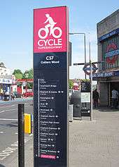
Networks, signage and maps
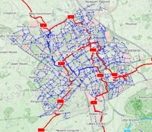
© OpenStreetMap contributors).
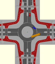
In 1970 in the United Kingdom, the Milton Keynes Development Corporation produced the "Master Plan for Milton Keynes".[3] Cycle networks of routes can be developed in co-ordination with maps. Co-ordination can be local or national.
Bikeways
Some examples of the types of bikeways under the purview of bicycle transportation engineers include partially segregated infrastructure in-road such as bike lanes, buffered bike lanes; physically segregated in-road such as cycle tracks; bike paths with their own right-of-way; and shared facilities such as bicycle boulevards, shared lane markings, advisory bike lane, road shoulders, wide outside lanes, shared street schemes, and any roadways with legal access for cycling.
In roadway
NACTO guidelines state "desired width for a cycle track should be 5 feet (1.5m). In areas with high bicyclist volumes or uphill sections, the desired width should be 7 feet (2.1m)". CROW standard width for one way cycle paths in the Netherlands is a minimum of 2.5 m (8'). For bidirectional use the minimum is 3.5 m (11').
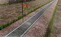
Unsegregated
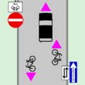 One-way street with two-way shared cycling
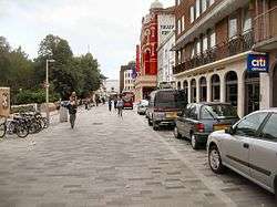 Streetscape in which all modes of travel (pedestrians, cyclists, and motorists) share the road
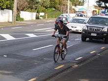 Streetscape in which cyclists and motorists share the road
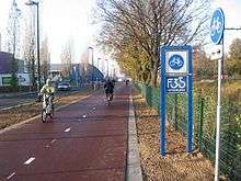
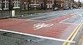
Partially segregated
 Streetscape with dedicated cycle facilities next to other traffic
- Cycle lane
- Shared lane marking
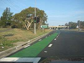
Segregated
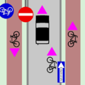 One way street with two way cycle tracks and shared road
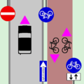 One way street with a single two way cycle track on right
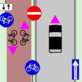 One way street with a single two way cycle track on left
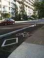 Cycle tracks with concrete barriers in downtown Ottawa, Ontario, Canada on Laurier Avenue in 2011.
 Separate traffic light for automobiles and bicycles on cycle track in Denmark
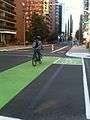 Cycle track with green lanes through intersection in Ottawa, Ontario, Canada (also on Laurier) in 2011.
Barriers
Options for barriers are soft-hit posts, raised curb or traffic barriers.
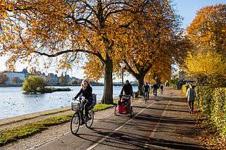
Off road
Intersections and signals

 Advanced stop line, Liverpool, UK
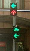 Signals for cyclists in China
Bicycle transportation engineers also are involved in improving intersections/junctions and traffic lights. Advanced stop lines are one example of road markings on mixed mode shared space as cycling infrastructure.
Other infrastructure
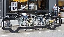 Bike rack shaped like a car
Road diets, curb extension, improving the road surface; building bicycle parking such as bicycle locks, bicycle stands, lockers.
Legislation
in California new bikeway design standards were last adopted in 1976. Those designs were adapted by the Association of American State Highway and Transportation Officials (AASHTO) to become the AASHTO Guide for Bicycle Facilities, which is followed in the USA.
See also
References
- "Association of Pedestrian and Bicycle Professionals". Retrieved 20 July 2015.
- "Active Transportation". Federal Administration Department. Retrieved 18 August 2015.
- Modern Milton Keynes: the master plan Archived 28 July 2012 at the Wayback Machine MK Web
| General and technical | |
|---|---|
| Utility and slow recreation | |
| Sports-related cycling and fast-paced recreation | |
| Health, safety and infrastructure |
|
| Other |
|
| Lists | |
| |
| In-roadway bikeways |
| ||||||
|---|---|---|---|---|---|---|---|
| Right-of-way paths |
| ||||||
| Health, safety and infrastructure |
| ||||||
| Design Guidelines |
| ||||||
| |||||||