Bellmore, Indiana
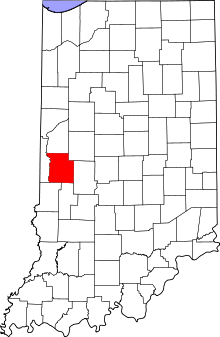
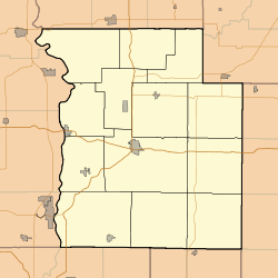
Bellmore (also known as Belle Moore, North Hampton or Northampton) is an unincorporated community in Union Township, Parke County, in the U.S. state of Indiana.[2] U.S. Route 36 and State Road 59 intersect in Bellmore.
Bellmore, Indiana | |
|---|---|
 Parke County's location in Indiana | |
 Bellmore Location in Park County | |
| Coordinates: 39°45′33″N 87°06′19″W | |
| Country | United States |
| State | Indiana |
| County | Parke |
| Township | Union |
| Elevation | 741 ft (226 m) |
| Time zone | UTC-5 (Eastern (EST)) |
| • Summer (DST) | UTC-4 (EDT) |
| ZIP code | 47830 |
| Area code(s) | 765 |
| GNIS feature ID | 430781 |
History
A post office has been in operation at Bellmore since 1852.[3]
Geography
Bellmore is located at 39°45′33″N 87°06′19″W at an elevation of 741 feet.
gollark: Unfortunately, it has to run in your browser and I don't have much compute, so I can't use very state-of-the-art methods like muzero. Not that I know how that works in much detail.
gollark: If people keep winning, I WILL be forced to actually implement a good AI.
gollark: Well, my computer doesn't have enough memory to hold those, and it would be hard to generate the optimal moves for each of them anyway.
gollark: There are 3433683820292512484657849089281 possible board states, roughly.
gollark: There is a "combinatorial explosion" issue.
References
- "US Board on Geographic Names". United States Geological Survey. October 25, 2007. Retrieved 2017-04-16.
- "Bellmore, Indiana". Geographic Names Information System. United States Geological Survey. Retrieved July 19, 2017.
- "Parke County". Jim Forte Postal History. Retrieved 30 September 2015.
This article is issued from Wikipedia. The text is licensed under Creative Commons - Attribution - Sharealike. Additional terms may apply for the media files.