Ballyloughloe
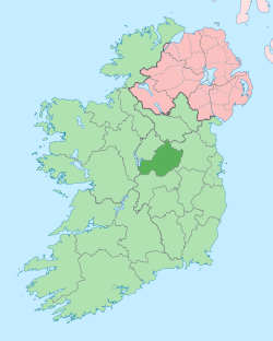
Ballyloughloe (Irish: Baile Locha Luatha)[1] is a civil parish in County Westmeath, Ireland. It is located about 31.67 kilometres (20 mi) west–south–west of Mullingar.
Ballyloughloe Baile Locha Luatha | |
|---|---|
 Ballyloughloe Location of Ballyloughloe within County Westmeath in the Republic of Ireland | |
| Coordinates: 53°25′22″N 7°47′28″W | |
| Country | |
| Province | Leinster |
| County | County Westmeath |
| Irish grid reference | N139414 |
Ballyloughloe is one of 4 civil parishes in the barony of Clonlonan in the Province of Leinster. The civil parish covers 13,004 acres (52.63 km2).
Ballyloughloe civil parish comprises 55 townlands: Aghanashanamore, Aghanvoneen, Annaghgortagh, Ardyduffy, Ballydoogan, Ballymurry, Ballynagarbry, Ballynagarbry (Mullock), Ballynagarbry (Pim), Bellanalack, Belville, Boyanaghcalry, Cappaghauneen, Cappaghbrack, Carnfyan, Carnpark, Clonrelick, Clonthread, Clonyegan, Cooleen, Coolvuck Lower, Coolvuck Upper, Correagh, Creeve, Creevebeg, Dunegan, Dunlom East, Dunlom West, Fassagh, Glebe, Glen, Killachonna (Castlemaine), Killachonna (Clibborn), Killachonna (Potts), Killeenatoor, Killinroan, Knockdomny, Labaun, Legan, Mackanranny, Magheramore, Mount Temple, Moydrum, Nahod Little, Nahod More, Rathduff, Shurock, Tullaghanshanlin, Tully, Tullybane, Tullywood, Twyford, Warren High, Warren Lower and Williamstown.
The neighbouring civil parishes are: Ballymore, Drumraney and Kilkenny West to the north, Kilcumreragh to the east, Kilcleagh and Kilmanaghan to the south and St. Mary's to the west.[2][3]
References
- Ballyloughloe civil parish The Placenames Database of Ireland. Retrieved on 22 July 2015.
- Ballyloughloe civil parish, Co. Westmeath townlands.ie Retrieved on 22 July 2015.
- Ballyloughloe civil parish, Co. Westmeath The IreAtlas Townland Data Base. Retrieved on 22 July 2015.
External links
- Ballyloughloe civil parish at the IreAtlas Townland Data Base
- Ballyloughloe civil parish at townlands.ie
- Ballyloughloe civil parish at The Placenames Database of Ireland
