Attica (region)
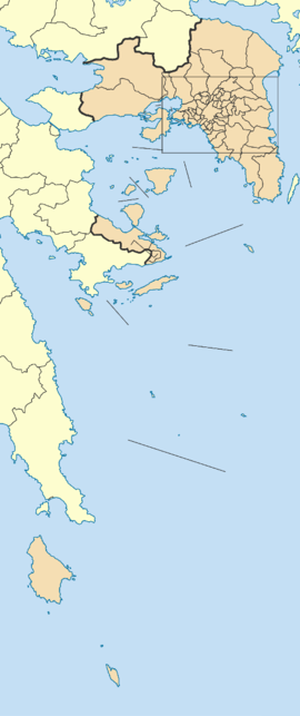
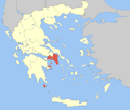
Attica Region (Greek: Περιφέρεια Αττικής, romanized: Periféria Attikís, [periˈferi.a atiˈcis]) is an administrative region of Greece, that encompasses the entire metropolitan area of Athens, the country's capital and largest city. The region is coextensive with the former Attica Prefecture of Central Greece, but covers a greater area than the historical region of Attica.
Attica Region Περιφέρεια Αττικής | |
|---|---|
 | |
| Coordinates: 38.0°N 23.7°E | |
| Country | |
| Decentralized Administration | Attica |
| Capital | Athens |
| Regional units | |
| Government | |
| • Regional Governor | Giorgos Patoulis (New Democracy) |
| Area | |
| • Total | 3,808.10 km2 (1,470.32 sq mi) |
| Population (2011)[1] | |
| • Total | 3,828,434 |
| • Density | 1,000/km2 (2,600/sq mi) |
| GRP | |
| • Total | €87 billion |
| • Per capita | €23,300 |
| Time zone | UTC+2 (EET) |
| • Summer (DST) | UTC+3 (EEST) |
| ISO 3166 code | GR-I |
| NUTS code | EL3 |
| HDI (2018) | 0.895[2] very high · 1st |
| Website | www |
Overview
Located on the eastern edge of Central Greece, Attica covers about 3,808 square kilometers. In addition to Athens, it contains within its area the cities of Eleusis, Megara, Laurium, and Marathon, as well as a small part of the Peloponnese peninsula and the islands of Salamis, Aegina, Angistri, Poros, Hydra, Spetses, Kythira, and Antikythera. About 3,750,000 people live in the region, of whom more than 95% are inhabitants of the Athens metropolitan area.
Administration
The region was established in the 1987 administrative reform, and until 2010 it comprised the 4 prefectures of Athens, East Attica, Piraeus and West Attica.
With the 2010 Kallikratis plan, the region's powers and authority were completely redefined and extended. Since 1 January 2011, the region represents the second-level local administration. While being supervised by the Decentralized Administration of Attica, it is now an independent self-governing body with powers and a budget comparable to the former prefectures.
The region is subdivided into eight subordinate regional units:[3]
Electoral districts
The Attica region consists of five electoral districts: Athens A, Athens B, Piraeus A, Piraeus B and Attica.
Major communities

- Acharnés (Αχαρνές) or Menídi (Μενίδι)
- Agía Paraskeví (Αγία Παρασκευή)
- Ágios Dimítrios (Άγιος Δημήτριος)
- Aigáleo (Αιγάλεω)
- Alimos (Άλιμος) or Kalamaki (Καλαμάκι)
- Athína (Αθήνα) (Municipality of Athens)
- Chalándri (Χαλάνδρι)
- Galátsi (Γαλάτσι)
- Glyfáda (Γλυφάδα)
- Ílion (Ίλιον) (formerly Nea Liosia)
- Ilioúpoli (Ηλιούπολη)
- Kallithéa (Καλλιθέα)
- Keratsíni (Κερατσίνι)
- Kifissia (Κηφισιά)
- Korydallós (Κορυδαλλός)
- Maroúsi (Μαρούσι) or Amaroúsion (Αμαρούσιον)
- Néa Ionía (Νέα Ιωνία)
- Néa Smýrni (Νέα Σμύρνη)
- Níkaia (Νίκαια)
- Palaió Fáliro (Παλαιό Φάληρο)
- Peiraiás (Πειραιάς) (Piraeus in English)
- Peristéri (Περιστέρι)
- Výronas (Βύρωνας)
- Zográfos (Ζωγράφος)
- See also
- List of municipalities and communities in Attica
- List of settlements in Attica
Economy
The Gross domestic product (GDP) of the region was 87.4 billion € in 2018, accounting for about 47% of the Greek economic output. GDP per capita adjusted for purchasing power was 28,000 € or 93% of the EU27 average in the same year. The GDP per employee was 99% of the EU average. Attica is the region in Greece with the highest GDP per capita.[4] Despite that, the unemployment rate stood at 21.6% in 2017.[5]
| Year | 2006 | 2007 | 2008 | 2009 | 2010 | 2011 | 2012 | 2013 | 2014 | 2015 | 2016 | 2017 |
|---|---|---|---|---|---|---|---|---|---|---|---|---|
| unemployment rate (in %) |
8.5 | 7.8 | 6.7 | 9.1 | 12.6 | 18.0 | 25.8 | 28.7 | 27.3 | 25.2 | 23.0 | 21.6 |
Transportation
Roads and highways
The main roads and highways of Attica are:
- Motorway 1 (Athens-Thessaloniki)
- Motorway 6 (northern beltway of Athens)
- Motorway 8 (Eleusis-Corinth)
- Motorway 62 (Athens Airport link)
- Motorway 64 (eastern beltway of Athens)
- Motorway 65 (western beltway of Athens)
- Motorway 642
- Greek National Road 1 (old road Athens-Thessaloniki)
- Greek National Road 3 (Eleusis-Lamia-Florina)
- Greek National Road 8 (old road Athens-Patras)
- Greek National Road 79
- Greek National Road 83 (Marathonos Avenue)
- Greek National Road 89
- Greek National Road 91
Ferry lines
Numerous ferry lines, both normal ferries and the "flying dolphins" (fast sea vessels), connect the port of Piraeus with the islands of the region.
Other
- Athens Mass Transit System
- Athens Metro
- Athens Tram
- Proastiakos
- Transit System (Attica)
Sports
Football clubs
|
All sports
Mini football
|
References
- "Resident Population of Greece - revised". Hellenic Statistical Authority. 30 November 2016.
- "Sub-national HDI - Area Database - Global Data Lab". hdi.globaldatalab.org. Retrieved 2018-09-13.
- "Kallikratis reform law text" (PDF).
- "Regional GDP per capita ranged from 30% to 263% of the EU average in 2018". Eurostat.
- "Regional Unemployment by NUTS2 Region". Eurostat.
