Armenia–Azerbaijan border
The Armenia–Azerbaijan border (Armenian: Ադրբեջան–Հայաստան սահման, romanized: Adrbejan–Hayastan sahman, Azerbaijani: Azərbaycan–Ermənistan sərhədi) is an international border running from north to south and from northwest to southeast across the Lesser Caucasus. The border spans 1,007.1 km (625.8 mi),[1] with Armenia mainly to the west and Azerbaijan to the east. The Azerbaijani exclave of the Nakhchivan Autonomous Republic borders Armenia at the north and east. The northernmost inhabited places of the Armenia–Azerbaijan border are Kamarli on the Azerbaijani side and Berdavan on the Armenian side. The southernmost inhabited places are Ganza and Agarak, respectively. European routes E002 and E117 cross the border.
The modern Armenia–Azerbaijan border largely follows that of the Armenian Soviet Socialist Republic and the Azerbaijan Soviet Socialist Republic, but is now closed due to the ongoing Nagorno-Karabakh conflict. The Azerbaijani Ministry of Foreign Affairs said that it may consider reopening its border with Armenia, in case of a breakthrough in the conflict.[2]
Geography
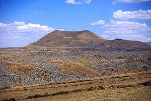
Along with the exclave of Nakhchivan, the border includes the much smaller Armenian exclave of Artsvashen (Bashkand) inside Azerbaijan and small Azerbaijani exclaves of Yukhary Askipara and Barkhudarly inside Armenia. The entire border lies mainly in mountainous terrain, with elevations between 600 m (2,000 ft) and 3,400 m (11,200 ft).
From north to south, it zigzags next to and around the Voskepar river, crosses through part of the Joghaz Water Reservoir at the mouth of the Voskepar, further south the Aghstafa River goes through the Sofulu exclave then enters Azerbaijan, touches the western tip of the Abbasbayli Water Reservoir, runs next to the eastern shore of Lake Sevan, crosses the Vorotan River (Bazarchay on Azerbaijani side), the Aylakh-Lich Lake and Sev Lich State Sanctuary, runs along the Hakari River and ends at the Araz River in the south. Two meridians (45th meridian east and 46th meridian east) and three parallels (39th parallel north, 40th parallel north and 41st parallel north) cross the Armenia–Azerbaijan border.
References
- "Country Report: Azerbaijan Borders". University of Eastern Finland. Archived from the original on 10 August 2014. Retrieved 3 August 2014.
- "Azerbaijan May Also Open Borders With Armenia". European Dialogue. Archived from the original on 8 August 2014. Retrieved 3 August 2014.