Alby-sur-Chéran
Alby-sur-Chéran (Francoprovençal: Arbi) is a commune in the Haute-Savoie department in the Auvergne-Rhône-Alpes region in south-eastern France.
Alby-sur-Chéran | |
|---|---|
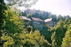
 Alby-sur-Chéran and Saint-Maurice chapel seen from the right bank of the river | |
 Coat of arms | |
Location of Alby-sur-Chéran 
| |
 Alby-sur-Chéran  Alby-sur-Chéran | |
| Coordinates: 45°49′03″N 6°01′18″E | |
| Country | France |
| Region | Auvergne-Rhône-Alpes |
| Department | Haute-Savoie |
| Arrondissement | Annecy |
| Canton | Rumilly |
| Intercommunality | Grand Annecy |
| Government | |
| • Mayor (2014-2020) | Jean-Claude Martin |
| Area 1 | 6.56 km2 (2.53 sq mi) |
| Population (2017-01-01)[1] | 2,579 |
| • Density | 390/km2 (1,000/sq mi) |
| Time zone | UTC+01:00 (CET) |
| • Summer (DST) | UTC+02:00 (CEST) |
| INSEE/Postal code | 74002 /74540 |
| Elevation | 360–606 m (1,181–1,988 ft) |
| 1 French Land Register data, which excludes lakes, ponds, glaciers > 1 km2 (0.386 sq mi or 247 acres) and river estuaries. | |
Geography
The Chéran flows northwestward through the north-eastern part of the commune and crosses the village.
Population
| Year | Pop. | ±% |
|---|---|---|
| 2004 | 1,870 | — |
| 2006 | 1,935 | +3.5% |
| 2007 | 1,959 | +1.2% |
| 2008 | 1,983 | +1.2% |
| 2009 | 2,007 | +1.2% |
| 2010 | 2,012 | +0.2% |
| 2011 | 2,049 | +1.8% |
| 2012 | 2,188 | +6.8% |
| 2013 | 2,324 | +6.2% |
| 2014 | 2,460 | +5.9% |
| 2015 | 2,528 | +2.8% |
| 2016 | 2,580 | +2.1% |
gollark: I'm sure you'd like me to think that you'd like us to think so.
gollark: Also use of most of this (https://github.com/satwikkansal/wtfpython) and the mildly exotic features like decorators.
gollark: If I were to enter this I may deliberately write my programs in the most stupid and ridiculous way possible (or at least I find it favorable to claim that now maybe), such as by, for example, using preprepared pickle streams for arbitrary code execution, doing everything in one line, horrible overuse of `exec`/`eval`, using that thing where python will execute code from a ZIP concatted onto an image, downloading data from pastebin or whatever, blatantly ignoring all available Python style guides, or mucking with the AST module and importlib to transform the code into other stuff.
gollark: Iterator functions vs for loops, classes versus namedtuples and dataclasses and whatever else, APLish array programming type solutions versus... not that?
gollark: I mean, they claim that, but you can solve many things in lots of different ways.
References
- "Populations légales 2017". INSEE. Retrieved 6 January 2020.
| Wikimedia Commons has media related to Alby-sur-Chéran. |
This article is issued from Wikipedia. The text is licensed under Creative Commons - Attribution - Sharealike. Additional terms may apply for the media files.