Dalhousie Parish, New Brunswick
Dalhousie is a civil parish[lower-alpha 1] in Restigouche County, New Brunswick, Canada.[2]
Dalhousie | |
|---|---|
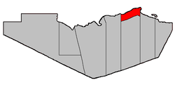 Location within Restigouche County. | |
| Coordinates: 48.0025°N 66.51889°W | |
| Country | |
| Province | |
| County | Restigouche |
| Established | 1839 |
| Area | |
| • Land | 62.7 km2 (24.2 sq mi) |
| Population (2016)[1] | |
| • Total | 1,067 |
| • Density | 17.0/km2 (44/sq mi) |
| • Change 2011-2016 | |
| • Dwellings | 531 |
| Time zone | UTC-4 (AST) |
| • Summer (DST) | UTC-3 (ADT) |
For governance purposes it is divided between the city of Campbellton; the town of Dalhousie; the Indian reserves of the villages of Atholville and Charlo; the Indian reserves of Eel River 3 and Indian Ranch; and the local service districts of Dalhousie Junction, McLeods, Point La Nim, and the parish of Dalhousie.[3]
Delineation
Dalhousie Parish is defined in the Territorial Division Act[2] as being bounded:
- West by Addington Parish, north by the Restigouche River; east and south by a line beginning on the east side of Eel River Gully, at the forty-eight mile post placed on the great road[lower-alpha 2] leading from Bathurst to Dalhousie, thence running true south to the southwest limit of Lot Number Five, fronting on Chaleur Bay, granted to Sebastian Doucett, thence in a northwesterly direction following the southwest limits of Lots Numbers Five, Four, Three, Two and One, and said limits of Lots Letters "O", "N", "M", "L" and "K" to the most westerly angle of the last mentioned lot; thence in a northeasterly direction along the northwest limit of said lot to the most easterly angle of the 100 acre lot granted to Archibald Chisholm; thence in a westerly, southerly, westerly and southerly direction following the bounds of said lot to the southeast angle of Lot Number Five, Eel River Crossing,[lower-alpha 3] granted to William Searls; thence in a westerly direction along the south limit of said lot and its prolongation to the east limit of Lot Number Seventy-two, Range One, Balmoral [Settlement], granted to Robert Good; thence in a northerly direction along said limit to the northeast angle of said lot; thence in a westerly direction along the northern limit of Range One, Balmoral, to the Addington Parish Line, including all the islands in front.
Communities
Parish population total does not include incorporated municipalities (in bold or italics).
|
|
Demographics
Population
| Canada census – Dalhousie Parish, New Brunswick community profile | |||
|---|---|---|---|
| 2016 | 2011 | 2006 | |
| Population: | 1,067 (-5.0% from 2011) | 2,247 (-2.9% from 2006) | 2,323 (-9.1% from 2001) |
| Land area: | 62.70 km2 (24.21 sq mi) | 121.32 km2 (46.84 sq mi) | 121.73 km2 (47.00 sq mi) |
| Population density: | 17.0/km2 (44/sq mi) | 18.5/km2 (48/sq mi) | 19.1/km2 (49/sq mi) |
| Median age: | 52.9 (M: 53.5, F: 52.2) | 47.4 (M: 48.0, F: 47.0) | 43.5 (M: 43.6, F: 43.3) |
| Total private dwellings: | 531 | 1,053 | 1,044 |
| Median household income: | $63,360 | $49,743 | $46,609 |
| References: 2016[4] 2011[5] 2006[6] earlier[7] | |||
|
|
| |||||||||||||||||||||||||||||||||
| [8][1] (Adj) adjustment due to boundary change. | |||||||||||||||||||||||||||||||||||
Language
| Canada Census Mother Tongue - Dalhousie Parish, New Brunswick[8] | ||||||||||||||||||
|---|---|---|---|---|---|---|---|---|---|---|---|---|---|---|---|---|---|---|
| Census | Total | French |
English |
French & English |
Other | |||||||||||||
| Year | Responses | Count | Trend | Pop % | Count | Trend | Pop % | Count | Trend | Pop % | Count | Trend | Pop % | |||||
2016 |
1,055 |
535 | 50.7% | 465 | 44.1% | 35 | 3.3% | 20 | 1.9% | |||||||||
2011 |
2,215 |
1,490 | 67.27% | 660 | 29.80% | 40 | 1.80% | 25 | 1.13% | |||||||||
2006 |
2,330 |
1,490 | 63.95% | 785 | 33.69% | 25 | 1.07% | 30 | 1.29% | |||||||||
2001 |
2,510 |
1,585 | 63.15% | 810 | 32.27% | 90 | 3.59% | 25 | 1.00% | |||||||||
1996 |
2,855 |
1,790 | n/a | 62.70% | 1,000 | n/a | 35.03% | 55 | n/a | 1.92% | 10 | n/a | 0.35% | |||||
Access Routes
Highways and numbered routes that run through the parish, including external routes that start or finish at the parish limits:[9]
|
|
|
|
gollark: I am HIGHLY* intelligent and capable of reading APL books.
gollark: Hi, alt!
gollark: Ugh, fiiine.
gollark: In the sense of "always cooperate" or "any which doesn't unconditionally betray"?
gollark: Which one is ☭ then?
See also
Notes
- Civil parishes served a variety of government functions until 1966, when the new Municipalities Act stripped them of their responsibilities; they continue to provide convenient boundaries for government uses, especially electoral districts and local service districts. Statistics Canada uses civil parishes as census subdivisions for all parts of the province that are not within municipalities and similar entities.
- Route 134
- Originally this read Eel River; the error appeared in the 1973 edition of the Revised Statutes of New Brunswick.
References
- "Census Profile, 2016 Census Dalhousie, Parish [Census subdivision], New Brunswick". Statistics Canada. Retrieved September 28, 2019.
- "Chapter T-3 Territorial Division Act". Government of New Brunswick. Retrieved 22 July 2020.
- "New Brunswick Regulation 84-168 under the Municipalities Act (O.C. 84-582)". Government of New Brunswick. Retrieved 22 July 2020.
- "2016 Community Profiles". 2016 Canadian Census. Statistics Canada. February 21, 2017. Retrieved 2019-09-28.
- "2011 Community Profiles". 2011 Canadian Census. Statistics Canada. July 5, 2013. Retrieved 2014-03-16.
- "2006 Community Profiles". 2006 Canadian Census. Statistics Canada. March 30, 2011. Retrieved 2014-03-16.
- "2001 Community Profiles". 2001 Canadian Census. Statistics Canada. February 17, 2012.
- Statistics Canada: 1996, 2001, 2006, 2011 census
- Atlantic Canada Back Road Atlas ISBN 978-1-55368-618-7 Pages 5-6
External links
- Village of Atholville
- City of Campbellton
- Village of Charlo
- Town of Dalhousie
- Village of Eel River Crossing
Places adjacent to Dalhousie Parish, New Brunswick | ||||||||||
|---|---|---|---|---|---|---|---|---|---|---|
| ||||||||||
| Subdivisions |
|
|---|---|
| Cities | |
| Counties | |
| |
This article is issued from Wikipedia. The text is licensed under Creative Commons - Attribution - Sharealike. Additional terms may apply for the media files.