Abbeville, Mississippi
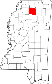
Abbeville is a town in Lafayette County, Mississippi. The population was 419 at the 2010 census.
Abbeville, Mississippi | |
|---|---|
| Town of Abbeville | |
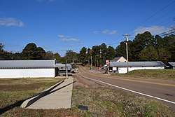
 Downtown Abbeville | |
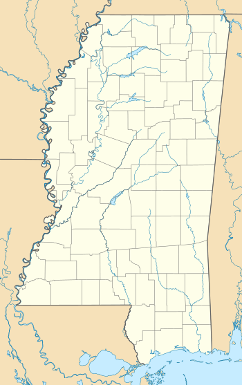
 Location of Abbeville, Mississippi | |
 Abbeville, Mississippi Location in Mississippi  Abbeville, Mississippi Abbeville, Mississippi (the United States)  Abbeville, Mississippi Abbeville, Mississippi (North America) | |
| Coordinates: 34°30′16″N 89°30′3″W | |
| Country | United States |
| State | Mississippi |
| County | Lafayette |
| Area | |
| • Total | 3.46 sq mi (8.96 km2) |
| • Land | 3.46 sq mi (8.96 km2) |
| • Water | 0.00 sq mi (0.00 km2) |
| Elevation | 371 ft (113 m) |
| Population (2010) | |
| • Total | 419 |
| • Estimate (2019)[2] | 423 |
| • Density | 122.25/sq mi (47.21/km2) |
| Time zone | UTC-6 (Central (CST)) |
| • Summer (DST) | UTC-5 (CDT) |
| ZIP code | 38601 |
| Area code(s) | 662 |
| FIPS code | 28-00100 |
| GNIS feature ID | 0691642 |
History
Abbeville was originally settled by pioneers from Abbeville, South Carolina in the 1830s. They lived in apparent peace with the local Chickasaw Indians, whose Chief Toby Tubby owned and operated a ferry along the Memphis-Oxford trade route.
During the American Civil War, Abbeville was almost completely destroyed in the Vicksburg Campaign.
Abbeville post office was established September 28, 1843, with John B. Davis as first postmaster.[3]
In 1950 Abbeville had a population of 275.[4]
Geography
According to the United States Census Bureau, the town has a total area of 3.5 square miles (9.1 km2), all land.
Transportation
Highways
Railroads
Demographics
As of the census[6] of 2010, there were 419 people and 166 occupied housing units in the town. The racial and ethnic makeup of the town was 89.7% non-Hispanic White, 8.8% African American, 1.0% reporting from two or more races with 0.5% of the population Hispanic or Latino.[7]
| Historical population | |||
|---|---|---|---|
| Census | Pop. | %± | |
| 1880 | 223 | — | |
| 1900 | 255 | — | |
| 1910 | 243 | −4.7% | |
| 1920 | 235 | −3.3% | |
| 1930 | 243 | 3.4% | |
| 1980 | 448 | — | |
| 1990 | 399 | −10.9% | |
| 2000 | 423 | 6.0% | |
| 2010 | 419 | −0.9% | |
| Est. 2019 | 423 | [2] | 1.0% |
| U.S. Decennial Census[8] | |||
Education
The Town of Abbeville is served by the Lafayette County School District.
The University of Mississippi also owns and operates the University of Mississippi Field Station, which is located in Abbeville. It is a natural laboratory used to study, research and teach about sustainable freshwater ecosystems.
Climate
The climate in this area is characterized by hot, humid summers and generally mild to cool winters. According to the Köppen Climate Classification system, Abbeville has a humid subtropical climate, abbreviated "Cfa" on climate maps.[9]
References
| Wikimedia Commons has media related to Abbeville, Mississippi. |
- "2019 U.S. Gazetteer Files". United States Census Bureau. Retrieved July 26, 2020.
- "Population and Housing Unit Estimates". United States Census Bureau. May 24, 2020. Retrieved May 27, 2020.
- Gallagher, John S. and Patera, Alan H. (1996) Mississippi Post Offices, p. 91. Lake Grove, Oregon: The Depot, ISBN 0-943645-35-2
- Encyclopædia Britannica Atlas, 1959 Edition, p. 298.
- "Mississippi Central Railroad Company". Pioneer Railcorp. Archived from the original on February 4, 2012.
- "U.S. Census website". United States Census Bureau. Retrieved 2008-01-31.
- 2010 census report of Abbeville
- "Census of Population and Housing". Census.gov. Retrieved June 4, 2015.
- Climate Summary for Abbeville, Mississippi
