Wrightsville, Pennsylvania
Wrightsville is a borough in York County, Pennsylvania, United States. The population was 2,310 at the 2010 census.[3] Wrightsville borough has a police department, historic society, and a volunteer fire company.
Wrightsville, Pennsylvania Wrights Ferry | |
|---|---|
Borough | |
 | |
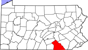
 Location in York County and the U.S. state of Pennsylvania. | |
 Wrightsville Location of Wrightsville in Pennsylvania  Wrightsville Wrightsville (the United States) | |
| Coordinates: 40°01′28″N 76°31′52″W | |
| Country | United States |
| State | Pennsylvania |
| County | York |
| Settled | 1811 |
| Incorporated | 1834 |
| Government | |
| • Type | Borough Council |
| • Mayor | Michael Albert |
| • Council President | Eric J White |
| Area | |
| • Total | 0.66 sq mi (1.70 km2) |
| • Land | 0.66 sq mi (1.70 km2) |
| • Water | 0.00 sq mi (0.00 km2) |
| Elevation | 390 ft (120 m) |
| Population (2010) | |
| • Total | 2,310 |
| • Estimate (2019)[2] | 2,296 |
| • Density | 3,505.34/sq mi (1,352.54/km2) |
| Time zone | UTC-5 (Eastern (EST)) |
| • Summer (DST) | UTC-4 (EDT) |
| Zip code | 17368 |
| Area code(s) | 717 |
| FIPS code | 42-86640 |
| Website | www |

History

According to a plaque at Samuel S. Lewis State Park, which overlooks Wrightsville and the Susquehanna River, Wrightsville was among George Washington's choices as the location of the capital of the United States.
The world's longest covered bridge, at 5,960 feet (1,820 m), once spanned the Susquehanna from Wrightsville to neighboring Columbia in Lancaster County. Built in 1814, it was destroyed by high water and ice in 1832. A replacement bridge was burned the night of June 28, 1863, by state militia during the Gettysburg Campaign in the American Civil War. Confederate troops under John Brown Gordon formed a bucket brigade to save the town from fire. Yet another replacement covered bridge was destroyed by a windstorm a few years later.
The final bridge, the Pennsylvania Railroad Bridge, was a steel open-air bridge constructed in 1896. It was razed in the early 1960s because of obsolescence and restructuring of the railroad industry.
Wrightsville was the northern terminus of the Susquehanna and Tidewater Canal, which extended to Havre de Grace, Maryland.
In 2007, Wrightsville was the chosen location for the rekindling of the War of the Roses between the York Revolution and the Lancaster Barnstormers baseball teams. Wrightsville was chosen for its location on the Susquehanna River, the boundary between York and Lancaster counties.
The Columbia-Wrightsville Bridge and Wrightsville Historic District are listed on the National Register of Historic Places.[4]
Geography
Wrightsville is located at 40°1′28″N 76°31′52″W (40.024481, -76.531221).[5]
According to the United States Census Bureau, the borough has a total area of 0.6 square miles (1.6 km2), all of it land.
Demographics
| Historical population | |||
|---|---|---|---|
| Census | Pop. | %± | |
| 1840 | 672 | — | |
| 1850 | 1,310 | 94.9% | |
| 1860 | 1,360 | 3.8% | |
| 1870 | 1,544 | 13.5% | |
| 1880 | 1,776 | 15.0% | |
| 1890 | 1,912 | 7.7% | |
| 1900 | 2,266 | 18.5% | |
| 1910 | 2,051 | −9.5% | |
| 1920 | 1,943 | −5.3% | |
| 1930 | 2,247 | 15.6% | |
| 1940 | 2,120 | −5.7% | |
| 1950 | 2,104 | −0.8% | |
| 1960 | 2,345 | 11.5% | |
| 1970 | 2,668 | 13.8% | |
| 1980 | 2,365 | −11.4% | |
| 1990 | 2,396 | 1.3% | |
| 2000 | 2,223 | −7.2% | |
| 2010 | 2,310 | 3.9% | |
| Est. 2019 | 2,296 | [2] | −0.6% |
| Sources:[6][7][8] | |||
As of the census[7] of 2000, there were 2,223 people, 955 households, and 606 families residing in the borough. The population density was 3,572.8 people per square mile (1,384.4/km²). There were 1,009 housing units at an average density of 1,621.7 per square mile (628.4/km²). The racial makeup of the borough was 97.62% White, 0.40% African American, 0.09% Native American, 0.36% Asian, 0.54% from other races, and 0.99% from two or more races. Hispanic or Latino of any race were 2.02% of the population.
There were 955 households out of which 29.7% had children under the age of 18 living with them, 46.1% were married couples living together, 11.1% had a female householder with no husband present, and 36.5% were non-families. 30.6% of all households were made up of individuals and 11.4% had someone living alone who was 65 years of age or older. The average household size was 2.33 and the average family size was 2.86.
In the borough, the population was spread out with 23.1% under the age of 18, 7.6% from 18 to 24, 31.4% from 25 to 44, 22.7% from 45 to 64, and 15.2% who were 65 years of age or older. The median age was 38 years. For every 100 females, there were 94.8 males. For every 100 females age 18 and over, there were 92.0 males.
The median income for a household in the borough was $37,379, and the median income for a family was $47,083. Males had a median income of $33,587 versus $23,073 for females. The per capita income for the borough was $18,711. About 4.9% of families and 5.8% of the population were below the poverty line, including 4.8% of those under age 18 and 10.6% of those age 65 or over.
Emergency Services
FIRE PROTECTION
Although fire protection in Wrightsville Borough can be traced back to the early 1800s, it wasn't until 1887 that the Wrightsville Steam Fire Engine and Hose Company #1 (York County Station 41) was organized. The fire department protects nearly 10,000 citizens in Wrightsville Borough and Hellam Township with an all-volunteer staffing of over 30 active firefighters, as well as a support staff and a junior fire department (ages 14–17).
The Wrightsville Fire Department has been recognized by the Commonwealth of Pennsylvania after meeting or exceeding the requirements set forth in the Voluntary Rescue Service Recognition Program. The Wrightsville Fire Department was also a participating department with the Commonwealth's professional certification program in which over 95% of its members are trained to the National Proboard Firefighter 1 & 2 certification levels. In 2018, the department responded to a total of 801 calls for service.
The department is located at 125 South Second Street in Wrightsville Borough. The current facility was completed in 1979, and houses four pieces of fire apparatus: a 1996 Seagrave rescue/pumper (Rescue 41-1), a 2005 Seagrave pumper (Engine 41), a 2005 Ford 550/Semo rescue (Rescue 41-2), and an AM General 900 Series 6x6 (Utility 41).
EMS COVERAGE
Aside from fire/rescue services, Station 41 provides Quick Response Services (QRS) to residents in Wrightsville Borough and Hellam Township. This includes basic emergency medical care provided by Emergency Medical Technicians and Emergency Medical Responders until transporting EMS units arrive. The average response time for QRS calls was 1 minute in 2014.
Basic life support (BLS), Advance life support (ALS), and transport coverage is contracted with Lancaster County-based Susquehanna Valley EMS (SVEMS) but respond from the Hellam Township Municipal Building as Ambulance 41. BLS services were previously provided by White Rose Ambulance, but ended service on June 1, 2017, after local municipal officials and White Rose Ambulance could not reach an agreement to renew the contract. Although they share the same station number as the Wrightsville Fire Department, there is no affiliation.
POLICE COVERAGE
Beginning July 1, 2018, Wrightsville Borough is protected by the Hellam Township Police Department. This came after, "marred by coverage gaps and poor management, according to Wrightville Council President Eric White" when Wrightsville Borough had its own police force.
Education
Wrightsville is served by the Eastern York School District (one of 500 Pennsylvania public school districts).[9]
References
- "2019 U.S. Gazetteer Files". United States Census Bureau. Retrieved July 28, 2020.
- "Population and Housing Unit Estimates". United States Census Bureau. May 24, 2020. Retrieved May 27, 2020.
- "Race, Hispanic or Latino, Age, and Housing Occupancy: 2010 Census Redistricting Data (Public Law 94-171) Summary File (QT-PL), Wrightsville borough, Pennsylvania". United States Census Bureau. Retrieved October 7, 2011.
- "National Register Information System". National Register of Historic Places. National Park Service. July 9, 2010.
- "US Gazetteer files: 2010, 2000, and 1990". United States Census Bureau. 2011-02-12. Retrieved 2011-04-23.
- "Census of Population and Housing". U.S. Census Bureau. Retrieved 11 December 2013.
- "U.S. Census website". United States Census Bureau. Retrieved 2008-01-31.
- "Incorporated Places and Minor Civil Divisions Datasets: Subcounty Resident Population Estimates: April 1, 2010 to July 1, 2012". Population Estimates. U.S. Census Bureau. Retrieved 11 December 2013.
- National Center for Education Statistics, Common Core of Data - Eastern York School District, 2012
Further reading
- Marcello, Ronald E. Small Town America in World War II: War Stories from Wrightsville, Pennsylvania (University of North Texas Press, 2014) 452 pp.
External links
| Wikimedia Commons has media related to Wrightsville, Pennsylvania. |
- Official website
- WrightsvillePA community website, news, video, and information about the town
- Historic Wrightsville, Inc
| Authority control |
|
|---|