Mount Wolf, Pennsylvania
Mount Wolf is a borough in York County, Pennsylvania, United States. The population was 1,393 at the 2010 Census.[4]
Mount Wolf, Pennsylvania | |
|---|---|
Borough | |
 Warehouses by the depot | |
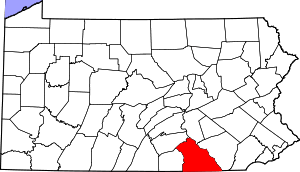
 Location in York County and the U.S. state of Pennsylvania. | |
 Mount Wolf Location of Mount Wolf in Pennsylvania  Mount Wolf Mount Wolf (the United States) | |
| Coordinates: 40°03′46″N 76°42′20″W | |
| Country | United States |
| State | Pennsylvania |
| County | York |
| Settled | 1867 |
| Incorporated | 1910 |
| Government | |
| • Type | Borough Council |
| • Mayor | Maureen Starner[1] |
| Area | |
| • Total | 0.52 sq mi (1.36 km2) |
| • Land | 0.52 sq mi (1.36 km2) |
| • Water | 0.00 sq mi (0.00 km2) |
| Elevation | 374 ft (114 m) |
| Population (2010) | |
| • Total | 1,393 |
| • Estimate (2019)[3] | 1,385 |
| • Density | 2,643.13/sq mi (1,020.06/km2) |
| Time zone | UTC-5 (Eastern (EST)) |
| • Summer (DST) | UTC-4 (EDT) |
| Zip code | 17347 |
| Area code(s) | 717 |
| FIPS code | 42-52056 |
| Website | Mount Wolf Borough website |
Geography
Mount Wolf is located at 40°3′46″N 76°42′20″W (40.062794, -76.705587).[5]
According to the United States Census Bureau, the borough has a total area of 0.5 square miles (1.4 km2), all of it land.
History
In the area later to become Mount Wolf, the earliest recorded land deeds were dated 1746.[6] Around 1850, the York and Cumberland Railroad decided to locate a station between Emigsville, Liverpool (now Manchester) and New Holland (now Saginaw).[7] The station was named Mount Campbell in honor of Thomas Campbell, who was instrumental in urging completion of the railway to Harrisburg. In the late 1850s, the station and post office became known as Mount Wolf in honor of George H. Wolf, who was the stationmaster, postmaster and owner of a local store and warehouse.
Mount Wolf became incorporated as a self-governing borough on August 23, 1910. It is governed by a mayor and a six-member council.[8][9][10][11]
In April 2011, the Mount Wolf Centennial Committee received second-place recognition in the 2011 Borough News Municipal Website contest for the population category under 2,500 from the Pennsylvania State Association of Boroughs. In September 2011, the Mount Wolf Centennial Committee received the "Community Award - Government/Civic Organization", at the annual board meeting of the York County Heritage Trust.
Thomas Westerman Wolf, who was elected Governor of Pennsylvania in 2014, is from Mount Wolf and is a descendant of George H. Wolf.
Demographics
| Historical population | |||
|---|---|---|---|
| Census | Pop. | %± | |
| 1880 | 148 | — | |
| 1920 | 688 | — | |
| 1930 | 999 | 45.2% | |
| 1940 | 970 | −2.9% | |
| 1950 | 1,164 | 20.0% | |
| 1960 | 1,514 | 30.1% | |
| 1970 | 1,811 | 19.6% | |
| 1980 | 1,517 | −16.2% | |
| 1990 | 1,365 | −10.0% | |
| 2000 | 1,373 | 0.6% | |
| 2010 | 1,393 | 1.5% | |
| Est. 2019 | 1,385 | [3] | −0.6% |
| Sources:[12][13][14] | |||
As of the census[13] of 2000, there were 1,373 people, 548 households, and 396 families residing in the borough. The population density was 2,530.6 people per square mile (981.7/km2). There were 570 housing units at an average density of 1,050.6 per square mile (407.6/km2). The racial makeup of the borough was 97.01% White, 1.24% African American, 0.15% Native American, 0.22% Asian, 0.22% from other races, and 1.17% from two or more races. Hispanic or Latino of any race were 1.60% of the population.
There were 548 households, out of which 28.5% had children under the age of 18 living with them, 56.8% were married couples living together, 10.9% had a female householder with no husband present, and 27.6% were non-families. 23.2% of all households were made up of individuals, and 11.5% had someone living alone who was 65 years of age or older. The average household size was 2.44 and the average family size was 2.85.
In the borough the population was spread out, with 24.4% under the age of 18, 7.1% from 18 to 24, 29.3% from 25 to 44, 22.2% from 45 to 64, and 17.0% who were 65 years of age or older. The median age was 40 years. For every 100 females there were 92.6 males. For every 100 females age 18 and over, there were 90.5 males.
The median income for a household in the borough was $42,135, and the median income for a family was $47,813. Males had a median income of $35,268 versus $25,859 for females. The per capita income for the borough was $19,760. About 2.5% of families and 4.7% of the population were below the poverty line, including 2.1% of those under age 18 and 3.1% of those age 65 or over.
Education
Mount Wolf is served by the Northeastern York School District (one of 500 public school districts in Pennsylvania). Students may also attend one of the Commonwealth's public cyber charter schools at no additional cost to the family or student. The local school district pays the Pennsylvania Department of Education set tuition fee to the cyber charter school that the resident student chooses to attend. By law, Pennsylvania cyber charter school students have access to all extracurriculars and sports programs at the local public school district. Alternatively, the Commonwealth of Pennsylvania permits parents to home school their children or they may attend a private school.[15]
References
- "Administration". mtwolfborough.com. Retrieved May 10, 2016.
- "2019 U.S. Gazetteer Files". United States Census Bureau. Retrieved July 28, 2020.
- "Population and Housing Unit Estimates". United States Census Bureau. May 24, 2020. Retrieved May 27, 2020.
- "Race, Hispanic or Latino, Age, and Housing Occupancy: 2010 Census Redistricting Data (Public Law 94-171) Summary File (QT-PL), Mount Wolf borough, Pennsylvania". United States Census Bureau. Retrieved October 6, 2011.
- "US Gazetteer files: 2010, 2000, and 1990". United States Census Bureau. February 12, 2011. Retrieved April 23, 2011.
- "Mount Wolf Borough History Before 1850". North Eastern York County History In Preservation. Retrieved August 30, 2018.
- "Mount Wolf Borough 1850-1910". North Eastern York County History In Preservation. Retrieved August 30, 2018.
- http://www.MtWolfBorough.com/History.html
- "A History of Mount Wolf The Centennial Edition" released September 22, 2010 ISBN 978-1-4507-3908-5 edited by Brad Rentzel and Charles Stambaugh.
- Borough of Mount Wolf history
- "Administration". Mt. Wolf Borough official site. Retrieved August 30, 2018.
- "Census of Population and Housing". U.S. Census Bureau. Retrieved December 11, 2013.
- "U.S. Census website". United States Census Bureau. Retrieved January 31, 2008.
- "Incorporated Places and Minor Civil Divisions Datasets: Subcounty Resident Population Estimates: April 1, 2010 to July 1, 2012". Population Estimates. U.S. Census Bureau. Archived from the original on June 11, 2013. Retrieved December 11, 2013.
- Pennsylvania Department of Education, Charter Schools, 2013
External links
| Authority control |
|
|---|