Stinesville, Indiana
Stinesville is a town in Bean Blossom Township, Monroe County, in the U.S. state of Indiana.[5] The population was 198 at the 2010 census. It is part of the Bloomington, Indiana Metropolitan Statistical Area.
Stinesville, Indiana | |
|---|---|
.jpg) Downtown Stinesville | |
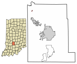 Location of Stinesville in Monroe County, Indiana. | |
| Coordinates: 39°17′57″N 86°39′0″W | |
| Country | United States |
| State | Indiana |
| County | Monroe |
| Township | Bean Blossom |
| Area | |
| • Total | 0.12 sq mi (0.30 km2) |
| • Land | 0.12 sq mi (0.30 km2) |
| • Water | 0.00 sq mi (0.00 km2) |
| Elevation | 581 ft (177 m) |
| Population (2010) | |
| • Total | 198 |
| • Estimate (2019)[3] | 218 |
| • Density | 1,863.25/sq mi (719.17/km2) |
| Time zone | UTC-5 (Eastern (EST)) |
| • Summer (DST) | UTC-4 (EDT) |
| ZIP code | 47464 |
| Area code(s) | 812, 930 |
| FIPS code | 18-73232[4] |
| GNIS feature ID | 444170 |
History
Stinesville was platted in 1855 when the New Albany and Salem Railroad was extended to that point.[6] The town was named for Eusebius Stine, the original owner of the town site.[7] A post office has been in operation at Stinesville since 1860.[8]
Stinesville Commercial Historic District was listed on the National Register of Historic Places in 1995.[9]
Geography
Stinesville is located at 39°17′57″N 86°39′0″W (39.299245, -86.650075),[10] approximately 5 miles north of Ellettsville.
According to the 2010 census, Stinesville has a total area of 0.11 square miles (0.28 km2), all land.[11]
Demographics
| Historical population | |||
|---|---|---|---|
| Census | Pop. | %± | |
| 1870 | 140 | — | |
| 1900 | 288 | — | |
| 1910 | 497 | 72.6% | |
| 1920 | 299 | −39.8% | |
| 1930 | 310 | 3.7% | |
| 1940 | 337 | 8.7% | |
| 1950 | 355 | 5.3% | |
| 1960 | 288 | −18.9% | |
| 1970 | 291 | 1.0% | |
| 1980 | 227 | −22.0% | |
| 1990 | 204 | −10.1% | |
| 2000 | 194 | −4.9% | |
| 2010 | 198 | 2.1% | |
| Est. 2019 | 218 | [3] | 10.1% |
| U.S. Decennial Census[12] | |||
As of the census[4] of 2000, there were 194 people, 67 households, and 48 families residing in the town. The population density was 1,783.8 people per square mile (680.9/km2). There were 94 housing units at an average density of 864.3 per square mile (329.9/km2). The racial makeup of the town was 95.88% White, 2.58% Asian, and 1.55% from two or more races.
There were 67 households out of which 32.8% had children under the age of 18 living with them, 55.2% were married couples living together, 11.9% had a female householder with no husband present, and 26.9% were non-families. 25.4% of all households were made up of individuals and 16.4% had someone living alone who was 65 years of age or older. The average household size was 2.90 and the average family size was 3.35.
In the town, the population was spread out with 30.9% under the age of 18, 6.2% from 18 to 24, 29.9% from 25 to 44, 22.7% from 45 to 64, and 10.3% who were 65 years of age or older. The median age was 36 years. For every 100 females, there were 96.0 males. For every 100 females age 18 and over, there were 91.4 males.
The median income for a household in the town was $31,875, and the median income for a family was $36,875. Males had a median income of $26,667 versus $15,000 for females. The per capita income for the town was $11,411. None of the families and 1.0% of the population were living below the poverty line, including no under eighteens and 7.4% of those over 64.
References
- "2019 U.S. Gazetteer Files". United States Census Bureau. Retrieved July 16, 2020.
- "US Board on Geographic Names". United States Geological Survey. 2007-10-25. Retrieved 2008-01-31.
- "Population and Housing Unit Estimates". United States Census Bureau. May 24, 2020. Retrieved May 27, 2020.
- "U.S. Census website". United States Census Bureau. Retrieved 2008-01-31.
- "Stinesville, Indiana". Geographic Names Information System. United States Geological Survey. Retrieved 2017-06-18.
- History of Lawrence and Monroe Counties, Indiana: Their People, Industries, and Institutions. B.F. Bowen. 1914. p. 102.
- Blanchard, Charles (1884). Counties of Morgan, Monroe and Brown, Indiana: Historical and Biographical. F.A. Battey & Company. p. 492.
- "Monroe County". Jim Forte Postal History. Retrieved 5 September 2015.
- "National Register Information System". National Register of Historic Places. National Park Service. July 9, 2010.
- "US Gazetteer files: 2010, 2000, and 1990". United States Census Bureau. 2011-02-12. Retrieved 2011-04-23.
- "G001 - Geographic Identifiers - 2010 Census Summary File 1". United States Census Bureau. Archived from the original on 2020-02-13. Retrieved 2015-07-25.
- "Census of Population and Housing". Census.gov. Retrieved June 4, 2015.
Municipalities and communities of Monroe County, Indiana, United States | ||
|---|---|---|
| City | Map of Indiana highlighting Monroe County | |
| Towns | ||
| Townships | ||
| CDPs | ||
| Other unincorporated communities |
| |
| Authority control |
|
|---|