Bean Blossom Township, Monroe County, Indiana
Bean Blossom Township is one of eleven townships in Monroe County, Indiana, United States. As of the 2010 census, its population was 2,916 and it contained 1,184 housing units.[2]
Bean Blossom Township | |
|---|---|
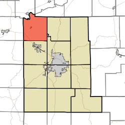 Location in Monroe County | |
| Coordinates: 39°17′46″N 86°37′18″W | |
| Country | |
| State | |
| County | Monroe |
| Government | |
| • Type | Indiana township |
| Area | |
| • Total | 36.35 sq mi (94.1 km2) |
| • Land | 36.34 sq mi (94.1 km2) |
| • Water | 0.01 sq mi (0.03 km2) 0.03% |
| Elevation | 755 ft (230 m) |
| Population (2010) | |
| • Total | 2,916 |
| • Density | 80.2/sq mi (31.0/km2) |
| Time zone | UTC-5 (Eastern (EST)) |
| • Summer (DST) | UTC-4 (EDT) |
| ZIP codes | 47404, 47429, 47433, 47464 |
| Area code(s) | 812, 930 |
| GNIS feature ID | 453100 |
History
Secrest Ferry Bridge was listed on the National Register of Historic Places in 1996.[3]
Geography
According to the 2010 census, the township has a total area of 36.35 square miles (94.1 km2), of which 36.34 square miles (94.1 km2) (or 99.97%) is land and 0.01 square miles (0.026 km2) (or 0.03%) is water.[2] The White River defines the northwest boundary of the township.
Cities, towns, villages
- Ellettsville (northwest edge)
- Stinesville
Unincorporated towns
Cemeteries
The township contains these four cemeteries: Ellett, King, Mount Carmel and Van Buskirk.
Major highways
School districts
- Richland-Bean Blossom Community School Corporation
Political districts
- Indiana's 4th congressional district
- State House District 46
- State Senate District 37
References
- "Bean Blossom Township, Monroe County, Indiana". Geographic Names Information System. United States Geological Survey. Retrieved 2009-09-27.
- United States Census Bureau 2008 TIGER/Line Shapefiles
- IndianaMap
- "US Board on Geographic Names". United States Geological Survey. October 25, 2007. Retrieved 2017-05-09.
- "Population, Housing Units, Area, and Density: 2010 - County -- County Subdivision and Place -- 2010 Census Summary File 1". United States Census. Archived from the original on 2020-02-12. Retrieved 2013-05-10.
- "National Register Information System". National Register of Historic Places. National Park Service. July 9, 2010.
External links
Places adjacent to Bean Blossom Township, Monroe County, Indiana | |
|---|---|
Municipalities and communities of Monroe County, Indiana, United States | ||
|---|---|---|
| City | Map of Indiana highlighting Monroe County | |
| Towns | ||
| Townships | ||
| CDPs | ||
| Other unincorporated communities |
| |
This article is issued from Wikipedia. The text is licensed under Creative Commons - Attribution - Sharealike. Additional terms may apply for the media files.