Sanford, New York
Sanford is a town in Broome County, New York, United States. The population was 2,407 at the 2010 census.[3]
Sanford, New York | |
|---|---|
Town | |
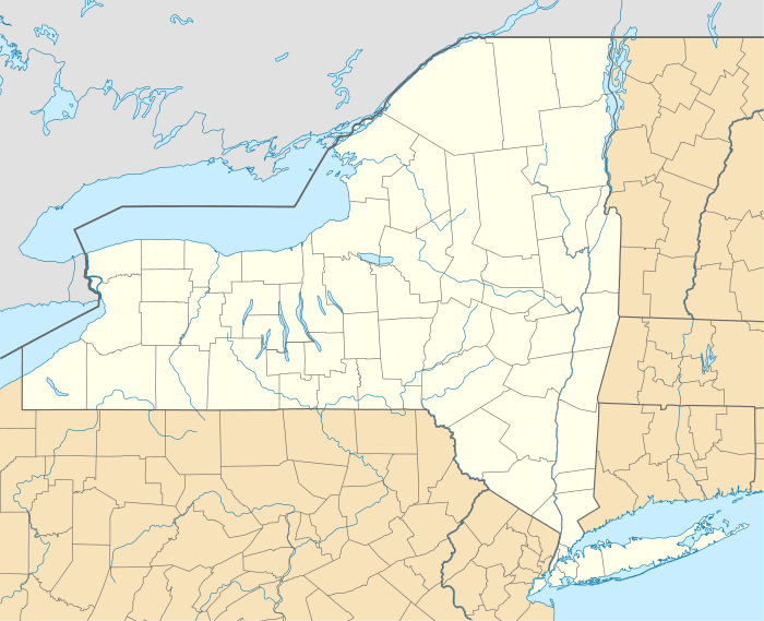 Sanford Location within the state of New York | |
| Coordinates: 42°4′52″N 75°28′46″W | |
| Country | United States |
| State | New York |
| County | Broome |
| Government | |
| • Type | Town Council |
| • Town Supervisor | Dewey A. Decker |
| • Town Council | Members' List
|
| Area | |
| • Total | 91.02 sq mi (235.75 km2) |
| • Land | 90.10 sq mi (233.35 km2) |
| • Water | 0.92 sq mi (2.39 km2) |
| Elevation | 1,148 ft (350 m) |
| Population (2010) | |
| • Total | 2,407 |
| • Estimate (2016)[2] | 2,367 |
| • Density | 26.27/sq mi (10.14/km2) |
| Time zone | UTC-5 (Eastern (EST)) |
| • Summer (DST) | UTC-4 (EDT) |
| ZIP code | 13754 |
| Area code(s) | 607 |
| FIPS code | 36-007-65112 |
| GNIS feature ID | 0979457 |
The town is on the east border of the county and the south border of the state of New York. Sanford is east of Binghamton.
History
Early ownership of the area was primarily divided into the Livingstone patent, the Fisher and Norton tract, and the Randolph patent. The region was first settled around 1787.
The town of Sanford was formed in 1821 from the town of Windsor.
Geography
According to the United States Census Bureau, the town has a total area of 91.0 square miles (235.7 km2), of which 90.1 square miles (233.4 km2) is land and 0.93 square miles (2.4 km2), or 1.01%, is water.[3]
The east town line is the border of Delaware County, the north town line is the border of Chenango County, and the south town line is the border of Pennsylvania, bordering Wayne and Susquehanna counties.
New York Route 17 crosses the town. New York State Route 41 intersects NY-17 west of McClure. The part of NY-17 near Deposit was one of the last sections to be completed in this part of New York, forcing travelers to exit at Deposit.
The West Branch of the Delaware River forms part of the eastern border of the town.
Demographics
| Historical population | |||
|---|---|---|---|
| Census | Pop. | %± | |
| 1830 | 931 | — | |
| 1840 | 1,173 | 26.0% | |
| 1850 | 2,508 | 113.8% | |
| 1860 | 3,061 | 22.0% | |
| 1870 | 3,249 | 6.1% | |
| 1880 | 3,495 | 7.6% | |
| 1890 | 3,265 | −6.6% | |
| 1900 | 3,514 | 7.6% | |
| 1910 | 2,980 | −15.2% | |
| 1920 | 2,681 | −10.0% | |
| 1930 | 2,538 | −5.3% | |
| 1940 | 2,502 | −1.4% | |
| 1950 | 2,416 | −3.4% | |
| 1960 | 2,489 | 3.0% | |
| 1970 | 2,528 | 1.6% | |
| 1980 | 2,635 | 4.2% | |
| 1990 | 2,576 | −2.2% | |
| 2000 | 2,477 | −3.8% | |
| 2010 | 2,407 | −2.8% | |
| Est. 2016 | 2,367 | [2] | −1.7% |
| U.S. Decennial Census[4] | |||
As of the census[5] of 2000, there were 2,477 people, 983 households, and 694 families residing in the town. The population density was 27.5 people per square mile (10.6/km2). There were 1,545 housing units at an average density of 17.2 per square mile (6.6/km2). The racial makeup of the town was 98.26% White, 0.48% African American, 0.08% Native American, 0.24% Asian, 0.52% from other races, and 0.40% from two or more races. Hispanic or Latino of any race were 2.10% of the population.
There were 983 households, out of which 30.5% had children under the age of 18 living with them, 56.6% were married couples living together, 8.5% had a female householder with no husband present, and 29.3% were non-families. 24.6% of all households were made up of individuals, and 11.7% had someone living alone who was 65 years of age or older. The average household size was 2.52 and the average family size was 2.99.
In the town, the population was spread out, with 25.2% under the age of 18, 7.3% from 18 to 24, 23.9% from 25 to 44, 27.9% from 45 to 64, and 15.7% who were 65 years of age or older. The median age was 40 years. For every 100 females, there were 101.1 males. For every 100 females age 18 and over, there were 98.7 males.
The median income for a household in the town was $33,309, and the median income for a family was $40,472. Males had a median income of $31,344 versus $20,365 for females. The per capita income for the town was $17,083. About 12.9% of families and 15.6% of the population were below the poverty line, including 22.7% of those under age 18 and 9.0% of those age 65 or over.
Communities and locations in Sanford
- Arctic Lake – A lake located in the northeast corner of the town.
- Big Hollow – A valley north of Deposit.
- Danville – A hamlet near the southern border of the town.
- Deposit – The village of Deposit is partly in Broome County and partly in Delaware County. It is bypassed by NY Route 17, with access from Exits 83 and 84.
- Gulf Summit – A hamlet in the southwest part of the town, south of NY-17.
- Howes – A hamlet near the west town line in the north part of the town on NY-41.
- McClure – A hamlet in the south part of the town with access from Exit 82 on NY-17. It was formerly known as "McClure Settlement", named after William McClure, surveyor and early settler.
- North Sanford – A hamlet near the north and east town lines on County Road 241.
- Ouaquaga – A former community in the town.
- Oquaga Creek – A stream that flows through most of the town and empties into the West Branch of the Delaware River by Deposit.
- Oquaga Lake – A small lake in the southeast part of the town bordered by County Road 237.
- Oquaga Creek State Park – A state park in the northeast corner of the town.
- Sanford – The hamlet of Sanford is on NY Route 41 near the center of the town.
- Vallonia Springs – A hamlet at the west town line.
References
- "2016 U.S. Gazetteer Files". United States Census Bureau. Retrieved Jul 4, 2017.
- "Population and Housing Unit Estimates". Retrieved June 9, 2017.
- "Geographic Identifiers: 2010 Demographic Profile Data (G001): Sanford town, Broome County, New York". U.S. Census Bureau, American Factfinder. Archived from the original on February 12, 2020. Retrieved February 4, 2014.
- "Census of Population and Housing". Census.gov. Retrieved June 4, 2015.
- "U.S. Census website". United States Census Bureau. Retrieved 2008-01-31.
External links
Municipalities and communities of Broome County, New York, United States | ||
|---|---|---|
| City | 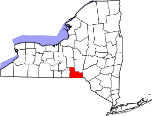 | |
| Towns | ||
| Villages | ||
| CDPs | ||
| Other hamlets | ||
| Footnotes | ‡This populated place also has portions in an adjacent county or counties | |