Glen Aubrey, New York
Glen Aubrey is a hamlet (and census-designated place) located in the town of Nanticoke in Broome County, New York, United States. Its population was 485 at the 2010 census.[1]
Glen Aubrey, New York | |
|---|---|
 Glen Aubrey Location within the state of New York | |
| Coordinates: 42°15′29″N 76°0′35″W | |
| Country | United States |
| State | New York |
| County | Broome |
| Town | Nanticoke |
| Area | |
| • Total | 1.0 sq mi (2.6 km2) |
| • Land | 1.0 sq mi (2.6 km2) |
| • Water | 0 sq mi (0 km2) |
| Elevation | 990 ft (300 m) |
| Population (2010) | |
| • Total | 485 |
| • Density | 492/sq mi (189.9/km2) |
| Time zone | UTC-5 (Eastern (EST)) |
| • Summer (DST) | UTC-4 (EDT) |
| ZIP codes | 13777 |
| Area code(s) | 607 |
| FIPS code | 36-29058 |
| GNIS feature ID | 0951166 |
Geography
Glen Aubrey is located in the southeast part of the town of Nanticoke. New York State Route 26 passes through the community, leading south 12 miles (19 km) to Endicott (west of Binghamton) and north 6 miles (10 km) to Interstate 81 at Whitney Point.
According to the United States Census Bureau, the CDP has a total area of 1.0 square mile (2.6 km2), all of it land.[1]
Glen Aubrey is in the valley of the East Branch of Nanticoke Creek, which flows south to the Susquehanna River.
References
- "Geographic Identifiers: 2010 Demographic Profile Data (G001): Glen Aubrey CDP, New York". U.S. Census Bureau, American Factfinder. Archived from the original on February 12, 2020. Retrieved February 5, 2014.
Municipalities and communities of Broome County, New York, United States | ||
|---|---|---|
| City | 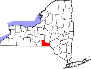 | |
| Towns | ||
| Villages | ||
| CDPs | ||
| Other hamlets | ||
| Footnotes | ‡This populated place also has portions in an adjacent county or counties | |
This article is issued from Wikipedia. The text is licensed under Creative Commons - Attribution - Sharealike. Additional terms may apply for the media files.