Saint-Martin-Château
Saint-Martin-Château is a commune in the Creuse department in central France.
Saint-Martin-Château | |
|---|---|
 The Maulde river, at the foot of the Jarrauds waterfall | |
Location of Saint-Martin-Château 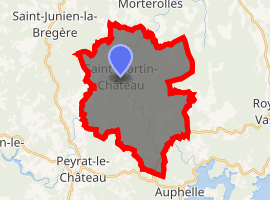
| |
 Saint-Martin-Château 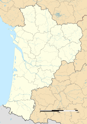 Saint-Martin-Château | |
| Coordinates: 45°51′29″N 1°47′59″E | |
| Country | France |
| Region | Nouvelle-Aquitaine |
| Department | Creuse |
| Arrondissement | Guéret |
| Canton | Felletin |
| Intercommunality | CC Creuse Sud Ouest |
| Government | |
| • Mayor (2014-2020) | Nicolas Derieux |
| Area 1 | 31.25 km2 (12.07 sq mi) |
| Population (2017-01-01)[1] | 144 |
| • Density | 4.6/km2 (12/sq mi) |
| Time zone | UTC+01:00 (CET) |
| • Summer (DST) | UTC+02:00 (CEST) |
| INSEE/Postal code | 23216 /23460 |
| Elevation | 410–741 m (1,345–2,431 ft) (avg. 600 m or 2,000 ft) |
| 1 French Land Register data, which excludes lakes, ponds, glaciers > 1 km2 (0.386 sq mi or 247 acres) and river estuaries. | |
Population
| Year | Pop. | ±% |
|---|---|---|
| 1793 | 1,134 | — |
| 1800 | 1,229 | +8.4% |
| 1806 | 1,110 | −9.7% |
| 1821 | 1,100 | −0.9% |
| 1831 | 1,196 | +8.7% |
| 1836 | 1,230 | +2.8% |
| 1841 | 1,210 | −1.6% |
| 1846 | 1,294 | +6.9% |
| 1851 | 1,311 | +1.3% |
| 1856 | 1,273 | −2.9% |
| 1861 | 1,176 | −7.6% |
| 1866 | 1,322 | +12.4% |
| 1872 | 1,300 | −1.7% |
| 1876 | 1,235 | −5.0% |
| 1881 | 1,279 | +3.6% |
| 1886 | 1,250 | −2.3% |
| 1891 | 1,289 | +3.1% |
| 1896 | 1,290 | +0.1% |
| 1901 | 1,228 | −4.8% |
| 1906 | 1,158 | −5.7% |
| 1911 | 1,118 | −3.5% |
| 1921 | 930 | −16.8% |
| 1926 | 812 | −12.7% |
| 1931 | 695 | −14.4% |
| 1936 | 667 | −4.0% |
| 1946 | 572 | −14.2% |
| 1954 | 485 | −15.2% |
| 1962 | 373 | −23.1% |
| 1968 | 323 | −13.4% |
| 1975 | 259 | −19.8% |
| 1982 | 219 | −15.4% |
| 1990 | 152 | −30.6% |
| 1999 | 135 | −11.2% |
| 2005 | 134 | −0.7% |
| 2006 | 136 | +1.5% |
| 2010 | 159 | +16.9% |
| 2011 | 157 | −1.3% |
See also
References
- "Populations légales 2017". INSEE. Retrieved 6 January 2020.
| Wikimedia Commons has media related to Saint-Martin-Château. |
| Authority control |
|
|---|
This article is issued from Wikipedia. The text is licensed under Creative Commons - Attribution - Sharealike. Additional terms may apply for the media files.