Rarotonga
Rarotonga is the most populous of the Cook Islands, with a population of 10,649 (2016 Cook Islands Census), out of the country's total resident population of 14,802.[1] Captain John Dibbs, master of the colonial brig Endeavour, is credited as the European discoverer on 25 July 1823, while transporting the missionary Reverend John Williams.
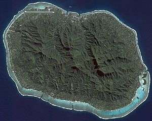 NASA satellite image of Rarotonga | |
 Rarotonga 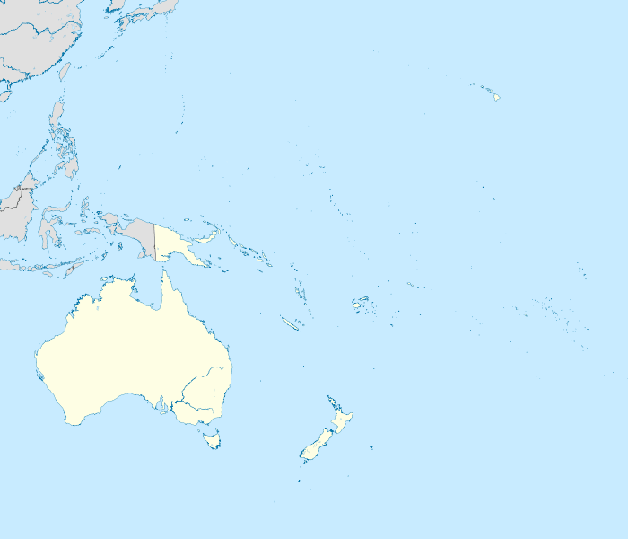 Rarotonga 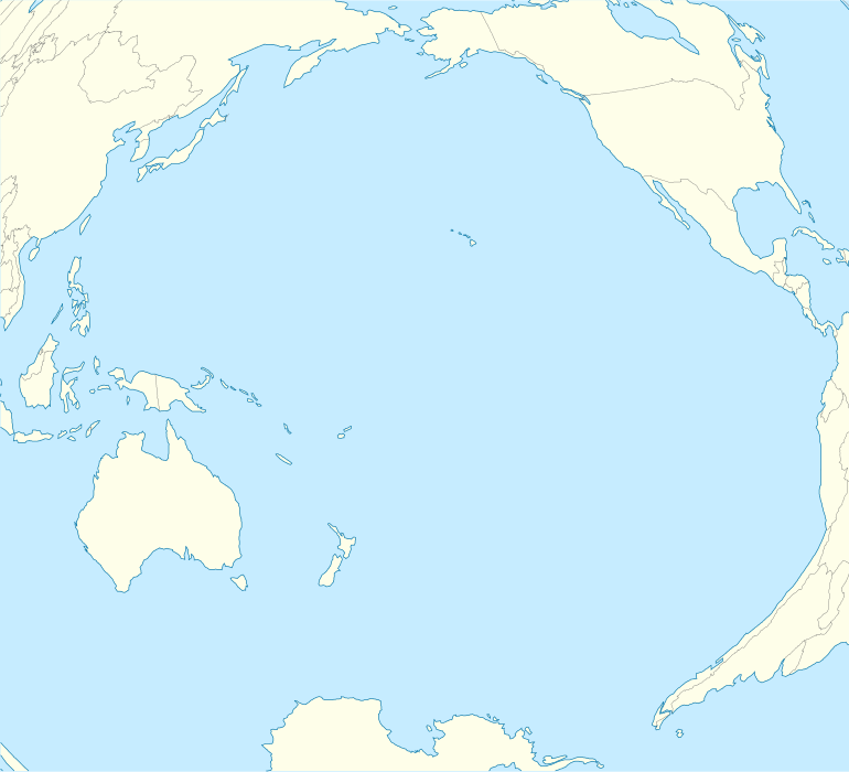 Rarotonga | |
| Geography | |
|---|---|
| Location | Central-Southern Pacific Ocean |
| Coordinates | 21°14′S 159°47′W |
| Archipelago | Cook Islands |
| Major islands |
|
| Area | 67.39 km2 (26.02 sq mi) |
| Administration | |
| Demographics | |
| Demonym | Rarotongan |
| Population | 10,649 |
The Cook Islands' Parliament buildings and international airport are on Rarotonga. Rarotonga is a very popular tourist destination with many resorts, hotels and motels. The chief town, Avarua, on the north coast, is the capital of the Cook Islands.
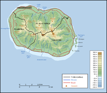
Geography
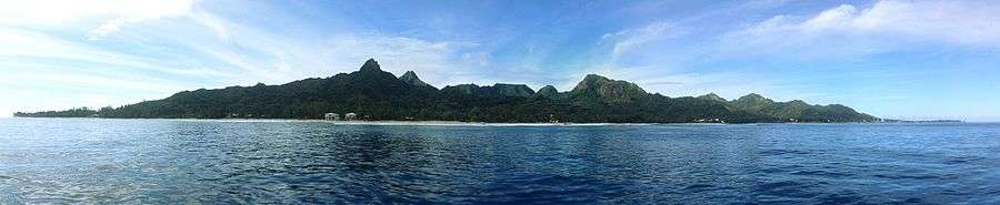
The volcanic island of Rarotonga stands over 14,750 feet (4,500 meters) above the ocean floor. It is 32 km (20 miles) in circumference and has an area of 67.19 km2 (26 square miles). At a depth of 4,000 m (13,000 ft) the volcano is nearly 50 km (31 miles) in diameter. Te Manga, at 658 m (2,140 ft) above sea level, is the highest peak on the island. Ikurangi, a smaller peak, overlooks the capital.
The island is surrounded by a lagoon, which often extends more than a hundred metres to the reef, then slopes steeply to deep water. The reef fronts the shore to the north of the island, making the lagoon there unsuitable for swimming and water sports, but to the south east, particularly around Muri, the lagoon is at its widest and deepest. This part of the island is the most popular with tourists for swimming, snorkelling and boating. Agricultural terraces, flats and swamps surround the central mountain area.
Along the southeast coast off Muri Beach are four small coral islets within a few hundred metres of the shore and within the fringing coral reef. From north to south, the islets are:[2]
- Motutapu, 11.0 hectares (0.042 sq mi)
- Oneroa, 10.6 hectares (0.041 sq mi)
- Koromiri, 3.0 hectares (0.012 sq mi)
- Taakoka, 1.7 hectares (0.0066 sq mi)
The interior of the island is dominated by eroded volcanic peaks cloaked in dense vegetation. Paved and unpaved roads allow access to valleys but the interior of the island remains largely unpopulated due to forbidding terrain and lack of infrastructure.
A large tract of land has been set aside in the south east as the Takitumu Conservation Area to protect native birds and plants, especially the endangered kakerori, the Rarotonga flycatcher.
History
The earliest evidence of human presence in the Southern Cook Islands has been dated to around AD 1000. Trading contact was evidently maintained with the Austral Islands, Society Islands and the Marquesas to import basalt that was used for making local adze heads, while a pottery fragment found on Ma'uke has been traced to Tongatapu to the west, the main island of Tonga.[3] At least 30 of the traditional Polynesian crop plants found here were likewise introduced from the west.[4]
Fletcher Christian visited the island in 1789 on HMS Bounty but did not land.[5] Captain Theodore Walker sighted the island in 1813 on the ship Endeavour. The first recorded landing by a European was Captain Philip Goodenough with William Wentworth in 1814 on the schooner Cumberland.[6] On 25 July 1823, while transporting the missionary Reverend John Williams, the Endeavour returned to Rarotonga. Papeiha, a London Missionary Society evangelist from Bora Bora, went ashore to teach his religion.[5] Further missionaries followed, and by 1830 the island had converted to Christianity.
From 1830 to 1850, Rarotonga was a popular stop for whalers and trading schooners.[5]
Subdivisions
_lookout.jpg)
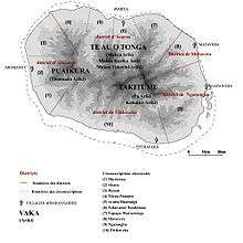
Rarotonga is divided into three main districts or vaka (tribes). Te Au O Tonga on the northern side of the island (Avarua is the capital), Takitumu on the eastern and southern side and Puaikura on the western side.
On the other hand, the island is also divided into five Land Districts. The Land District of Avarua is represented under vaka Te Au O Tonga, the Land Districts of Matavera, Ngatangiia and Titikaveka are represented under vaka Takitumu and the Land District Arorangi is represented under vaka Puaikura.
In 2008, the three vaka councils of Rarotonga were abolished.[7][8]
Area attractions
.jpg)
Palm-studded white sandy beaches fringe most of the island, and there is a popular cross-island walk that connects Avatiu valley with the south side of the island. It passes the Te Rua Manga, the prominent needle-shaped rock visible from the air and some coastal areas. Hikes can also be taken to the Raemaru, or flat-top mountain. Other attractions include Wigmore Falls (Papua Falls) and the ancient marae, Arai te Tonga.
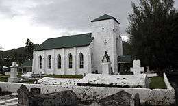
Popular island activities include snorkeling, scuba diving, bike riding, kite surfing, hiking, deep-sea fishing, boat tours, scenic flights, going to restaurants, dancing, seeing island shows, squash, tennis, zipping around on mopeds, and sleeping on the beach. There are many churches open for service on Sunday, with a cappella singing. People congregate at the sea wall that skirts the end of the airport's runway to be "jetblasted" by aircraft.[9]
Transport
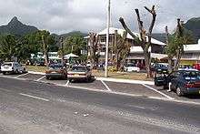
Rarotonga has three harbours, Avatiu, Avarua and Avana, of which only Avatiu harbour is of commercial significance. The Port of Avatiu serves a small fleet of inter-island and fishing vessels, with cargo ships regularly visiting from New Zealand via other Pacific Islands ports. Large cruise ships regularly visit Rarotonga but the port is too small for cruise ships to enter and they are required to anchor off shore outside the harbour.
The island is encircled by a main road, Ara Tapu, that traces the coast. Three-quarters of Rarotonga is also encircled by the ancient inner road, Ara Metua. Approximately 29 km long, this road was constructed in 11th century and for most or all of its whole length was paved with large stone slabs. Along this road are several important marae, including Arai Te Tonga, the most sacred shrine in Rarotonga. Due to the mountainous interior, there is no road crossing the island. Rarotonga has only two bus routes: clockwise and anticlockwise.[10] The clockwise bus runs from morning operating an hourly schedule until a last service at 11pm. The anti-clockwise route leaves Avarua on the half-hour, with the last service at 4.30 pm. Although there are bus stops, the buses pick up and set down anywhere en route.
Rarotonga International Airport is the international airport of the Cook Islands. Air Rarotonga operates domestic inter-island flights: daily flights to Aitutaki, regular flights to Atiu, Mangaia, Mauke and Mitiaro, and occasional flights to the remote northern atolls of Manihiki, Tongareva (Penrhyn) and Pukapuka.
As of 2017 Air New Zealand operates weekly direct flights to and from Los Angeles and Sydney, in addition to five flights a week from Auckland. An additional six flights per week from Auckland are operated by Jetstar (3) and Virgin Australia (3). Air Tahiti operates one or two flights per week direct to and from Papeete, depending on the season.
In the media
- The travel writer Robert Dean Frisbie died on the island, after having lived there only briefly.
- The 1995 album Finn by the Finn Brothers ends with the song "Kiss the Road of Rarotonga", which was inspired by a motorcycle accident that Tim Finn had during a visit there.
- The U.S. television series Survivor: Cook Islands was filmed on Aitutaki, one of the islands in the southern group. One of the tribes was called Rarotonga (or Raro for short).
- A number of feature-length films are linked to Rarotonga: Merry Christmas, Mr. Lawrence, depicting a Japanese POW camp for British prisoners in the island of Java in the year 1942, was filmed here, The Other Side of Heaven, which is set in Niuatoputapu, Tonga, but was filmed in part on Rarotonga, and Johnny Lingo which was set here.
- In the 2008 film Nim's Island, Rarotonga is portrayed as a waypoint for fictional adventure writer Alexandra Rover (Jodie Foster) on her journey from San Francisco to a South Pacific island.
- In 1951 Mexican writers Yolanda Vargas Dulché and Guillermo de la Parra wrote Rarotonga, a comic book whose plot unfolds on the island. The heroine of the story is called Zonga, an enigmatic woman with superhuman powers. The comic inspired a Mexican movie filmed in 1978 and a song by the Mexican rock band Café Tacuba.
- The 1948 film Another Shore has as its central character an Irish civil servant who fantasises about going to live on Rarotonga.
- Smooth Walker (Howard Hesseman) books a flight to Rarotonga in the 1983 film Doctor Detroit.
- Former New Zealand cricket captain John Wright's 1990 autobiography is titled Christmas in Rarotonga.[11]
See also
- Auparu – in Cook Islands mythology, Auparu ("gentle dew") is a stream in Rarotonga, the bathing-place of nymphs or fairies.
- Nukutere College – the country's only Roman Catholic secondary school
- Rarotonga hotspot – volcano that created Rarotonga
- Roman Catholic Diocese of Rarotonga
- Treaty of Rarotonga – 1985 South Pacific Nuclear Free Zone Treaty
References
- "Census 2016 - Cook Islands - Ministry of Finance and Economic Management". www.mfem.gov.ck. Archived from the original on 28 August 2017. Retrieved 2017-11-11.
- "Archived copy" (PDF). Archived from the original (PDF) on 2009-09-18. Retrieved 2008-08-21.CS1 maint: archived copy as title (link), page 107
- Richard Walter; W.R. Dickinson (1989). "A ceramic sherd from Ma'uke in the Southern Cook Islands". The Journal of the Polynesian Society. 98 (4): 465-470. Retrieved 6 August 2020.
- Crowe, Andrew (2018). Pathway of the Birds: The Voyaging Achievements of Māori and their Polynesian Ancestors. Auckland, New Zealand: Bateman. ISBN 9781869539610.
- Alphons M.J. Kloosterman (1976). Discoverers Of The Cook Islands And The Names They Gave. p. 47.
- Coppell, W. G. (1973). "About the Cook Islands. Their Nomenclature and a Systematic Statement of Early European contacts". Journal de la Société des océanistes. 29 (38): 43. doi:10.3406/jso.1973.2410. Retrieved 2018-01-18.
- "Cook Islands govt abolishes Rarotonga Vaka councils". 2007. Retrieved 1 September 2015.
- "Statoids: Cook Islands". Retrieved 1 September 2015.
- Vaimoana Tapaleo (2015-07-03). "Tourists hurt by Air New Zealand jet blast in Rarotonga". The New Zealand Herald. ISSN 1170-0777. Retrieved 2020-05-12.
- Bus & Taxis / Sokala Villas, Muri Beach, Rarotonga, Cook Islands
- Gideon Haigh (20 December 2003). "Cricket, the Wright way". The Age. Retrieved 28 April 2018.
External links
| Wikivoyage has a travel guide for Rarotonga. |

- History of districts and villages
- FAQ, cookislands.travel
- Original Tapere subdivision of Rarotonga
| Northern | ||
|---|---|---|
| Southern - Nga-pu-Toru | ||
| Southern - other | ||
| Authority control |
|
|---|