Ikurangi
Ikurangi is one of the four major peaks of Rarotonga in the Cook Islands. It has an elevation of 485 metres above sea level and overlooks the capital Avarua and the village of Matavera. The peak is climable by a hiking trail.[2] Its name is derived from a mountain in Tahiti and in turn is remembered by Mount Hikurangi in New Zealand.[3]
| Ikurangi | |
|---|---|
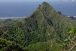 Ikurangi Peak viewed from the route up Te Manga. | |
| Highest point | |
| Elevation | 485 m (1,591 ft) [1] |
| Prominence | 165 m (541 ft) |
| Coordinates | 21°13′17.47″S 159°45′45.61″W |
| Geography | |
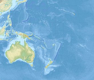 Ikurangi Map of Oceania | |
| Location | Rarotonga, Cook Islands |
See also
References
- "Mount Ikurangi, Cook Islands". peakbagger.com. Retrieved 17 July 2020.
- "Ikurangi Ascent". All Trails. Retrieved 17 July 2020.
- Rāwiri Taonui (24 November 2008). "Tapa whenua – naming places - Traditions and place names from Polynesia". Te Ara - the Encyclopedia of New Zealand. Retrieved 17 July 2020.
This article is issued from Wikipedia. The text is licensed under Creative Commons - Attribution - Sharealike. Additional terms may apply for the media files.