Pottsville, Arkansas
Pottsville is a city[3] in Pope County, Arkansas, United States. As of the 2010 census the population was 2,838. It is part of the Russellville Micropolitan Statistical Area.
Pottsville, Arkansas | |
|---|---|
 "Downtown" Pottsville | |
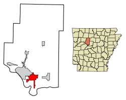 Location of Pottsville in Pope County, Arkansas. | |
| Coordinates: 35°14′56″N 93°2′49″W | |
| Country | United States |
| State | Arkansas |
| County | Pope |
| Area | |
| • Total | 13.63 sq mi (35.29 km2) |
| • Land | 13.60 sq mi (35.23 km2) |
| • Water | 0.03 sq mi (0.07 km2) |
| Elevation | 381 ft (116 m) |
| Population (2010) | |
| • Total | 2,838 |
| • Estimate (2019)[2] | 3,327 |
| • Density | 244.61/sq mi (94.45/km2) |
| Time zone | UTC-6 (Central (CST)) |
| • Summer (DST) | UTC-5 (CDT) |
| ZIP code | 72858 |
| Area code(s) | 479 |
| FIPS code | 05-56990 |
| GNIS feature ID | 0078087 |
| Website | cityofpottsville |
Geography
Pottsville is located at 35°14′56″N 93°2′49″W (35.248856, -93.046820).[4] It is surrounded by Russellville to the west, Atkins to the east, and Crow Mountain to the north.
According to the United States Census Bureau, the town has a total area of 7.5 square miles (19 km2), of which 7.5 square miles (19 km2) is land and 0.04 square miles (0.10 km2) (0.27%) is water.
Demographics
| Historical population | |||
|---|---|---|---|
| Census | Pop. | %± | |
| 1900 | 192 | — | |
| 1910 | 205 | 6.8% | |
| 1920 | 275 | 34.1% | |
| 1930 | 293 | 6.5% | |
| 1940 | 308 | 5.1% | |
| 1950 | 224 | −27.3% | |
| 1960 | 250 | 11.6% | |
| 1970 | 411 | 64.4% | |
| 1980 | 564 | 37.2% | |
| 1990 | 984 | 74.5% | |
| 2000 | 1,271 | 29.2% | |
| 2010 | 2,838 | 123.3% | |
| Est. 2019 | 3,327 | [2] | 17.2% |
| U.S. Decennial Census[5] | |||
As of the 2000 census the population stood at 1,271, with 475 households and 372 families in the town. The population density was 169.3 inhabitants per square mile (65.3/km2). There were 500 housing units at an average density of 66.6 per square mile (25.7/km2). The racial makeup of the town was 95.67% White, 0.79% Black or African American, 0.71% Native American, 0.79% Asian, 0.16% from other races, and 1.89% from two or more races. 0.55% of the population were Hispanic or Latino of any race.
Of the 475 households 38.1% had children under the age of 18 living with them, 63.4% were married couples living together, 9.1% had a female householder with no husband present, and 21.5% were non-families. 18.1% of households were one person and 8.8% were one person aged 65 or older. The average household size was 2.68 and the average family size was 3.02.
The age distribution was 26.8% under the age of 18, 7.6% from 18 to 24, 31.2% from 25 to 44, 22.5% from 45 to 64, and 11.9% 65 or older. The median age was 36 years. For every 100 females, there were 100.2 males. For every 100 females age 18 and over, there were 99.8 males.
The median household income was $32,841 and the median family income was $37,763. Males had a median income of $27,237 versus $18,625 for females. The per capita income for the town was $15,066. About 12.6% of families and 16.7% of the population were below the poverty line, including 27.8% of those under age 18 and 10.0% of those age 65 or over.
References
- "2019 U.S. Gazetteer Files". United States Census Bureau. Retrieved June 30, 2020.
- "Population and Housing Unit Estimates". United States Census Bureau. May 24, 2020. Retrieved May 27, 2020.
- Local.Arkansas.gov - Pottsville, retrieved September 3, 2012
- "US Gazetteer files: 2010, 2000, and 1990". United States Census Bureau. 2011-02-12. Retrieved 2011-04-23.
- "Census of Population and Housing". Census.gov. Retrieved June 4, 2015.
External links
- Pottsville High School Web Site
Municipalities and communities of Pope County, Arkansas, United States | ||
|---|---|---|
| Cities | 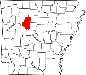 Map of Arkansas highlighting Pope County | |
| Town | ||
| Unincorporated communities |
| |
| Townships | ||