Pilot Township, Kankakee County, Illinois
Pilot Township is one of seventeen townships in Kankakee County, Illinois, USA. As of the 2010 census, its population was 2,086 and it contained 859 housing units.[2] It was formed from a portion of Salina Township on March 11, 1857.
Pilot Township | |
|---|---|
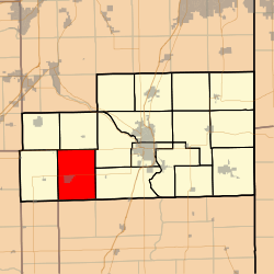 Location in Kankakee County | |
 Kankakee County's location in Illinois | |
| Coordinates: 41°03′31″N 88°04′21″W | |
| Country | United States |
| State | Illinois |
| County | Kankakee |
| Established | March 11, 1857 |
| Government | |
| • Supervisor | Timothy Feller |
| Area | |
| • Total | 49.44 sq mi (128.0 km2) |
| • Land | 49.44 sq mi (128.0 km2) |
| • Water | 0 sq mi (0 km2) 0% |
| Elevation | 663 ft (202 m) |
| Population (2010) | |
| • Estimate (2016)[1] | 2,019 |
| • Density | 42.2/sq mi (16.3/km2) |
| Time zone | UTC-6 (CST) |
| • Summer (DST) | UTC-5 (CDT) |
| ZIP codes | 60901, 60913, 60917, 60922, 60941 |
| FIPS code | 17-091-59819 |
Geography
According to the 2010 census, the township has a total area of 49.44 square miles (128.0 km2), all land.[2]
Cities, towns, villages
Unincorporated towns
- Dickeys at 41.050865°N 88.037268°W
- Goodrich at 41.108921°N 88.058104°W
- Lehigh at 41.11031°N 88.018103°W
(This list is based on USGS data and may include former settlements.)
Extinct towns
- Pilot Center at 41.057532°N 88.075881°W
(These towns are listed as "historical" by the USGS.)
Adjacent townships
- Salina Township (north)
- Limestone Township (northeast)
- Otto Township (east)
- Chebanse Township, Iroquois County (southeast)
- Milks Grove Township, Iroquois County (south)
- Rogers Township, Ford County (southwest)
- Norton Township (west)
- Essex Township (northwest)
Cemeteries
The township contains these seven cemeteries: Grand Prairie, Grand Prairie United, Mount Hope, Pilot Center, Saint Peter and Paul, Trinity and Zion Lutheran.
Government
The township is governed by an elected Town Board of a Supervisor and four Trustees. The Township also has an elected Assessor, Clerk, Highway Commissioner and Supervisor. The Township Office is located at 366 East Kay, Herscher, IL 60941.
Political districts
- Illinois' 11th congressional district
- State House District 75
- State Senate District 38
School districts
- Herscher Community Unit School District 2
References
- "Pilot Township, Kankakee County, Illinois". Geographic Names Information System. United States Geological Survey. Retrieved 2010-02-20.
- United States Census Bureau 2007 TIGER/Line Shapefiles
- United States National Atlas
- "Population and Housing Unit Estimates". Retrieved June 9, 2017.
- "Population, Housing Units, Area, and Density: 2010 - County -- County Subdivision and Place -- 2010 Census Summary File 1". United States Census. Archived from the original on 2020-02-12. Retrieved 2013-05-28.
- "Census of Population and Housing". Census.gov. Retrieved June 4, 2016.
External links
Municipalities and communities of Kankakee County, Illinois, United States | ||
|---|---|---|
| Cities | Map of Illinois highlighting Kankakee County | |
| Villages | ||
| Townships | ||
| Unincorporated communities | ||
| Footnotes | ‡This populated place also has portions in an adjacent county or counties. | |