Essex Township, Kankakee County, Illinois
Essex Township is one of seventeen townships in Kankakee County, Illinois, USA. As of the 2010 census, its population was 1,480 and it contained 686 housing units.[2]
Essex Township | |
|---|---|
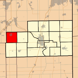 Location in Kankakee County | |
 Kankakee County's location in Illinois | |
| Coordinates: 41°09′32″N 88°11′19″W | |
| Country | United States |
| State | Illinois |
| County | Kankakee |
| Established | August 1, 1855 |
| Government | |
| • Supervisor | Don Babjak |
| Area | |
| • Total | 36.23 sq mi (93.8 km2) |
| • Land | 35.64 sq mi (92.3 km2) |
| • Water | 0.59 sq mi (1.5 km2) 1.63% |
| Elevation | 584 ft (178 m) |
| Population (2010) | |
| • Estimate (2016)[1] | 1,414 |
| • Density | 41.5/sq mi (16.0/km2) |
| Time zone | UTC-6 (CST) |
| • Summer (DST) | UTC-5 (CDT) |
| ZIP codes | 60424, 60481, 60913, 60917, 60935, 60941, 60961 |
| FIPS code | 17-091-24465 |
History
The now lost towns of Tracy, Oklahoma, and Clarke City, which housed coal miners in the 1800s, were located in Essex Township.[3]
Geography
According to the 2010 census, the township has a total area of 36.23 square miles (93.8 km2), of which 35.64 square miles (92.3 km2) (or 98.37%) is land and 0.59 square miles (1.5 km2) (or 1.63%) is water.[2]
Cities, towns, villages
Adjacent townships
- Reed Township, Will County (north)
- Custer Township, Will County (northeast)
- Salina Township (east)
- Pilot Township (southeast)
- Norton Township (south)
- Greenfield Township, Grundy County (west)
- Braceville Township, Grundy County (northwest)
Cemeteries
The township contains these two cemeteries: North Essex and South Essex.
Major highways
Airports and landing strips
- Lagrange Airport
- Rashs Acres Airport
Government
The township is governed by an elected Town Board of a Supervisor and four Trustees. The Township also has an elected Assessor, Clerk, Highway Commissioner and Supervisor. The Township Office is located at 315 North Pine, Essex, IL 60935.
Political districts
- Illinois' 11th congressional district
- State House District 75
- State Senate District 38
School districts
- Herscher Community Unit School District 2
- Reed Custer Community Unit School District 255U
References
- "Essex Township, Kankakee County, Illinois". Geographic Names Information System. United States Geological Survey. Retrieved 2010-02-20.
- United States Census Bureau 2007 TIGER/Line Shapefiles
- United States National Atlas
- "Population and Housing Unit Estimates". Retrieved June 9, 2017.
- "Population, Housing Units, Area, and Density: 2010 - County -- County Subdivision and Place -- 2010 Census Summary File 1". United States Census. Archived from the original on 2020-02-12. Retrieved 2013-05-28.
- Klasey, Jack (2016-06-18). "These Kankakee County towns vanished with hardly a trace". Daily Journal (News article). Kankakee, IL. Archived from the original on 2020-05-06. Retrieved 2020-05-06.
The most dramatic "lost towns" story took place in Essex Township...In the early 1880s, three towns sprung up to house miners exploiting a seam of coal...They lived in the towns of Tracy, Oklahoma and Clarke City...When the coal seam ran out around 1900, the towns were doomed. Tracy and Oklahoma disappeared quickly, but Clarke City declined more gradually.
- "Census of Population and Housing". Census.gov. Retrieved June 4, 2016.
External links
Municipalities and communities of Kankakee County, Illinois, United States | ||
|---|---|---|
| Cities | Map of Illinois highlighting Kankakee County | |
| Villages | ||
| Townships | ||
| Unincorporated communities | ||
| Footnotes | ‡This populated place also has portions in an adjacent county or counties. | |