Otto Township, Kankakee County, Illinois
Otto Township is one of seventeen townships in Kankakee County, Illinois, USA. As of the 2010 census, its population was 2,582 and it contained 937 housing units.[2] It was formed from portions of Aroma and Limestone townships on December 11, 1855 as Carthage Township; its name was changed to Otto Township on March 11, 1857.
Otto Township | |
|---|---|
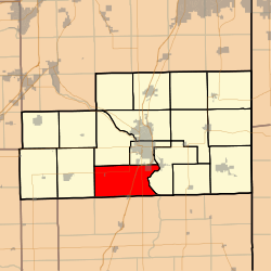 Location in Kankakee County | |
 Kankakee County's location in Illinois | |
| Coordinates: 41°02′21″N 87°54′56″W | |
| Country | United States |
| State | Illinois |
| County | Kankakee |
| Established | December 11, 1855 |
| Government | |
| • Supervisor | Ronald W. Thompsen |
| Area | |
| • Total | 48.53 sq mi (125.7 km2) |
| • Land | 48.21 sq mi (124.9 km2) |
| • Water | 0.32 sq mi (0.8 km2) 0.66% |
| Elevation | 636 ft (194 m) |
| Population (2010) | |
| • Estimate (2016)[1] | 2,505 |
| • Density | 53.6/sq mi (20.7/km2) |
| Time zone | UTC-6 (CST) |
| • Summer (DST) | UTC-5 (CDT) |
| ZIP codes | 60901, 60922, 60941 |
| FIPS code | 17-091-57017 |
Geography
According to the 2010 census, the township has a total area of 48.53 square miles (125.7 km2), of which 48.21 square miles (124.9 km2) (or 99.34%) is land and 0.32 square miles (0.83 km2) (or 0.66%) is water.[2]
Cities, towns, villages
- Aroma Park (west edge)
- Chebanse (north quarter)
- Irwin
- Kankakee (southwest quarter)
- Sammons Point (vast majority)
Unincorporated towns
(This list is based on USGS data and may include former settlements.)
Adjacent townships
- Kankakee Township (northeast)
- Aroma Township (east)
- Papineau Township, Iroquois County (east)
- Chebanse Township, Iroquois County (south)
- Milks Grove Township, Iroquois County (southwest)
- Pilot Township (west)
- Limestone Township (northwest)
Cemeteries
The township contains these two cemeteries: Barnett and Saint James.
Major highways
Airports and landing strips
- Greater Kankakee Airport
Government
The township is governed by an elected Town Board of a Supervisor and four Trustees. The Township also has an elected Assessor, Clerk, Highway Commissioner and Supervisor. The Township Office is located at 809 East 4000 South Road, Kankakee, IL 60901. The township assessor is Bill Surprenant and his son Phil is the assistant assessor for Otto Township. The township clerk is Mauricio Rua.
Political districts
- Illinois' 11th congressional district
- State House District 75
- State House District 79
- State Senate District 38
- State Senate District 40
School districts
- Central Community Unit School District 4
- Herscher Community Unit School District 2
- Kankakee School District 111
References
- "Otto Township, Kankakee County, Illinois". Geographic Names Information System. United States Geological Survey. Retrieved 2010-02-20.
- United States Census Bureau 2007 TIGER/Line Shapefiles
- United States National Atlas
- "Population and Housing Unit Estimates". Retrieved June 9, 2017.
- "Population, Housing Units, Area, and Density: 2010 - County -- County Subdivision and Place -- 2010 Census Summary File 1". United States Census. Archived from the original on 2020-02-12. Retrieved 2013-05-28.
- "Census of Population and Housing". Census.gov. Retrieved June 4, 2016.
External links
Municipalities and communities of Kankakee County, Illinois, United States | ||
|---|---|---|
| Cities | Map of Illinois highlighting Kankakee County | |
| Villages | ||
| Townships | ||
| Unincorporated communities | ||
| Footnotes | ‡This populated place also has portions in an adjacent county or counties. | |