Okoč
Local election 2010 results by the Statistical Office of the Slovak Republic
Okoč | |
|---|---|
Village | |
 | |
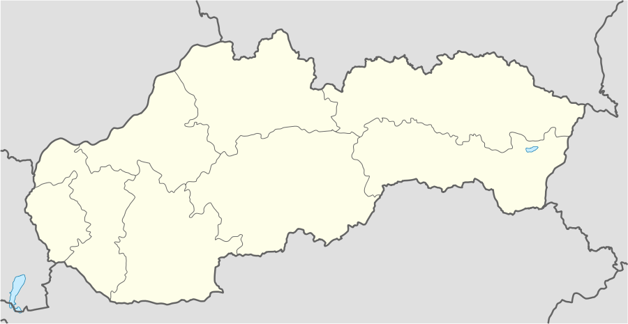 Okoč Location of Okoč in Slovakia | |
| Coordinates: 47°53′N 17°49′E | |
| Country | Slovakia |
| Region | Trnava |
| District | Dunajská Streda |
| First mentioned | 1268 |
| Government | |
| • Mayor | László Polák |
| Area | |
| • Total | 63.427 km2 (24.489 sq mi) |
| Elevation | 112 m (367 ft) |
| Population (2008-12-31) | |
| • Total | 3,794 |
| • Density | 60/km2 (150/sq mi) |
| Postal code | 930 28 |
| Car plate | DS |
Okoč (Hungarian: Ekecs, Hungarian pronunciation:[ˈɛkɛtʃ]) is a village and municipality in the Dunajská Streda District in the Trnava Region of south-west Slovakia.
Component villages
The municipality comprises the following villages and manors:
| In Slovak | In Hungarian |
|---|---|
| Opatovský Sokolec | Apácaszakállas |
| Asód | Aszódpuszta |
| Jánošíkovo na Ostrove | Béle |
| Okoč | Ekecs |
| Nový Goľáš | Gólyás |
| Veľký Sek | Nagyszegmajor |
| Dropie | Túzokpuszta |
| Viharoš | Viharos |
Demography
In 1910, the village had 544, for the most part, Hungarian inhabitants. At the 2001 Census the recorded population of the village was 3804 while an end-2008 estimate by the Statistical Office had the villages's population as 3794. As of 2001, 92.53% of its population were Hungarians while 6.07% were Slovaks. Roman Catholicism is the majority religion of the village, its adherents numbering 60.52% of the total population.[1]
History
In historical records the village was first mentioned in 1268 by it Hungarian name as Ekech. The village was first recorded in 1468 as the estate of the Dóczy family. Until the end of World War I, it was part of Hungary and fell within the Csallóköz district of Komárom County. Until the end of the 19th century, villagers made their living by fishing on the Danube and the Small-Danube. After the Austro-Hungarian army disintegrated in November 1918, Czechoslovak troops occupied the area. After the Treaty of Trianon of 1920, the village became officially part of Czechoslovakia. In November 1938, the First Vienna Award granted the area to Hungary and it was held by Hungary until 1945. After Soviet occupation in 1945, Czechoslovak administration returned and the village became officially part of Czechoslovakia in 1947. The present municipality was formed in 1976 when Opatovský Sokolec (Apácaszakállas) and Okoč (Ekecs) were unified following the merger of the respective agricultural co-operatives in 1973.
Geography
The municipality lies at an altitude of 112 metres and covers an area of 63.426 km².
Picture gallery
Okoč (Ekecs)
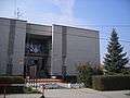 The village hall built in the 1980s
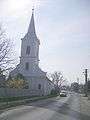 The Hungarian Reformed church
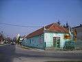 The corner of Laki and Main street
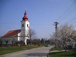
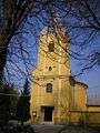 The Roman Catholic parish church
Opatovský Sokolec (Apácaszakállas)
 Landscape
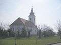 The Hungarian reformed church
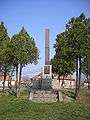 WW memorial
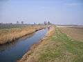 The Komárom-channel at Nový Goľáš (Gólyás)
References
- "Urban and Municipal Statistics MOŠ". Archived from the original on February 26, 2011.
External links
| Wikimedia Commons has media related to Okoč. |