Dunajský Klátov
Dunajský Klátov (Hungarian: Dunatőkés, Hungarian pronunciation:[ˈdunɒtøːkeːʃ]) is a village and municipality in the Dunajská Streda District in the Trnava Region of south-west Slovakia.
Dunajský Klátov Dunatőkés | |
|---|---|
village | |
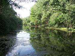 Little Danube in the village | |
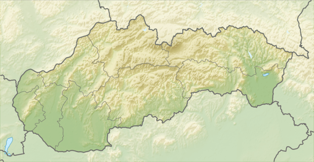 Location of the village | |
| Coordinates: 48°02′07″N 17°41′30″E | |
| Country | |
| Region | Trnava |
| District | Dunajská Streda |
| First written mention | 1393 |
| Government | |
| • Mayor | Mária Csiba[1][2] (Most-Híd) |
| Area | |
| • Total | 4.57 km2 (1.76 sq mi) |
| Elevation | 113 m (371 ft) |
| Population (2001)[3] | |
| • Total | 460 |
| • Estimate (2008) | 456 |
| • Density | 100/km2 (300/sq mi) |
| Ethnicity | |
| • Hungarians | 93.91% |
| • Slovaks | 5.22% |
| Time zone | UTC+1 (EET) |
| • Summer (DST) | UTC+2 (EEST) |
| Postal Code | 930 21 |
| Area code(s) | +421 31 |
Geography
The municipality lies at an altitude of 114 metres and covers an area of 4.574 km². It has a population of about 456 people.
History
In the 9th century, the territory of Dunajský Klátov became part of the Kingdom of Hungary.In historical records the village was first mentioned in 1393. After the Austro-Hungarian army disintegrated in November 1918, Czechoslovak troops occupied the area, later acknowledged internationally by the Treaty of Trianon. Between 1938 and 1945 Dunajský Klátov once more became part of Miklós Horthy's Hungary through the First Vienna Award. From 1945 until the Velvet Divorce, it was part of Czechoslovakia. Since then it has been part of Slovakia.
References
- Election results 2006 Archived 2012-03-08 at the Wayback Machine
- Local election 2010 results by the Statistical Office of the Slovak Republic Archived August 11, 2011, at the Wayback Machine
- "Institute of Informatics and Statistics". Archived from Institute of Informatics and Statistics the original Check
|url=value (help) on 2011-02-26.
| Wikimedia Commons has media related to Dunajský Klátov. |
Genealogical resources
The records for genealogical research are available at the state archive "Statny Archiv in Bratislava, Slovakia"
- Roman Catholic church records (births/marriages/deaths): 1673-1942 (parish B)
- Lutheran church records (births/marriages/deaths): 1823-1946 (parish B)
- Reformated church records (births/marriages/deaths): 1784-1926 (parish B)
External links