Ohrady
Ohrady (Hungarian: Csallóközkürt, Hungarian pronunciation:[ˈtʃɒlloːkøzkyrt]) is a village and municipality in the Dunajská Streda District in the Trnava Region of south-west Slovakia.
Ohrady Csallóközkürt | |
|---|---|
village | |
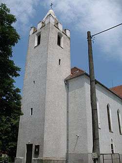 Church of Saint Stephen | |
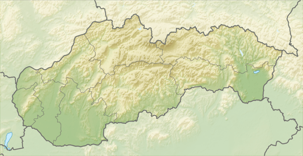 Location of the village | |
| Coordinates: 47°59′00″N 17°42′00″E | |
| Country | |
| Region | Trnava |
| District | Dunajská Streda |
| First written mention | 1252 |
| Named for | Hungarian tribe 'Kürt' |
| Government | |
| • Mayor | Anikó Rabay (Ind.) |
| Area | |
| • Total | 14.776 km2 (5.705 sq mi) |
| Elevation | 113 m (371 ft) |
| Population (2001)[3] | |
| • Total | 1,141 |
| • Estimate (2008) | 1,181 |
| • Density | 80/km2 (200/sq mi) |
| Ethnicity | |
| • Hungarians | 95,27% |
| • Slovaks | 4,38% |
| Time zone | UTC+1 (EET) |
| • Summer (DST) | UTC+2 (EEST) |
| Postal Code | 930 12 |
| Area code(s) | +421 31 |
| Website | www |
History
The village was first recorded in 1138 as Kywrth in 1252 as Kurth and Kyrth which refers to the ancient Hungarian tribe 'Kürt'. Until the end of World War I, it was part of Hungary and fell within the Dunaszerdahely district of Pozsony County. After the Austro-Hungarian army disintegrated in November 1918, Czechoslovak troops occupied the area. After the Treaty of Trianon of 1920, the village became officially part of Czechoslovakia. In November 1938, the First Vienna Award granted the area to Hungary and it was held by Hungary until 1945. After Soviet occupation in 1945, Czechoslovak administration returned and the village became officially part of Czechoslovakia in 1947.
Its original Slovak name was created in 1927 as Kerty, but the village was renamed by the authorities in 1948 to the current official name.
Demography
In 1910, the village had 903, for the most part, Hungarian inhabitants. At the 2001 Census the recorded population of the village was 1141 while an end-2008 estimate by the Statistical Office had the villages's population as 1181. As of 2001, 95.27% of its population were Hungarians while 4.38% were Slovaks.
Roman Catholicism is the majority religion of the village, its adherents numbering 93.69% of the total population.[3]
Geography
The municipality lies at an elevation of 113 metres and covers an area of 10.776 km².
Notable people
- Imrich Bugár, discus thrower
References
- Local election results by the Statistical Office of the Slovak Republic, December 2006 Archived August 11, 2011, at the Wayback Machine
- Local election 2010 results by the Statistical Office of the Slovak Republic Archived August 11, 2011, at the Wayback Machine
- "Urban and Municipal Statistics MOŠ". Archived from the original on February 26, 2011.