Norbiton
Norbiton is an area within the Royal Borough of Kingston upon Thames, London. It lies approximately 1 mile (1.6 km) east of Kingston upon Thames town centre, and 11 miles (17.7 km) from Charing Cross. Its main landmarks include Kingston Hospital and Kingsmeadow football stadium, which is currently used for the home matches of both AFC Wimbledon and Chelsea F.C. Women. St Peter's Anglican parish church serves the area.
| Norbiton | |
|---|---|
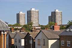 Towers of the 1970s Cambridge Road estate | |
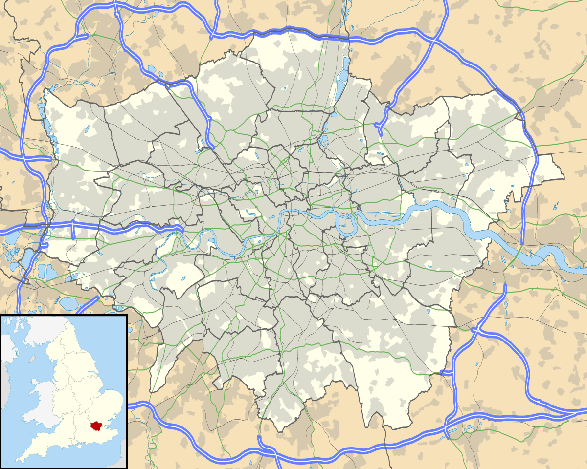 Norbiton Location within Greater London | |
| Population | 10,107 (2011 Census. Ward)[1] |
| OS grid reference | TQ195695 |
| London borough | |
| Ceremonial county | Greater London |
| Region | |
| Country | England |
| Sovereign state | United Kingdom |
| Post town | Kingston upon Thames |
| Postcode district | KT1, KT2 |
| Dialling code | 020 |
| Police | Metropolitan |
| Fire | London |
| Ambulance | London |
| UK Parliament | |
| London Assembly | |
History
Its name was originally Norberton(e) and it was named in a similar way to Surbiton on the opposite side of the Hogsmill River. The origin of the place-name is from the Old English words north, bere and tun (meaning northern grange or outlying farm).[2]
The area was originally a part of the parish of All Saints Church, Kingston upon Thames. In 1840 a separate Norbiton parish was created, with St Peter's Church built between 1840 and 1842 to a design of Gilbert Scott and William Moffatt.[3]
Until the mid-nineteenth century much of Norbiton was made up of country estates, all since sold as housing land. These included:
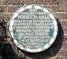
Norbiton Hall, a manor from the 16th century. Residents included Richard Taverner, who lived there 1547–75 and Sir Anthony Benn, 1605–18. In 1829, the Surrey MP Charles Pallmer sold the estate to Mary, Countess of Liverpool, widow of the late prime minister Lord Liverpool.[4] It was finally demolished in the 1930s to make way for a complex of flats, also called Norbiton Hall.
Norbiton Place was bought by Sir John Philipps, who died here in 1764.[5] One of the family's servants was Cesar Picton, an African slave brought to England aged six in 1761. He lived at Norbiton Place for nearly thirty years, before becoming a successful coal-merchant in Kingston.[6]
In the early 1800s Norbiton Place became the main residence of Charles Pallmer, owner of neighbouring Norbiton Hall.[4] Pallmer greatly developed the estate, including adding a dairy styled like an Indian temple and a lodge in the form of a doric temple.[5] Living above his means, Pallmer was declared bankrupt in 1831.[7] Much of the main house was pulled down after 1830,[4] with St Peter's Church built on part of the grounds.[8]
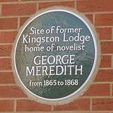
Kingston Lodge, opposite Norbiton Hall, was leased by Novelist George Meredith in 1865. Disliking the increasing development of the area, he moved away at the end of 1867.[9]
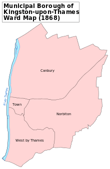
Norbiton was part of the Municipal Borough of Kingston-upon-Thames from its creation in 1835, and became part of the larger Royal Borough of Kingston upon Thames in 1965.[10]
Norbiton today
Norbiton's housing stock largely consists of large Victorian and Edwardian family houses, plus small localised brownfield redevelopments of 1960s, 1980s and modern flats. It contains more council and social housing than most other areas of Kingston – one of the largest such sites, the Cambridge Road Estate, was used as a fictional council estate in TV drama The Bill, as well as the BBC sitcom Some Girls. It is home also to Kingston Cemetery on Bonner Hill.
As Norbiton is only 25 minutes by train from Waterloo station, the suburban population includes a large concentration of London commuters. Norbiton railway station was used as a location for the British sitcom The Fall and Rise of Reginald Perrin. The headquarters of the Fire Brigades Union is located close to the station, on Coombe Road.
Education in Norbiton. See the main Royal Borough of Kingston upon Thames article.
Transport and locale
Nearby places
Nearest railway stations
- Norbiton railway station
- Kingston railway station
- Berrylands railway station
- New Malden railway station
References
- "Kingston Ward population 2011". Neighbourhood Statistics. Office for National Statistics. Retrieved 11 October 2016.
- Mills, A.D. (2011) [First published 1991]. A Dictionary of British Place Names (First edition revised 2011 ed.). Oxford: Oxford University Press. ISBN 9780199609086.
- Cherry, Bridget; Pevsner, Nikolaus (1983). Pevsner Architectural Guides. The Buildings of England London 2: South. London: Penguin. p. 313. ISBN 978-0-300-09651-4.
- Malden, H.E. (1911). A History of the County of Surrey: Volume 3. Victoria County History, London, 1911. pp. 501–516. Accessed 30 March 2020
- Prosser, G.F. (1828). Select Illustrations of the County of Surrey. Rivington, London. Accessed 9 April 2020
- Historic England. "Picton House, Kingston upon Thames (1080069)". National Heritage List for England. Retrieved 9 April 2020.
- "No. 18798". The London Gazette. 26 April 1831. p. 807.
- "St Peter's Church". Diocese of Southwark. Retrieved 3 June 2020.
- Lee, Sidney, ed. (1912). . Dictionary of National Biography (2nd supplement). 2. London: Smith, Elder & Co. pp. 604–616.
- Great Britain Historical GIS / University of Portsmouth, Kingston upon Thames London Borough. Retrieved 3 June 2020.
| Districts | 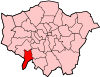 | |
|---|---|---|
| Attractions |
| |
| Bridges and tunnels | ||
| Parks and open spaces |
| |
| Constituencies | ||
| Rail stations | ||
| Places of worship | ||
| Sport | ||
| Other topics | ||
| ||