National Register of Historic Places listings in Rock Hill, South Carolina
This is a list of the National Register of Historic Places listings in Rock Hill, South Carolina.
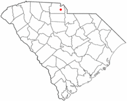
Location of Rock Hill in South Carolina
This is intended to be a complete list of the properties and districts on the National Register of Historic Places in Rock Hill, South Carolina, United States. The locations of National Register properties and districts for which the latitude and longitude coordinates are included below, may be seen on a map.[1]
There are 55 properties and districts listed on the National Register in York County. The city of Rock Hill is the location of 26 of these properties and districts, they are listed here, while the 29 properties and districts in the remaining parts of the county are listed separately.
- This National Park Service list is complete through NPS recent listings posted August 14, 2020.[2]
Current listings
| [3] | Name on the Register[4] | Image | Date listed[5] | Location | City or town | Description |
|---|---|---|---|---|---|---|
| 1 | Afro-American Insurance Company Building |  Afro-American Insurance Company Building |
June 10, 1992 (#92000651) |
558 S. Dave Lyle Boulevard 34°55′19″N 81°02′09″W |
Rock Hill | |
| 2 | Anderson House |  Anderson House |
May 13, 1982 (#82003908) |
227 Oakland Ave. 34°55′54″N 81°01′34″W |
Rock Hill | Designed by architect George Franklin Barber |
| 3 | Bleachery Water Treatment Plant |  Bleachery Water Treatment Plant |
March 6, 2008 (#08000154) |
Stewart Ave. 34°56′06″N 81°01′53″W |
Rock Hill | |
| 4 | Catawba Rosenwald School |  Catawba Rosenwald School |
July 3, 2013 (#13000465) |
3071 S.. Anderson Rd 34°54′43″N 80°58′35″W |
Rock Hill | |
| 5 | Charlotte Avenue-Aiken Avenue Historic District |  Charlotte Avenue-Aiken Avenue Historic District |
June 10, 1992 (#92000659) |
Roughly Aiken Ave. from College Ave. to Charlotte Ave. and Charlotte from Aiken to Union Ave. 34°56′09″N 81°01′28″W |
Rock Hill | |
| 6 | Ebenezer Academy | .jpg) Ebenezer Academy |
August 16, 1977 (#77001234) |
2132 Ebenezer Rd. 34°58′01″N 81°03′06″W |
Rock Hill | |
| 7 | First Presbyterian Church |  First Presbyterian Church |
June 10, 1992 (#92000653) |
234 E. Main St. 34°55′25″N 81°01′31″W |
Rock Hill | |
| 8 | Hermon Presbyterian Church |  Hermon Presbyterian Church |
June 10, 1992 (#92000652) |
446 Dave Lyle Boulevard 34°55′24″N 81°02′03″W |
Rock Hill | |
| 9 | Highland Park Manufacturing Plant and Cotton Oil Complex | Highland Park Manufacturing Plant and Cotton Oil Complex |
June 10, 1992 (#92000655) |
869 Standard St. and 732 and 737 E. White St. 34°55′15″N 81°00′42″W |
Rock Hill | |
| 10 | Laurelwood Cemetery |  Laurelwood Cemetery |
July 31, 2008 (#08000746) |
Bordered by Laurel, W. White, Stewart, and W. Main Sts. 34°55′55″N 81°01′59″W |
Rock Hill | |
| 11 | Marion Street Area Historic District |  Marion Street Area Historic District |
June 10, 1992 (#92000654) |
Roughly Marion St. from Hampton St. to Center St. and Center from State St. to Marion 34°55′13″N 81°01′43″W |
Rock Hill | |
| 12 | McCorkle-Fewell-Long House |  McCorkle-Fewell-Long House |
August 21, 1980 (#80003715) |
639 College Ave. 34°56′30″N 81°01′36″W |
Rock Hill | |
| 13 | Mount Prospect Baptist Church |  Mount Prospect Baptist Church |
June 10, 1992 (#92000656) |
339 W. Black St. 34°55′45″N 81°02′08″W |
Rock Hill | |
| 14 | Nation Ford Fish Weir | March 1, 2007 (#00000595) |
In the Catawba River approximately 1200 feet upstream from the Nation Ford railroad trestle 34°57′40″N 80°57′20″W |
Rock Hill | ||
| 15 | People's National Bank Building |  People's National Bank Building |
March 25, 1999 (#99000396) |
131-133 E. Main St. 34°55′32″N 81°01′37″W |
Rock Hill | |
| 16 | Reid Street-North Confederate Avenue Area Historic District |  Reid Street-North Confederate Avenue Area Historic District |
June 10, 1992 (#92000657) |
Roughly Reid St. and N. Confederate Ave. between E. Main St. and E. White St. 34°55′26″N 81°01′19″W |
Rock Hill | |
| 17 | Rock Hill Body Company |  Rock Hill Body Company |
March 6, 2008 (#08000155) |
601 W. Main St. 34°55′55″N 81°02′11″W |
Rock Hill | |
| 18 | Rock Hill Cotton Factory | Rock Hill Cotton Factory |
June 10, 1992 (#92000658) |
215 Chatham St.; also 130 W. White St. 34°55′42″N 81°01′39″W |
Rock Hill | 130 White represents a boundary increase of March 6, 2008 |
| 19 | Rock Hill Downtown Historic District |  Rock Hill Downtown Historic District |
June 24, 1991 (#91000828) |
Roughly S. Oakland Ave. from south of Peoples Pl. to E. Main St. 34°55′31″N 81°01′30″W |
Rock Hill | |
| 20 | Rock Hill Printing and Finishing Company | February 5, 2013 (#12001264) |
400 W. White St. 34°55′51″N 81°01′49″W |
Rock Hill | ||
| 21 | Stokes-Mayfield House |  Stokes-Mayfield House |
May 17, 1984 (#84002100) |
353 Oakland Ave. 34°56′03″N 81°01′40″W |
Rock Hill | |
| 22 | Tillman Hall | .jpg) Tillman Hall |
December 2, 1977 (#77001235) |
Oakland Ave. on the Winthrop College campus 34°56′18″N 81°01′47″W |
Rock Hill | |
| 23 | US Post Office and Courthouse | _1933.jpg) US Post Office and Courthouse |
January 21, 1988 (#87002523) |
102 Main St. 34°55′30″N 81°01′33″W |
Rock Hill | |
| 24 | White House |  White House |
December 3, 1969 (#69000176) |
258 E. White St. 34°55′33″N 81°01′18″W |
Rock Hill | |
| 25 | Winthrop College Historic District |  Winthrop College Historic District |
April 23, 1987 (#86003469) |
Along Oakland Ave. between Cherry Rd. and Stewart Ave. on the Winthrop College campus 34°56′22″N 81°01′48″W |
Rock Hill | |
| 26 | Withers Building | .jpg) Withers Building |
August 20, 1981 (#81000571) |
Oakland Ave. 34°50′28″N 81°01′42″W |
Rock Hill |
References
- The latitude and longitude information provided in this table was derived originally from the National Register Information System, which has been found to be fairly accurate for about 99% of listings. Some locations in this table may have been corrected to current GPS standards.
- "National Register of Historic Places: Weekly List Actions". National Park Service, United States Department of the Interior. Retrieved on August 14, 2020.
- Numbers represent an ordering by significant words. Various colorings, defined here, differentiate National Historic Landmarks and historic districts from other NRHP buildings, structures, sites or objects.
- "National Register Information System". National Register of Historic Places. National Park Service. March 13, 2009.
- The eight-digit number below each date is the number assigned to each location in the National Register Information System database, which can be viewed by clicking the number.
| Topics |  | |
|---|---|---|
| Lists by county |
| |
| Lists by city |
| |
| Other lists | ||
Municipalities and communities of York County, South Carolina, United States | ||
|---|---|---|
| Cities | 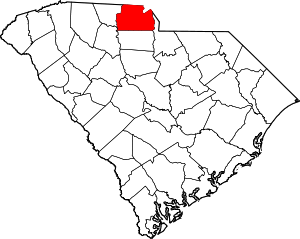 Map of South Carolina highlighting York County | |
| Towns | ||
| CDPs | ||
| Other unincorporated communities | ||
| Unincorporated communities | ||
| Indian reservation | ||
| Footnotes | ‡This populated place also has portions in an adjacent county or counties | |
This article is issued from Wikipedia. The text is licensed under Creative Commons - Attribution - Sharealike. Additional terms may apply for the media files.